

Mar 10: Snow Storm Discussion
A major snow storm is modeled for next Tuesday-Wednesday. Here are my latest thoughts…
Disco: The most noticeable trend to me over the last day or so is a NW shift in storm track. The most accurate data package from this range is likely the European ensembles just due to raw processing power and number of ensemble members. While the European operational suggested a SNJ jackpot, most ensemble members suggest a cluster to the N and W of the operational in storm track. Therefore, I would not be surprised to see the NW tick continue or at least hold through most of tonight and tomorrow’s model guidance.
We’re dealing with 3 waves of upper-level cyclonic vorticity (energy). The southernmost piece wants to race ahead to our S. This piece was associated with the storm that caused panic earlier this week when it was modeled to hit the Mid-Atlantic US. Two more pieces of energy should then phase over the Ohio Valley area and pull that southern piece back into the east coast. If everything phased together with maximum potential then we would be talking a historic event. If the energy interacts some but doesn’t fully phase in time, then this could become a mediocre event very quickly.
The interaction between the energy streams is extremely important because it will dictate the capturing trough axis. If that trough axis tilts negative too quickly then it could bring the storm inland which would mean rain and wind for most of New Jersey with only NWNJ possibly getting in on snow. If the trough tilts too late then the most reasonable expectation would be just another snow event. However, if the trough tilts perfectly and captures the southernmost piece of energy just right…then it will place a strong surface low in ideal position for a late-winter major snow storm.
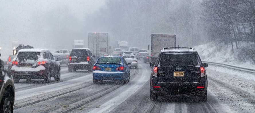
As if there are not enough phase/timing dynamics involved, we’re also fighting seasonal climatology and sun angle. Average daily highs and lows are increasing every day and the sun angle is increasing each day heading into the spring equinox. You saw today how powerful the sun can be regarding melting and preventing maximum ratio accumulations. For this reason, we still simply continue to monitor this possibility. We acknowledge the potential for someone to get rocked but it is still too soon to state where that likely-Kaboom axis will likely setup (NW, along or SE of the I-95 corridor).
Coastal areas are going to have to watch this closely. I’m seeing a prolonged period of onshore flow from Monday night through a solid part of Tuesday. This is when wind direction will rock from SE to N/NE before onshore flow shuts off with northerly winds. During that period I would have to assume at least moderate coastal flooding and beach erosion is possible. Tidal guidance is a bit out of range still but tomorrow it should come into focus.
In English: Chances are increasing for a major winter storm early next week (broad timing range of Monday PM to Wednesday AM). A lot of model support is suggesting a warmer and rainier scenario for the I-95 corridor and points SE of such. We’ll have to see if this idea continues as we further approach. This would mean an absolute rock-job Kaboom for Eastern PA and parts of NNJ though. The big cities of NYC and PHL would then be right on the snow/rain line. While current model consensus is leaning towards this idea, there is plenty of time for curve balls and surprises, especially with this complex of a setup. We will continue to monitor and heavily discuss but likely won’t have a snow map out until Sunday when all energy is over sensor-rich North American land. At that point we can compare fresh data with relevant live observations and deliver a forecast with snow map. For now, keep the possibility in your mind but prepare to start preparing on Sunday morning if this beast is still showing as-is. Coastal regions should monitor closely for onshore flow-related coastal flooding and beach erosion. Will touch more on that tomorrow. Have a great night and please be safe! JC
Jonathan Carr (JC) is the founder and sole operator of Weather NJ, New Jersey’s largest independent weather reporting agency. Since 2010, Jonathan has provided weather safety discussion and forecasting services for New Jersey and surrounding areas through the web and social media. Originally branded as Severe NJ Weather (before 2014), Weather NJ is proud to bring you accurate and responsible forecast discussion ahead of high-stakes weather scenarios that impact this great garden state of ours. All Weather. All New Jersey.™ Be safe! JC


LOCAL FORECAST | INTERACTIVE RADAR | LATEST NJ WEATHER ALERTS | WEDDING FORECAST| PRIVACY POLICY
© Copyright 2025 Weather NJ LLC. All Rights Reserved.
Some information that can be found on our website is provided by a private weather station and is not an officially recognized station for weather reporting. Though we always strive to achieve accurate reporting for our own use, it is important that you do NOT depend on the data provided here for any purpose.
