

Mar 12: Saturday Washout Detected

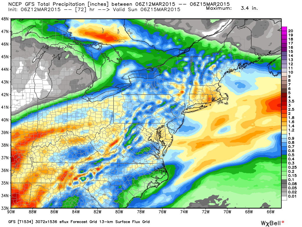
A low pressure disturbance is currently forming in the Gulf of Mexico. It will track to the NE and pass to the W of most of New Jersey before transferring towards the ocean across NNJ. This should bring widespread rainfall to the region between late Friday night and early Sunday AM. Here’s the latest GFS showing total precipitation through early Sunday AM which suggests between .5-1.0″ of rainfall.
As far as wind goes, expect a warmer southerly flow ahead of the low while it’s to our W. Once it transfers to the ocean (likely Saturday night), winds will become northerly and temperatures will become colder. Expect sustained winds of 10-15mph with gusts to 25mph. Let’s allow a small chance for a few remnant ending snow flurries in NWNJ/NNJ with little to no accumulation. Back end snow is typically an old tale with this kind of a setup (weak transferring low with no stall) so all rain is a more likely solution.
In English: Expect moderate to heavy rainfall between Friday night and Sunday morning which will likely lead to a Saturday washout. Winds will be noticeable but nothing crazy. I’ll have the full weekend outlook posted tomorrow morning. Be safe! JC
Jonathan Carr (JC) is the founder and sole operator of Weather NJ, New Jersey’s largest independent weather reporting agency. Since 2010, Jonathan has provided weather safety discussion and forecasting services for New Jersey and surrounding areas through the web and social media. Originally branded as Severe NJ Weather (before 2014), Weather NJ is proud to bring you accurate and responsible forecast discussion ahead of high-stakes weather scenarios that impact this great garden state of ours. All Weather. All New Jersey.™ Be safe! JC


LOCAL FORECAST | INTERACTIVE RADAR | LATEST NJ WEATHER ALERTS | WEDDING FORECAST| PRIVACY POLICY
© Copyright 2026 Weather NJ LLC. All Rights Reserved.
Some information that can be found on our website is provided by a private weather station and is not an officially recognized station for weather reporting. Though we always strive to achieve accurate reporting for our own use, it is important that you do NOT depend on the data provided here for any purpose.
