

Mar 14: Spring Storm Detected
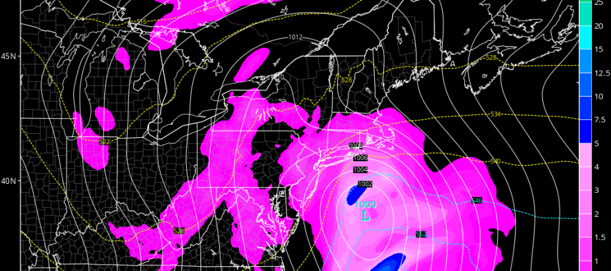
The first day of spring (this Sunday) could be a wet and windy day. Model guidance has been pretty persistent on a low pressure system tracking through the Mid-Atlantic US this Saturday-Sunday. This system should be all rain for most of New Jersey (lower 2/3 of state). For elevations in central/NE PA as well as NWNJ, some wet snow could mix in. The surface temperature profile for the entire state of New Jersey is pretty marginal which will substantially limit any snow accumulations from occurring. Here is the latest GFS showing 850mb pressure and precipitation Sunday morning:
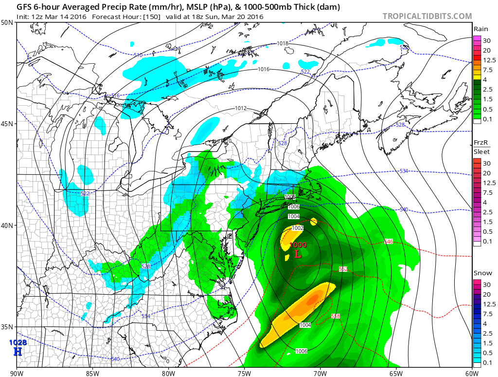
As far as the overall pattern goes, we have a mostly neutral AO/NAO and positive PNA. This tells us that there is some cold air and some blocking available but not a lot of either. This also tells us that there will be a ridge upstream over the W. US which will try to force a trough for the E. US. The end result is a low pressure track unfavorable for a coastal plain snow storm but favorable for rain and wind. Even though the higher elevations of NWNJ could see some snow, I’m highly skeptical of any accumulations. If we had a super strong storm like the March 1993 anomaly, perhaps the cold could win. This low however will likely be too weak for such despite still being able to produce heavy rain downpours and gusty winds.

In English: Saturday night into Sunday could be rainy and windy for most with some wet snow possible for the elevations of NWNJ. Any wet snow that falls should struggle to accumulate. I’ll be tracking this possibility this week and will have a much more confident handle on specifics (precip amounts, wind strength, etc) by Thursday evening. In the meantime, enjoy the mild weather and be safe! JC
Jonathan Carr (JC) is the founder and sole operator of Weather NJ, New Jersey’s largest independent weather reporting agency. Since 2010, Jonathan has provided weather safety discussion and forecasting services for New Jersey and surrounding areas through the web and social media. Originally branded as Severe NJ Weather (before 2014), Weather NJ is proud to bring you accurate and responsible forecast discussion ahead of high-stakes weather scenarios that impact this great garden state of ours. All Weather. All New Jersey.™ Be safe! JC


LOCAL FORECAST | INTERACTIVE RADAR | LATEST NJ WEATHER ALERTS | WEDDING FORECAST| PRIVACY POLICY
© Copyright 2026 Weather NJ LLC. All Rights Reserved.
Some information that can be found on our website is provided by a private weather station and is not an officially recognized station for weather reporting. Though we always strive to achieve accurate reporting for our own use, it is important that you do NOT depend on the data provided here for any purpose.
