

Mar 2: Watching Two Wintry Disturbances
A cut-off low pressure disturbance in the SW US is responsible for sending a few waves of energy eastward along a slow moving frontal boundary. This means a few snow chances for New Jersey this week. The frontal boundary will be moving northward Tuesday-Wednesday and southward Wednesday-Thursday. This is why we are looking at a snow-to-rain situation tomorrow, light rain showers and mild temperatures on Wednesday, and snow Wednesday night into Thursday.
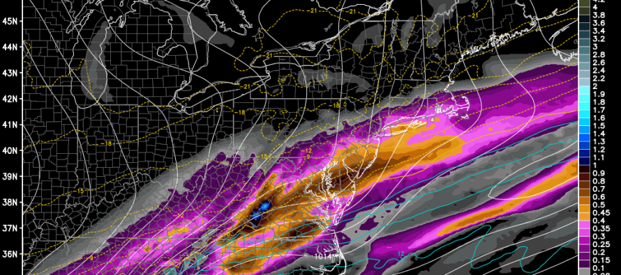
Tomorrow’s first wave of energy is modeled with lesser wintry impact. CNJ and SNJ should see very little snow to start before transitioning to ice and then rain. NNJ has the best chance for some light accumulations before the changeover to rain. The timing is tomorrow afternoon/evening through early Wednesday morning. Here’s the latest GFS showing precipitation between 1PM and 7PM tomorrow:
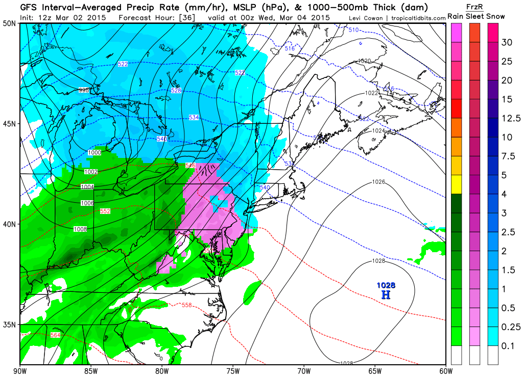
This next GFS slide shows precipitation between 7AM and 1PM on Wednesday. This is when temperatures will feel mild with 40s throughout most of the state and SENJ approaching 50:
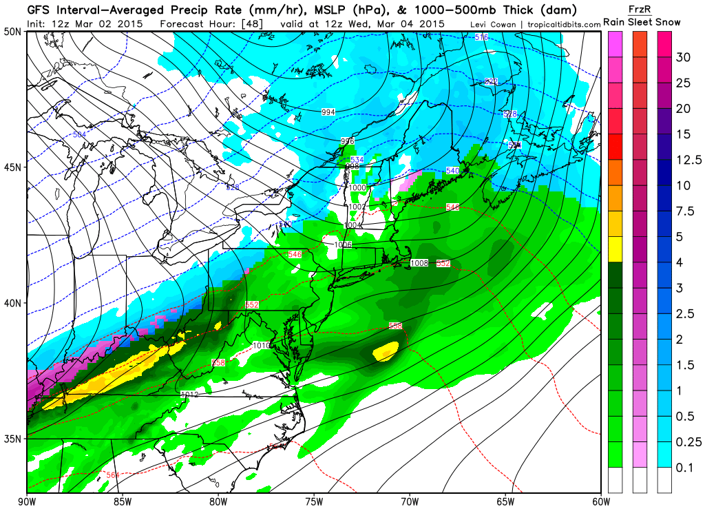
Eventually temperatures will begin to drop Wednesday evening as that frontal boundary pushes back south with a weak low pressure disturbance riding though. This will change the rain back over to accumulating snow as seen here between 1AM and 7AM on Thursday morning:
In English: Expect snow to rain tomorrow evening, warmer on-and-off rain showers on Wednesday and rain to snow Wednesday night into Thursday. I doubt anyone will see more than a coating to a few inches tomorrow evening (best chance in NNJ) but Thursday could bring significant (3-6″) to heavy (6-12″) accumulations throughout the state. The jackpot zone is uncertain at this point. I’ll likely just now-cast tomorrow but will have an initial snow map out for Thursday by tomorrow afternoon. Be safe! JC
Jonathan Carr (JC) is the founder and sole operator of Weather NJ, New Jersey’s largest independent weather reporting agency. Since 2010, Jonathan has provided weather safety discussion and forecasting services for New Jersey and surrounding areas through the web and social media. Originally branded as Severe NJ Weather (before 2014), Weather NJ is proud to bring you accurate and responsible forecast discussion ahead of high-stakes weather scenarios that impact this great garden state of ours. All Weather. All New Jersey.™ Be safe! JC


LOCAL FORECAST | INTERACTIVE RADAR | LATEST NJ WEATHER ALERTS | WEDDING FORECAST| PRIVACY POLICY
© Copyright 2026 Weather NJ LLC. All Rights Reserved.
Some information that can be found on our website is provided by a private weather station and is not an officially recognized station for weather reporting. Though we always strive to achieve accurate reporting for our own use, it is important that you do NOT depend on the data provided here for any purpose.
