

Mar 20: Updated Storm Impact Map
Here is my latest and final storm impact map. This will be the last map I issue as we are now in live-casting mode:
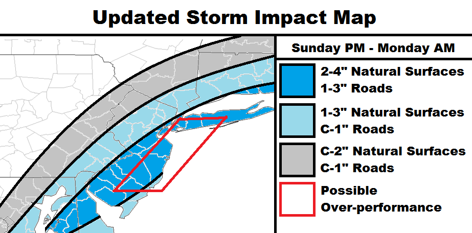
Dark blue area: This is my expected jackpot zone once rain changes over to snow. Roads will see less accumulations than natural surfaces.
Light blue area: NW region should simply see less snowfall but under colder conditions. SE region will be last to change from rain to snow despite still seeing higher amounts of precipitation overall.
Gray area: This will be the NW cut-off in precipitation with the coldest conditions of the precipitation shield.
Red-boxed area: This area could see intense mesoscale banding of snowfall during overnight/early-Monday AM hours. Should this occur, then expected accumulations could bust low. I would give this a 25% chance of happening.

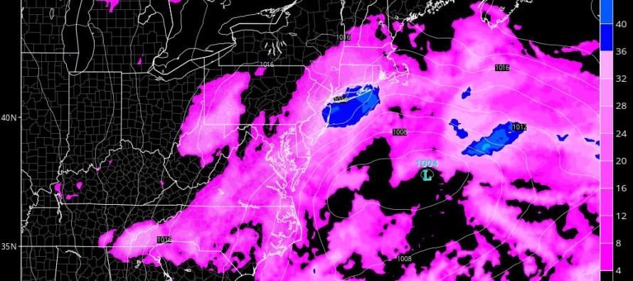
In English: Precipitation should start in SNJ by afternoon hours and spread into most/all of NJ by evening hours. Rain should change to snow around the general sunset time and accumulate on natural surfaces much more easily than on paved surfaces/roads. Snow could then fall overnight and into the AM hours of Monday before the storm eventually pulls away to the E. If this wraps up before midnight then minimal travel disruption is expected. If it lasts through 3-4AM with heavy snowfall then travel disruption is possible tomorrow morning. Coastal waters should be up as with any coastal low but flooding only appears to meet minor criteria. Expect higher wind gusts along the shore between now and tomorrow. It is now time to live-cast. I’ll check back with you when the rain is changing to snow later this afternoon/evening. Be safe! JC
Jonathan Carr (JC) is the founder and sole operator of Weather NJ, New Jersey’s largest independent weather reporting agency. Since 2010, Jonathan has provided weather safety discussion and forecasting services for New Jersey and surrounding areas through the web and social media. Originally branded as Severe NJ Weather (before 2014), Weather NJ is proud to bring you accurate and responsible forecast discussion ahead of high-stakes weather scenarios that impact this great garden state of ours. All Weather. All New Jersey.™ Be safe! JC


LOCAL FORECAST | INTERACTIVE RADAR | LATEST NJ WEATHER ALERTS | WEDDING FORECAST| PRIVACY POLICY
© Copyright 2026 Weather NJ LLC. All Rights Reserved.
Some information that can be found on our website is provided by a private weather station and is not an officially recognized station for weather reporting. Though we always strive to achieve accurate reporting for our own use, it is important that you do NOT depend on the data provided here for any purpose.
