

Mar 24: Possible Thunderstorms Detected
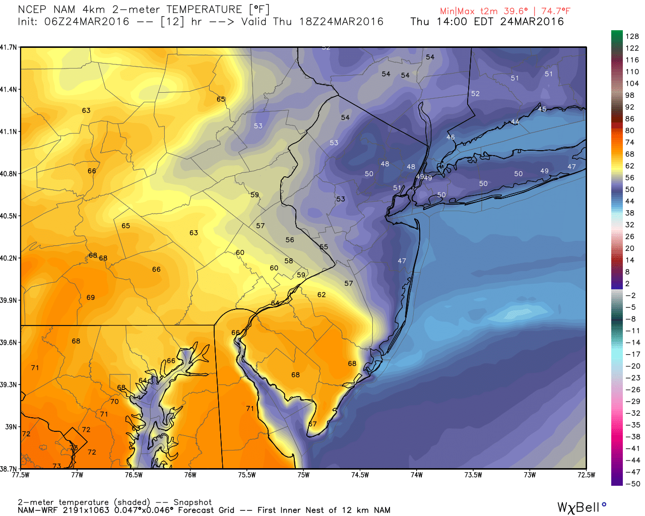
We have an active weather pattern setting up over the next 24-36 hours. A cold front has backed into New Jersey from the NE, bringing a cold and cloudy Atlantic Ocean air mass to many locations. Our primary driver will be a low pressure system currently approaching Illinois. As it tracks over the Great Lakes and ultimately over Maine, it will first reverse the backdoor cold front into a warm front. That frontal boundary should only make it partially into New Jersey by the end of peak diurnal heating today, as see here on the high-res NAM (2-meter temps at 2PM):
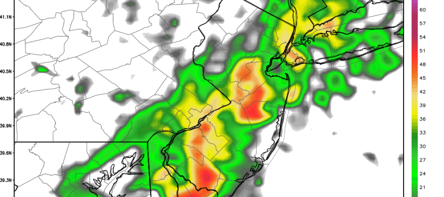
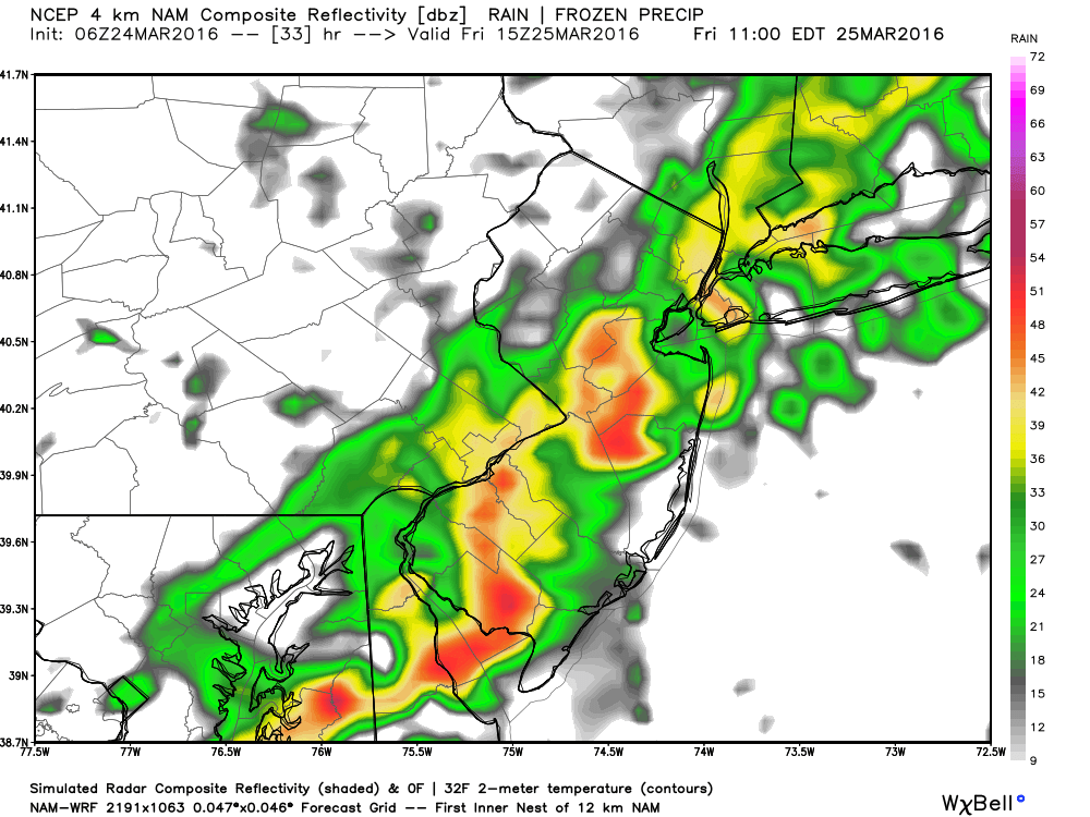
Let’s allow a small chance for showers (maybe a boomer) along that frontal boundary today. Temperatures should then, for the most part, hold overnight tonight as the warm front advances northward. Since New Jersey will be warm-sectored overnight and into tomorrow, it could feel warm and muggy until the cold front comes through around noon (give or take a few hours) tomorrow. Rain showers and thunderstorms are possible ahead of this cold front, as also indicated on the high-res NAM (Simulated rainfall at 11AM tomorrow):
Once the cold front is through, we’re then looking dry for the weekend but cooler (highs in the 40s/50s). I’ll have the detailed weekend outlook posted this evening.

In English: Today will be much warmer for SWNJ than other parts of the state. NENJ should be a different planet than SWNJ. Somewhere in the middle will be a sharp temperature difference separating 60s/70s and 40s/50s. There is a small chance of afternoon showers along that area today. We will then be warm and possibly sticky overnight into tomorrow as more rain showers and possibly thunderstorms form along a cold frontal passage during the day. It should all clear through by late-afternoon but could make for a wet and thundery AM commute/late-morning. Be safe! JC
Jonathan Carr (JC) is the founder and sole operator of Weather NJ, New Jersey’s largest independent weather reporting agency. Since 2010, Jonathan has provided weather safety discussion and forecasting services for New Jersey and surrounding areas through the web and social media. Originally branded as Severe NJ Weather (before 2014), Weather NJ is proud to bring you accurate and responsible forecast discussion ahead of high-stakes weather scenarios that impact this great garden state of ours. All Weather. All New Jersey.™ Be safe! JC


LOCAL FORECAST | INTERACTIVE RADAR | LATEST NJ WEATHER ALERTS | WEDDING FORECAST| PRIVACY POLICY
© Copyright 2026 Weather NJ LLC. All Rights Reserved.
Some information that can be found on our website is provided by a private weather station and is not an officially recognized station for weather reporting. Though we always strive to achieve accurate reporting for our own use, it is important that you do NOT depend on the data provided here for any purpose.
