

Mar 30: Friday Looks Disruptive
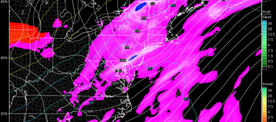
A cold air mass is coming. A series of low pressure systems will ride the front of the upper-level trough as it swings its axis into a negative tilt. Precipitation should form along the entire front side of the trough and pass through our region between Thursday night and Friday afternoon/evening. Here’s the latest GFS showing precipitation between 8AM and 2PM on Friday as well as 850mb pressure:
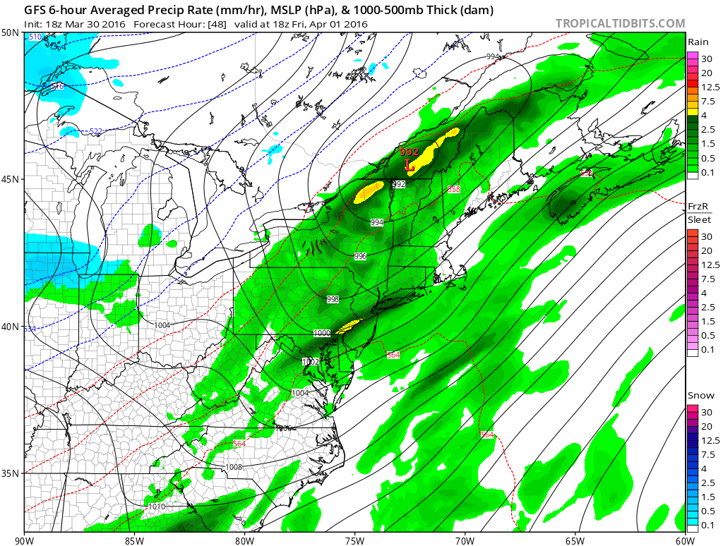
Since the low pressure will be passing to our NW, rain is the likely form of precipitation, especially after a mild Thursday. As far as severe criteria goes there are a few things to consider. Instability is lacking so if any embedded thunderstorms are going to form, they will have to be shear driven. We do have a strong lower-level jet however and a frontal passage to act as a trigger. We also have some pretty cold air aloft. This presents a hail possibility wherever any downdraft-assisted rain columns occur. With all of this being said, the most likely scenario is a prolonged period of rain and gusty winds late Thursday night into Friday afternoon/evening. However, if embedded thunderstorms form and/or bring down hail with it, the National Weather Service will issue a severe thunderstorm warning—should wind gusts exceed 58mph and/or hail exceeds an inch in diameter. My gut feeling is the former with only isolated instances of the latter if any.

In English: Thursday looks mild but cloudy. Rain is then possible between later Thursday evening and Friday afternoon, possibly evening. The most realistic scenario is a prolonged period of rain and pockets of gusty winds. However, embedded thunderstorms are possible which could bring higher wind gusts and possibly some hail. I’ll be keeping an eye on this but again, the former is more likely than the latter. I’ll have the weekend outlook posted tomorrow evening. Be safe! JC
Jonathan Carr (JC) is the founder and sole operator of Weather NJ, New Jersey’s largest independent weather reporting agency. Since 2010, Jonathan has provided weather safety discussion and forecasting services for New Jersey and surrounding areas through the web and social media. Originally branded as Severe NJ Weather (before 2014), Weather NJ is proud to bring you accurate and responsible forecast discussion ahead of high-stakes weather scenarios that impact this great garden state of ours. All Weather. All New Jersey.™ Be safe! JC


LOCAL FORECAST | INTERACTIVE RADAR | LATEST NJ WEATHER ALERTS | WEDDING FORECAST| PRIVACY POLICY
© Copyright 2026 Weather NJ LLC. All Rights Reserved.
Some information that can be found on our website is provided by a private weather station and is not an officially recognized station for weather reporting. Though we always strive to achieve accurate reporting for our own use, it is important that you do NOT depend on the data provided here for any purpose.
