

Mar 4: Friday Morning Observations
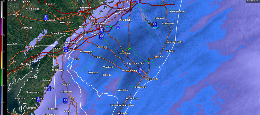
The coastal low is down to a 1004mb intensity and will continue to strengthen as it pulls away into the Atlantic Ocean. The onshore flow is actually enhancing snowfall for SNJ while cutting off precipitation sharply to the N and NW. This is pretty much what I thought would happen in my gut but I had little model guidance to support the hunch I had over the last few days. Here’s the latest radar with official reports from trained spotters displayed:
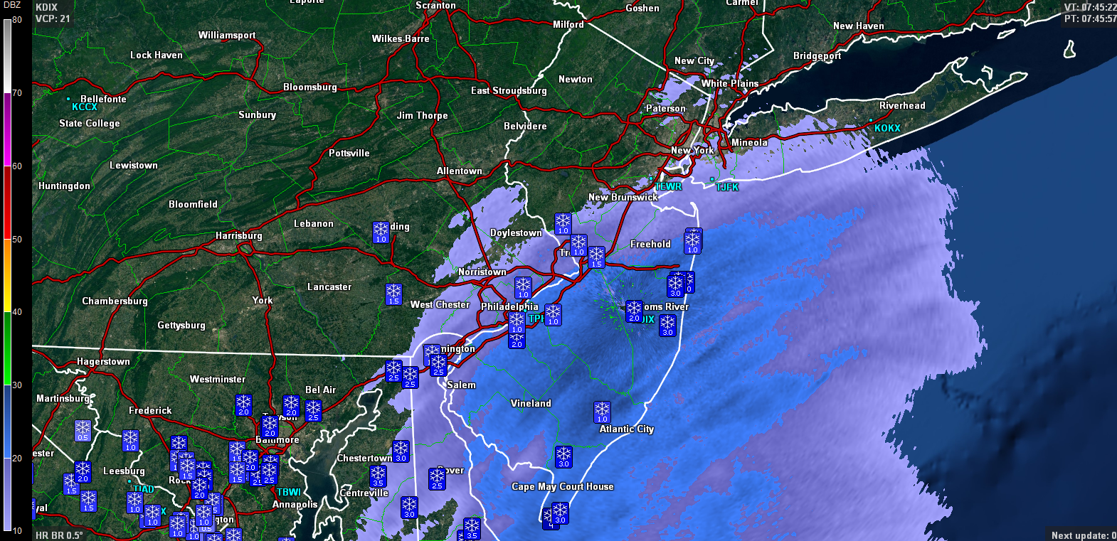
As you can see, there are a few 3 inch reports and even a 4 in Cape May County. Snow should continue to rip as precipitation gradually cuts off from W to E (between now and about noon). Therefore the coast should be last to stop. No reason why 1-2 more inches couldn’t stack up on natural surfaces. Most roads appear to be either just wet or slightly snow-covered. As the sun gets higher all snow will easily melt on paved surfaces, leaving natural surface accumulations last to melt later this afternoon/evening.

In English: SNJ, especially SENJ, is over-performing like the red-striped “See Text” area on my snow map yesterday. Therefore, light-to-significant accumulations are possible before snow ends around noon for the coast (earlier away from coast). Roads will still struggle to see anything more than a slushy coating, especially now that the sun is up and rising. Snowfall could still continue to puke however so be careful out there and please be safe! JC
Jonathan Carr (JC) is the founder and sole operator of Weather NJ, New Jersey’s largest independent weather reporting agency. Since 2010, Jonathan has provided weather safety discussion and forecasting services for New Jersey and surrounding areas through the web and social media. Originally branded as Severe NJ Weather (before 2014), Weather NJ is proud to bring you accurate and responsible forecast discussion ahead of high-stakes weather scenarios that impact this great garden state of ours. All Weather. All New Jersey.™ Be safe! JC


LOCAL FORECAST | INTERACTIVE RADAR | LATEST NJ WEATHER ALERTS | WEDDING FORECAST| PRIVACY POLICY
© Copyright 2026 Weather NJ LLC. All Rights Reserved.
Some information that can be found on our website is provided by a private weather station and is not an officially recognized station for weather reporting. Though we always strive to achieve accurate reporting for our own use, it is important that you do NOT depend on the data provided here for any purpose.
