

March 21: Morning Winter Storm Update
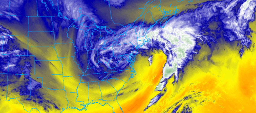
Discussion: We have a snow/sleet/rain line/situation currently near the I-95 corridor. I expect this to advance to the SE between now and afternoon hours (possibly earlier) as the low-mid level temperatures crash. Precipitation should then bring this colder air down to the surface and allow for the late-March stickage. Since SENJ will be the last to changeover to snow, SENJ should expect the least accumulations from this winter storm. By 4pm the entire state should be all snow and we’ll stay that way through evening and possibly overnight hours. The latest short-range model guidance has snow tapering off between 3-4AM Thursday morning.
Based on the relationship between the departing wave (yesterday’s event), the approaching upper-level low and the new coastal low forming off Delmarva, we have a slight tweak to make. The ULL is a little bit further S and W than it should be and the coastal low is a little more organized as a singular low. We think this could possibly open up the jackpot about 25 miles to the NW of where it was. This would mean slightly higher snow amounts for NWNJ and slightly less for areas just SE of the I-95 corridor. No changes for most of SENJ.
Winds are gusting from 38-44mph (from Atlantic City down through Cape May). Points N of that on the ENJ coast are seeing gusts in the 30s. Areas away from the ocean are seeing lesser wind values. Winds should ramp up over the next 6 hours with the singular coastal low development and sustain higher values well into Thursday. The good news is that coastal flooding risk has likely been reduced. I’m fairly confident we can take major criteria off the table given the more organized low—leading to more of a N/NE storm surge direction (more perpendicular to our inlets). I would still however expect moderate-to-major coastal flooding, especially for the SENJ coast.
In English: The storm is just getting started. Areas still seeing rain should soon transition to sleet or possibly just go right to snow. No one along or SE of I-95 should be surprised by the rainy/mixed start this morning. It was well advertised, timing is right on track and we’re about to thump through early tomorrow morning. We now think more of NWNJ could see higher snowfall accumulations (like NENJ and CNJ) with a small reduction just SE of the I-95 corridor. No changes for most of SENJ. We’re talking a couple of inches either way here so nothing drastic. All warranted hazards remain. Winds should continue intensifying along the coast throughout today but the coastal flooding risk has likely been reduced (good news) from the moderate-to-major category down to the minor-to-moderate category. Areas away from the ocean should also notice winds picking up soon but not as bad as the coast. I hope everyone is warm and well-prepared. Be safe! JC
For year-round comprehensive and interactive analysis, including run-by-run model storm analysis, that goes way above and beyond the detail of this public forecast, check out our premium services which include early hyper-local text notifications and guaranteed individual forum interaction. A must for outdoor businesses or the most extreme passionate weather enthusiast who depends on the best real-time data possible.
Jonathan Carr (JC) is the founder and sole operator of Weather NJ, New Jersey’s largest independent weather reporting agency. Since 2010, Jonathan has provided weather safety discussion and forecasting services for New Jersey and surrounding areas through the web and social media. Originally branded as Severe NJ Weather (before 2014), Weather NJ is proud to bring you accurate and responsible forecast discussion ahead of high-stakes weather scenarios that impact this great garden state of ours. All Weather. All New Jersey.™ Be safe! JC


LOCAL FORECAST | INTERACTIVE RADAR | LATEST NJ WEATHER ALERTS | WEDDING FORECAST| PRIVACY POLICY
© Copyright 2026 Weather NJ LLC. All Rights Reserved.
Some information that can be found on our website is provided by a private weather station and is not an officially recognized station for weather reporting. Though we always strive to achieve accurate reporting for our own use, it is important that you do NOT depend on the data provided here for any purpose.
