

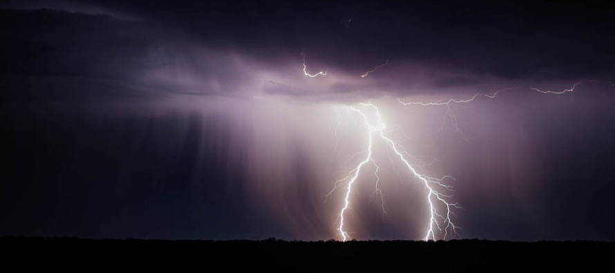
May 11: Thunderstorm Outbreak Detected
Discussion: A warm front will push through from our SW to NE overnight. This should bring periods of rainfall and embedded thunderstorms across New Jersey between midnight and mid-to-late morning. A break is then expected until late-afternoon/early-evening. At some point between late-afternoon/early evening tomorrow and midnight tomorrow night, a line of thunderstorms should push through New Jersey from NW to SE in a flat nature along the zonal flow. Therefore NWNJ first (late afternoon/early evening) and SENJ last (late-evening).
The warm front will eventually stall either across NNJ or SNJ tomorrow. You’ll be able to clearly see the temperature separation tomorrow. Areas to the N of the warm front will see less thunderstorm action but are still on the hook for periods of rain and breeze. Areas S of the warm front will have more saturated dew points and therefore be favored for thunderstorm action. Basically, areas that just nose into the warm sector will see the strongest storms tomorrow. We won’t know that exact separation until tomorrow but I would plan for rain and storms statewide regardless. At this point I can only argue that SNJ is more favored than NNJ.
Wind shear potential is sufficient for convective enhancement/development given the proximity of fronts and low pressure center. The low pressure center at the surface is a lifting trigger in itself. All ingredients are on the table for a stormy Saturday evening with severe criteria very much on the table. Such criteria includes wind gusts greater than 58 mph and or quarter-inch or larger hail. Wind damage is possible in the form of either straight-line (most likely) or tornado (less likely).
In English: Expect rain and storms to move through overnight and clear by 10am tomorrow morning. A break is then expected until later in the afternoon/evening. During this break SNJ should become hot and muggy while NNJ possibly stays cool and comfortable. CNJ could go either way but that line of division will likely separate weaker storms to the N and stronger storms to the S. We won’t know that until tomorrow. The storms that could move through tomorrow night could produce intense conditions (gusty/damaging winds, downed trees and wires, power outages, frequent lightning and possibly hail). I expect this main event line of thunderstorms to push through from NWNJ to SENJ tomorrow between 5pm and midnight. Tomorrow we can narrow the timing down. Have a great night and please be safe! JC
Jonathan Carr (JC) is the founder and sole operator of Weather NJ, New Jersey’s largest independent weather reporting agency. Since 2010, Jonathan has provided weather safety discussion and forecasting services for New Jersey and surrounding areas through the web and social media. Originally branded as Severe NJ Weather (before 2014), Weather NJ is proud to bring you accurate and responsible forecast discussion ahead of high-stakes weather scenarios that impact this great garden state of ours. All Weather. All New Jersey.™ Be safe! JC


LOCAL FORECAST | INTERACTIVE RADAR | LATEST NJ WEATHER ALERTS | WEDDING FORECAST| PRIVACY POLICY
© Copyright 2026 Weather NJ LLC. All Rights Reserved.
Some information that can be found on our website is provided by a private weather station and is not an officially recognized station for weather reporting. Though we always strive to achieve accurate reporting for our own use, it is important that you do NOT depend on the data provided here for any purpose.
