

May 18: What to expect this weekend
A decent amount of rainfall is expected this weekend however the entire weekend does not look like a washout. I’ve been tracking this disturbance since last Thursday but wanted to wait until today’s guidance to issue the best forecast I could.
Rain should start by late Saturday morning (let’s call it between 8AM and 11AM) and clear out by late Saturday evening (a few hours before or after midnight). Regardless, the bulk of rain should fall between noon and 8PM on Saturday. Sunday isn’t looking too bad but I cannot promise (yet) that there won’t be a few lingering sprinkles. Trust me, I’m hoping for a nice Sunday but science often fails to answer the call of hope.
Here’s the total expected rainfall through the early AM hours of Sunday when the system is expected to taper off by:
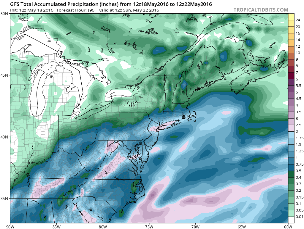
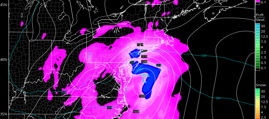
As you can see, anything from .75 to 2 inches of liquid is possible. I would take the heaviest area of rainfall (the pink area running through NNJ) with the grain of salt as that will vary on model guidance approaching Saturday. With that said, most of New Jersey should see between .75 and 1.25 with a 1.25-2 inch jackpot of rainfall possible locally (wont know what specific New Jersey area that is until it happens). The low pressure disturbance that will be responsible for this is not modeled very strong. We’re talking about a 1000-1005mb surface low tracking from the VA/NC border through the BM and out to sea relatively quickly. With that said, I generally expect sustained winds of 15-20mph with gusts to 30mph. The shore will feel these winds more than areas away from the ocean.
We do have a full moon on Saturday (also known as the Flower Moon). Because of this, the coastal flooding concern is slightly elevated. This includes the Delaware Bay and the entire Jersey shore from Cape May up through Sandy Hook. With that said, I would expect run-of-mill flooding for barrier islands and back bays that normally flood during weaker coastal storms, especially during the onshore component of the passing system.

In English: We’re actually not looking bad from now through Friday night. Widespread rain (moderate to heavy at times) is possible between Saturday morning and the early hours of Sunday morning. Winds should not be that bad but will be noticeable, especially along the coast. Coastal flooding is possible due to onshore flow + full moon. Conditions should improve for Sunday but could still feature clouds and a few sprinkles. I’ll have the detailed weekend outlook posted tomorrow evening. Have a great rest of your Wednesday and be safe! JC
Jonathan Carr (JC) is the founder and sole operator of Weather NJ, New Jersey’s largest independent weather reporting agency. Since 2010, Jonathan has provided weather safety discussion and forecasting services for New Jersey and surrounding areas through the web and social media. Originally branded as Severe NJ Weather (before 2014), Weather NJ is proud to bring you accurate and responsible forecast discussion ahead of high-stakes weather scenarios that impact this great garden state of ours. All Weather. All New Jersey.™ Be safe! JC


LOCAL FORECAST | INTERACTIVE RADAR | LATEST NJ WEATHER ALERTS | WEDDING FORECAST| PRIVACY POLICY
© Copyright 2026 Weather NJ LLC. All Rights Reserved.
Some information that can be found on our website is provided by a private weather station and is not an officially recognized station for weather reporting. Though we always strive to achieve accurate reporting for our own use, it is important that you do NOT depend on the data provided here for any purpose.
