

May 22: Heat Wave Detected!

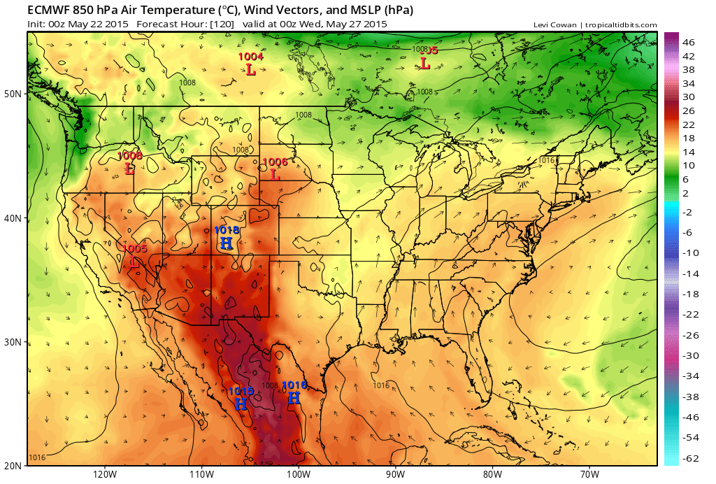
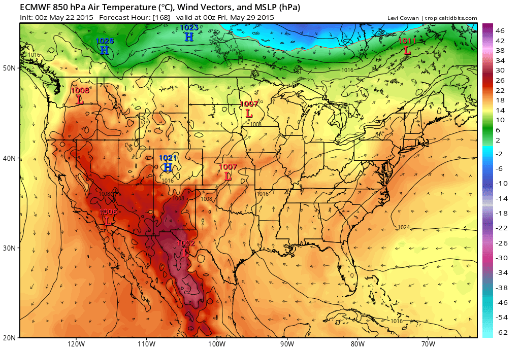
Stubborn high pressure should create a ridge over the E. US next week. This means hazy, hot, and humid conditions starting Tuesday and lasting until at least next Sunday. Let’s go straight to European model guidance, specifically 850mb temperature, wind direction, and pressure:
Tuesday May 26:
Thursday May 28:
Saturday May 30:
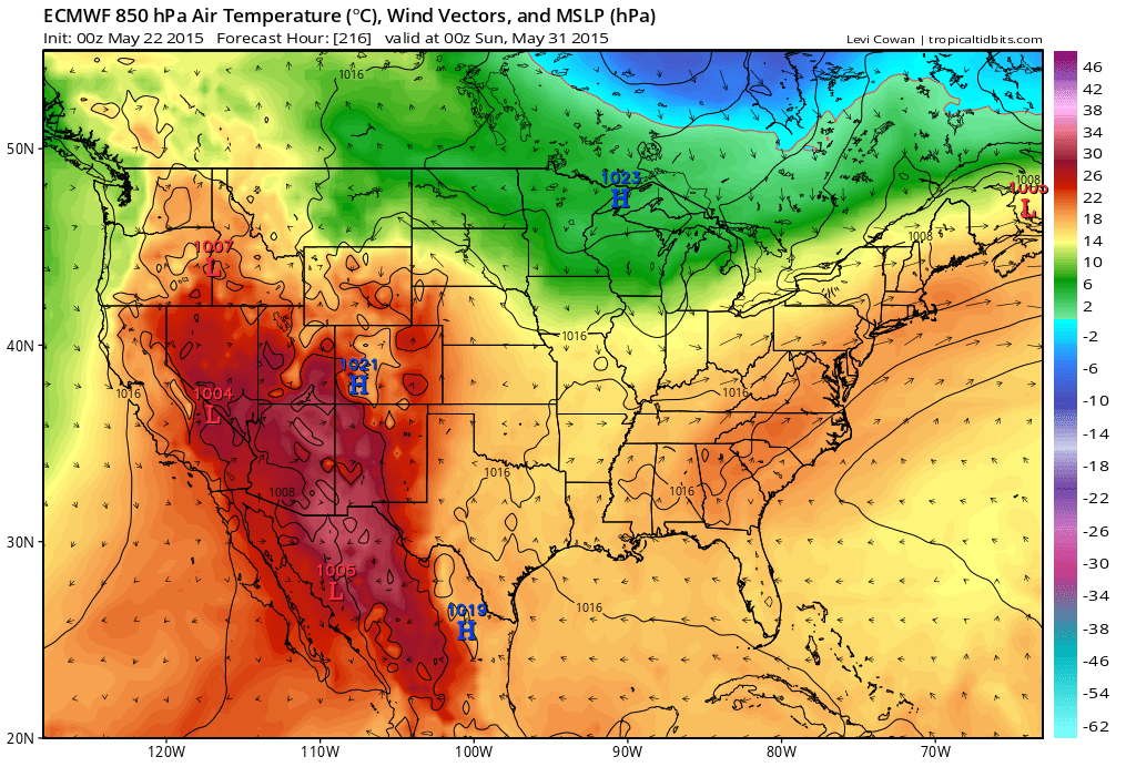
Notice the wind direction remaining stubborn out of the SW. This flow is what will draw up the warmth and moisture from Gulf of Mexico air mass and it will remain stubborn so long as the high pressure system in the Atlantic Ocean remains parked in the Bermuda area. This coupled with high-angle diurnal surface heating should put most of interior New Jersey in the 90s for high temperatures. Coastal regions would remain cooler from ocean surface temperature influence.
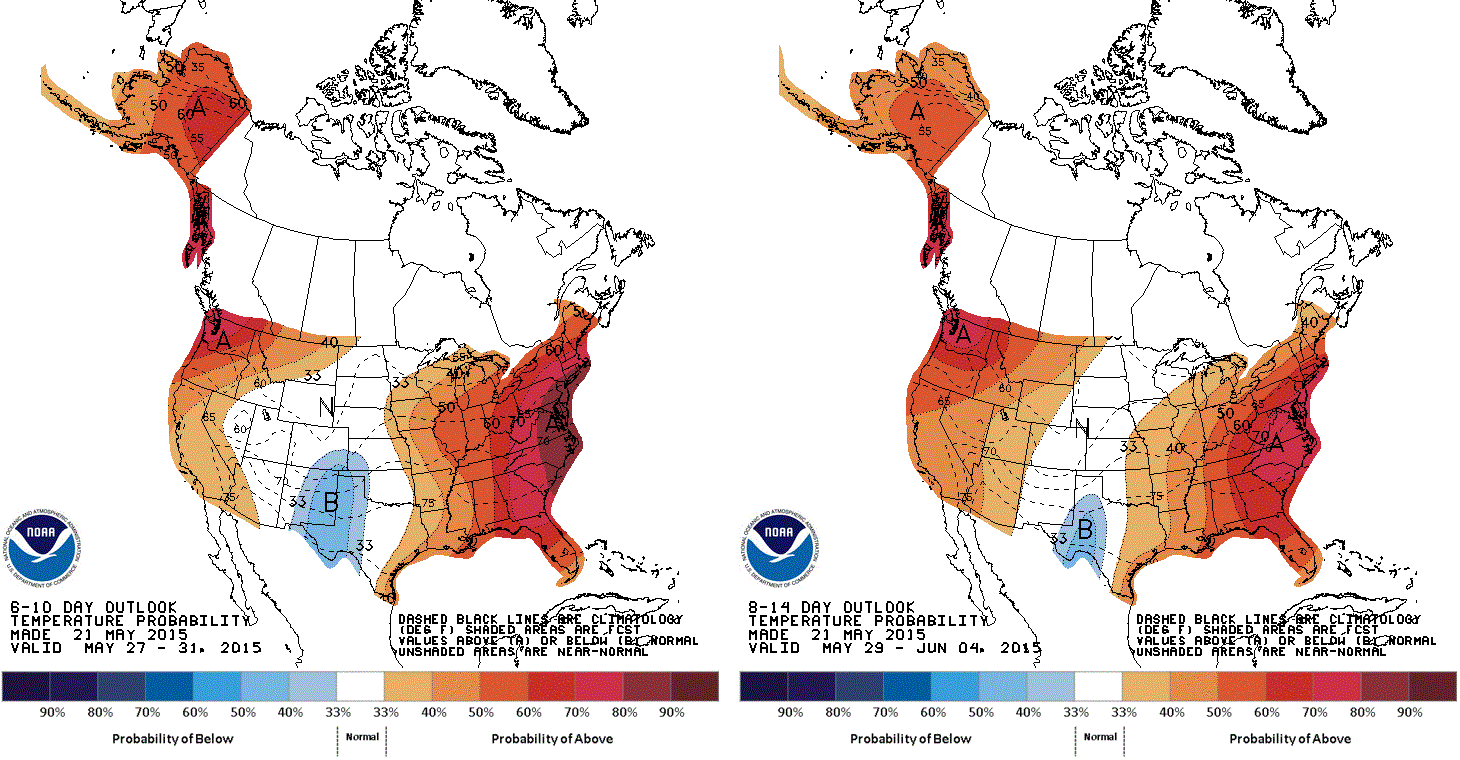
The NWS Climate Prediction Center has released the following probability diagrams indicating the percent chance of above/below-average temperatures for the 6-10 day period (left) and 8-14 day period (right):
Wild cards to watch out for during this heat wave: Fog between sunset and sunrise. PM instability-driven showers and thunderstorms. Fire hazards for areas currently in drought (NNJ and parts of CNJ).
In English: It will be hot for most of New Jersey from Tuesday through at least next weekend. July in May. Be safe! JC
Jonathan Carr (JC) is the founder and sole operator of Weather NJ, New Jersey’s largest independent weather reporting agency. Since 2010, Jonathan has provided weather safety discussion and forecasting services for New Jersey and surrounding areas through the web and social media. Originally branded as Severe NJ Weather (before 2014), Weather NJ is proud to bring you accurate and responsible forecast discussion ahead of high-stakes weather scenarios that impact this great garden state of ours. All Weather. All New Jersey.™ Be safe! JC


LOCAL FORECAST | INTERACTIVE RADAR | LATEST NJ WEATHER ALERTS | WEDDING FORECAST| PRIVACY POLICY
© Copyright 2026 Weather NJ LLC. All Rights Reserved.
Some information that can be found on our website is provided by a private weather station and is not an officially recognized station for weather reporting. Though we always strive to achieve accurate reporting for our own use, it is important that you do NOT depend on the data provided here for any purpose.
