

May 26: Watching PM Thunderstorms
Discussion: No surprises on today being the hottest and most humid day of the week. We’ve got warm sector S/SW flow at most lower-mid levels pumping in humid air mass while the near-highest sun-angle of the year heats up the surface. There hasn’t been much thunderstorm action this year. But today we have some thunderstorm triggers in place.
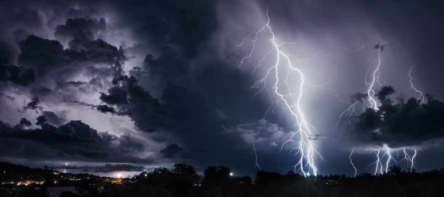
As a low moves across SE Canada from W to E, it will drag two lifting triggers across NJ. First will be a pre-frontal leeward trough. Air moves across the Appalachian Mountain range. It compresses when passing over the mountain peaks and decompresses on the other side as elevations lower. The decompression drops pressure linearly along the SE side of the Apps. This linear pressure drop forms a leeward pre-frontal trough (leeward side of mountains and before the cold front later on). The pre-frontal trough should cause enough lifting to get thunderstorms going by late-afternoon for W parts of NJ. These storms should then push across NJ from late afternoon until ~sunset (after 8pm).
As of right now NNJ is favored to see these storms but all of NJ is on the hook for at least isolated cells. SENJ has the least chance due to marine influence however sometimes sea breeze fronts can spark cells too. Not everyone will see storm activity but those who do could see severe criteria produced (for damaging wind gusts and hail). Lightning could be frequent given the CAPE and LI instability parameters. Wind shear is not crazy but adequate to support thunderstorms. The trigger is obviously the pre-frontal trough lifting mechanism (pressure drops aloft and lifts the surface – same principle as lowering mouth pressure to drink upwards through a straw.
Once the pre-frontal trough pushes through completely (likely before midnight tonight), the cold front will then closely trail through NJ during early Thursday AM hours. The pre-frontal trough should zap a lot of energy from the atmosphere so I don’t expect anything crazy with the cold front storms. Probably more like showers and breeze for a brief period (between midnight and sunrise Thursday). We then see N flow with great conditions Thursday. Friday-forward is complicated.
As of right now a rain system has high confidence to hit NJ between early Friday afternoon and early Saturday morning. Some models are clearing the rain by sunrise Saturday morning. Others are lingering the rain into Sunday. There is still a lot of uncertainty in this and hopefully I’ll have more detail in tomorrow’s Memorial Day Weekend outlook. Regardless of whether the rain shuts off early Saturday morning or sometime Sunday, we’re looking at onshore flow, clouds, and cool temperatures (mid-50s to lower-60s). Monday looks like the much better day of the weekend. I’m watching closely and will report more tomorrow with the weekend outlook.
In English: Expect a swampy humid day today until periodic showers and thunderstorms push through between afternoon today and early AM hours tomorrow. Storms should be isolated-to-scattered not widespread…so hit or miss for many. NNJ is favored for more action than SNJ. Isolated instances of severe conditions are possible especially for NWNJ. Thursday looks great with much drier feel. Friday into at least Saturday morning, possibly Sunday, looks cool (58-64) and wet. Sunday could go either way at this point (cool and dry or cool and wet). Monday looks like the better weekend day.
Jonathan Carr (JC) is the founder and sole operator of Weather NJ, New Jersey’s largest independent weather reporting agency. Since 2010, Jonathan has provided weather safety discussion and forecasting services for New Jersey and surrounding areas through the web and social media. Originally branded as Severe NJ Weather (before 2014), Weather NJ is proud to bring you accurate and responsible forecast discussion ahead of high-stakes weather scenarios that impact this great garden state of ours. All Weather. All New Jersey.™ Be safe! JC


LOCAL FORECAST | INTERACTIVE RADAR | LATEST NJ WEATHER ALERTS | WEDDING FORECAST| PRIVACY POLICY
© Copyright 2026 Weather NJ LLC. All Rights Reserved.
Some information that can be found on our website is provided by a private weather station and is not an officially recognized station for weather reporting. Though we always strive to achieve accurate reporting for our own use, it is important that you do NOT depend on the data provided here for any purpose.
