

May 3: When will the Rain End?
An upper-level trough is about to slowly swing through the entire east coast, delivering a sustained period of unsettled weather through the weekend. Here’s the 500mb look Friday afternoon when the upper-level trough centers over the Mid-Atlantic US:
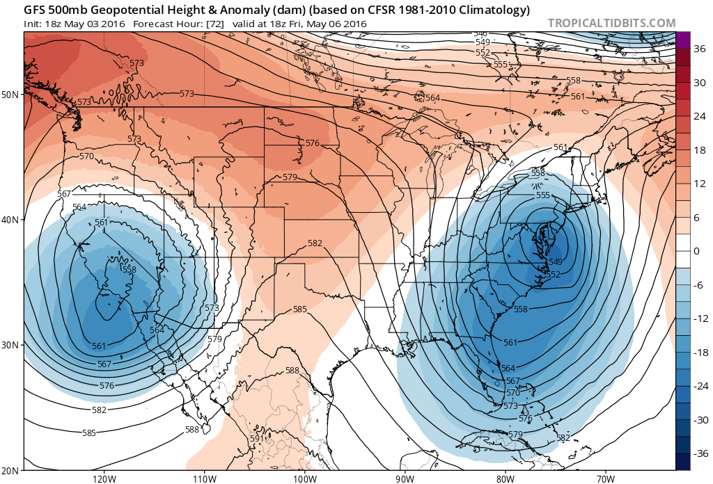
Even though the upper-level dynamics appear impressive on the front end of another omega block, there is weakness at the surface. If there was a sub-990mb surface low stacked beneath the upper-level low, then we would be dealing with a much stronger coastal storm and possibly a nor’easter. Instead we will likely see a weaker disturbance in the 1002-1004mb intensity range. So do we have a coastal storm forming for late Thursday through Saturday morning? Yes but it is weak. It will still provide nuisance conditions via onshore flow, keeping it cloudy and at the very least damp.
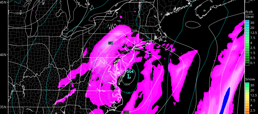
Upper-level troughs generally mean cooler and cloudier conditions but periods of sun are still possible. We’ll likely see the sun poke its head out over the next couple of days and this weekend. We’re just not going to escape being on the hook for isolated/scattered rain showers from time to time. So a mixed bag if you will until this upper-level trough kicks out. A warmer and drier ridge expected to set up next week. Here’s a surface look at the coastal disturbance on Friday. Again, weak cyclonic flow but there:
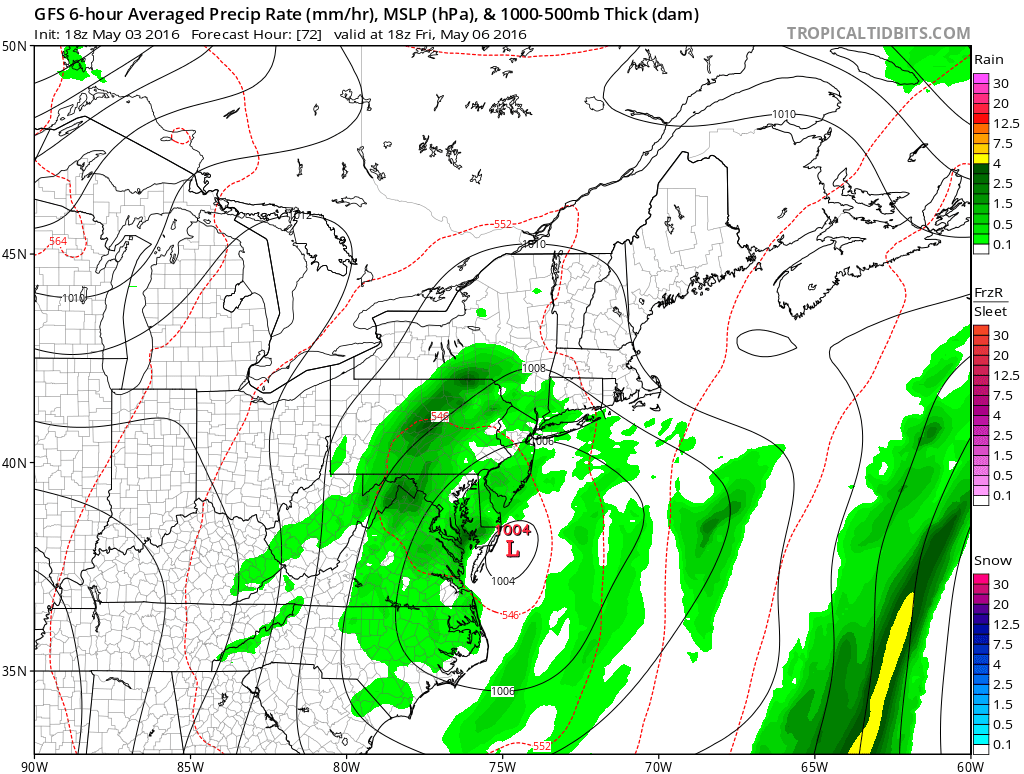
So there should be rain and winds off the ocean for this coastal disturbance between Thursday night and Saturday morning. Rainfall amounts are hard to decipher within the overall wet period this week but flooding risk should be moderate at most due to prolonged distribution of such moisture. E and E/NE winds should only be a nuisance off the ocean and felt moreso along the coast. These winds however will push some water into the normal areas prone to coastal flooding so keep an eye out for that and be careful! The best way to describe everything between now and Sunday are nuisance conditions. I wish I could tell you Saturday and Sunday will be completely dry but I can’t. It still looks unsettled. Again, sun is likely but with isolated-to-scattered showers possible.

In English: Nuisance conditions (scattered rain, light onshore winds, damp conditions and clouds) are expected through the weekend. There should still be periods of sun, especially tomorrow, Thursday morning and Saturday-Sunday. Thursday night through Saturday morning looks a little rainier due to a weak coastal disturbance passing to our S. Hang in there Jersey. We’re eventually going to snap into a warmer pattern. That still looks to happen next week. I’ll have the detailed weekend outlook posted on Thursday. Have a great night and be safe! JC
Jonathan Carr (JC) is the founder and sole operator of Weather NJ, New Jersey’s largest independent weather reporting agency. Since 2010, Jonathan has provided weather safety discussion and forecasting services for New Jersey and surrounding areas through the web and social media. Originally branded as Severe NJ Weather (before 2014), Weather NJ is proud to bring you accurate and responsible forecast discussion ahead of high-stakes weather scenarios that impact this great garden state of ours. All Weather. All New Jersey.™ Be safe! JC


LOCAL FORECAST | INTERACTIVE RADAR | LATEST NJ WEATHER ALERTS | WEDDING FORECAST| PRIVACY POLICY
© Copyright 2026 Weather NJ LLC. All Rights Reserved.
Some information that can be found on our website is provided by a private weather station and is not an officially recognized station for weather reporting. Though we always strive to achieve accurate reporting for our own use, it is important that you do NOT depend on the data provided here for any purpose.
