

May 31: Showers and Storms Rock NNJ. SNJ on Deck!
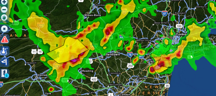
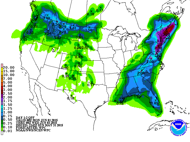
A slow moving boundary with showers and thunderstorms is pushing through the region. This should bring substantial widespread rainfall to the entire state by Tuesday morning in addition to isolated instances of severe weather. NWNJ will see the rainfall first, which is from now through tomorrow morning. SENJ should then see rainfall tomorrow through early Tuesday morning. Here are the estimated rainfall totals from now through Tuesday from the NWS Hydrological Prediction Center (basically 2-3 inches for most of NJ. 1-2 inches for SENJ):
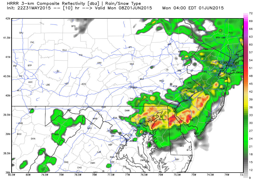
Showers and thunderstorms should continue through overnight hours. Here’s the latest ultra-high-res HRRR model showing estimated precipitation intensity at 4AM tomorrow morning:
The axis of precipitation should parallel 95 and push from NW to SE over the next 36 hours. As it does so, tropical-like moisture will continue to fall right alongside of it. The latest short-range guidance clears everything out by Tuesday afternoon with more rainfall expected next week. I’ll have the Monday-Friday outlook posted tomorrow AM.
In English: Expect humid conditions with rain and thunderstorms between now and Tuesday morning. Stormier today for those NW of the turnpike. Rainier (with some storms) overnight and tomorrow for those SE of the turnpike. Everything should move NW to SE and clear SENJ by Tuesday afternoon if not by Tuesday morning. Regardless…much needed widespread rainfall! Be safe! JC
Jonathan Carr (JC) is the founder and sole operator of Weather NJ, New Jersey’s largest independent weather reporting agency. Since 2010, Jonathan has provided weather safety discussion and forecasting services for New Jersey and surrounding areas through the web and social media. Originally branded as Severe NJ Weather (before 2014), Weather NJ is proud to bring you accurate and responsible forecast discussion ahead of high-stakes weather scenarios that impact this great garden state of ours. All Weather. All New Jersey.™ Be safe! JC


LOCAL FORECAST | INTERACTIVE RADAR | LATEST NJ WEATHER ALERTS | WEDDING FORECAST| PRIVACY POLICY
© Copyright 2026 Weather NJ LLC. All Rights Reserved.
Some information that can be found on our website is provided by a private weather station and is not an officially recognized station for weather reporting. Though we always strive to achieve accurate reporting for our own use, it is important that you do NOT depend on the data provided here for any purpose.
