

May 5: Thunderstorms Expected!
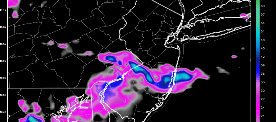
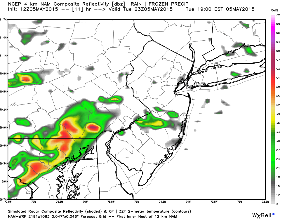
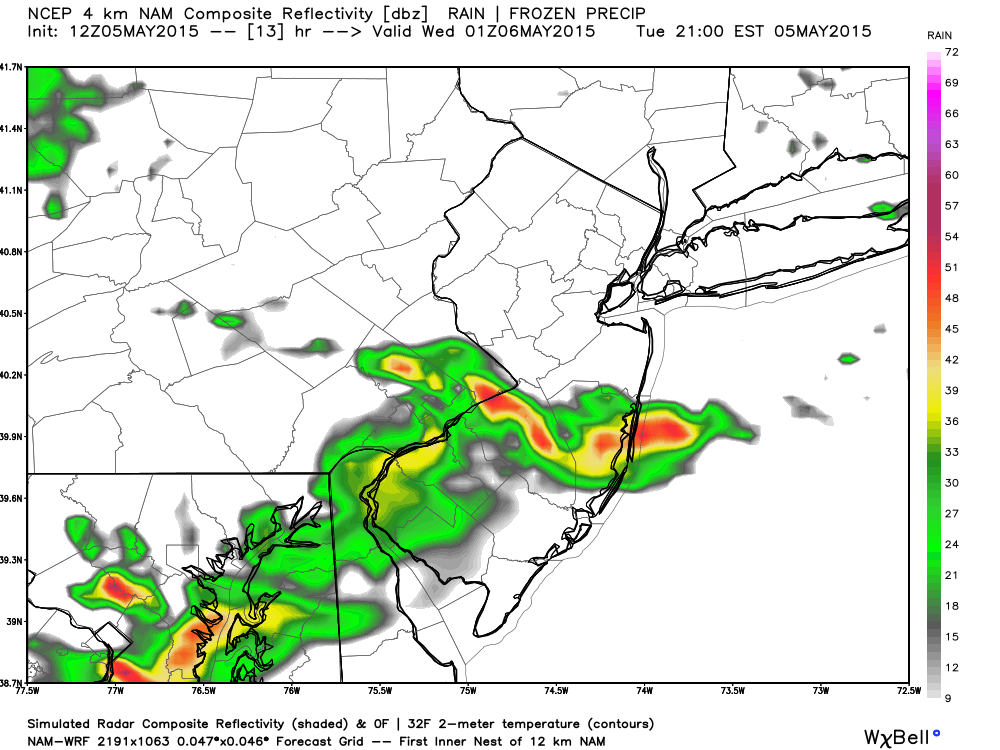
A slow moving frontal boundary will crawl across the Ohio Valley and mid-Atlantic US today. Instability and shear are both marginal but enough to support thunderstorm development in the afternoon-evening hours. The most concentrated region modeled for storms appears to span from the Philadelphia metro area across Burlington and Ocean Counties—although I’d go with CNJ/SNJ in general. Here are some simulated radar returns off the latest high-resolution NAM indicating that the window of timing is ~6-11PM:
Between 6-7PM:
Between 8-9PM (red = heavy rain):
Between 10-11PM (red = heavy rain):
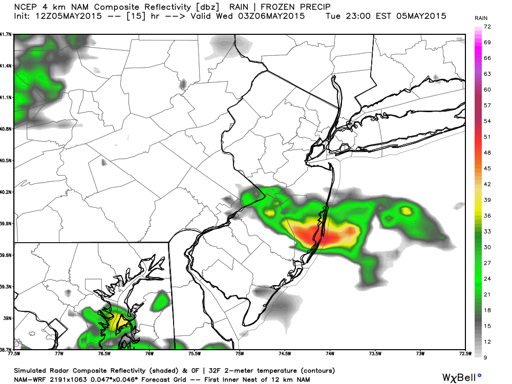
In English: Expect rain and storms this afternoon-evening, moreso for CNJ/SNJ than NNJ. 6-11PM is the best I can do given how slow the boundary will be moving. Expect heavy downpours, gusty winds, and lightning. Given the setup, lightning might be more of a periodic than frequent nature. By midnight everything should clear out to sea. More rain and storms are expected tomorrow. Be safe! JC
Jonathan Carr (JC) is the founder and sole operator of Weather NJ, New Jersey’s largest independent weather reporting agency. Since 2010, Jonathan has provided weather safety discussion and forecasting services for New Jersey and surrounding areas through the web and social media. Originally branded as Severe NJ Weather (before 2014), Weather NJ is proud to bring you accurate and responsible forecast discussion ahead of high-stakes weather scenarios that impact this great garden state of ours. All Weather. All New Jersey.™ Be safe! JC


LOCAL FORECAST | INTERACTIVE RADAR | LATEST NJ WEATHER ALERTS | WEDDING FORECAST| PRIVACY POLICY
© Copyright 2026 Weather NJ LLC. All Rights Reserved.
Some information that can be found on our website is provided by a private weather station and is not an officially recognized station for weather reporting. Though we always strive to achieve accurate reporting for our own use, it is important that you do NOT depend on the data provided here for any purpose.
