

May 6: Tropical Update
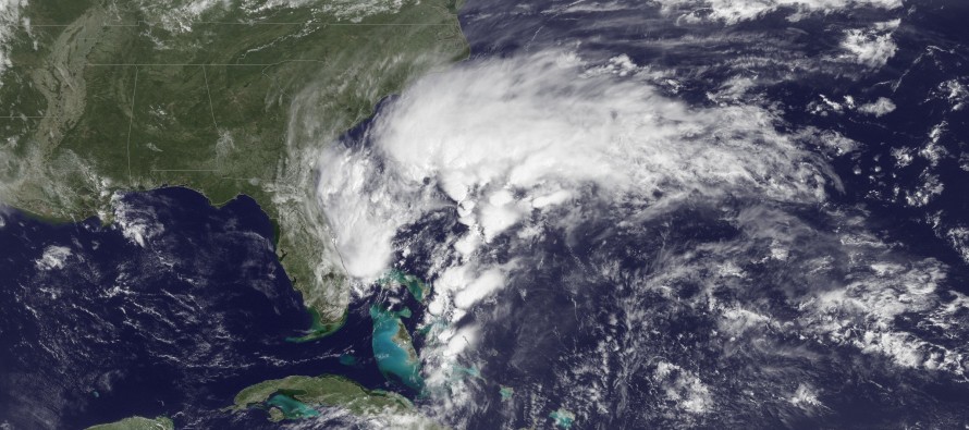
A surface low continues to develop just north of the Bahamas (above image courtesy of NOAA). The latest model guidance continues to suggest a ~South Carolina landfall in the Thursday-Friday time period. Whether or not the storm meets tropical storm criteria as Ana, the energy will linger near the SE US coast over the weekend and eventually lift out with a cold front early next week. What this means is that New Jersey should be spared from any primary tropical or sub-tropical storm impact (wind and coastal flooding). Instead, we should see some much needed widespread rainfall when the remnant energy does pass over New Jersey with other frontal precipitation ~next Tuesday.
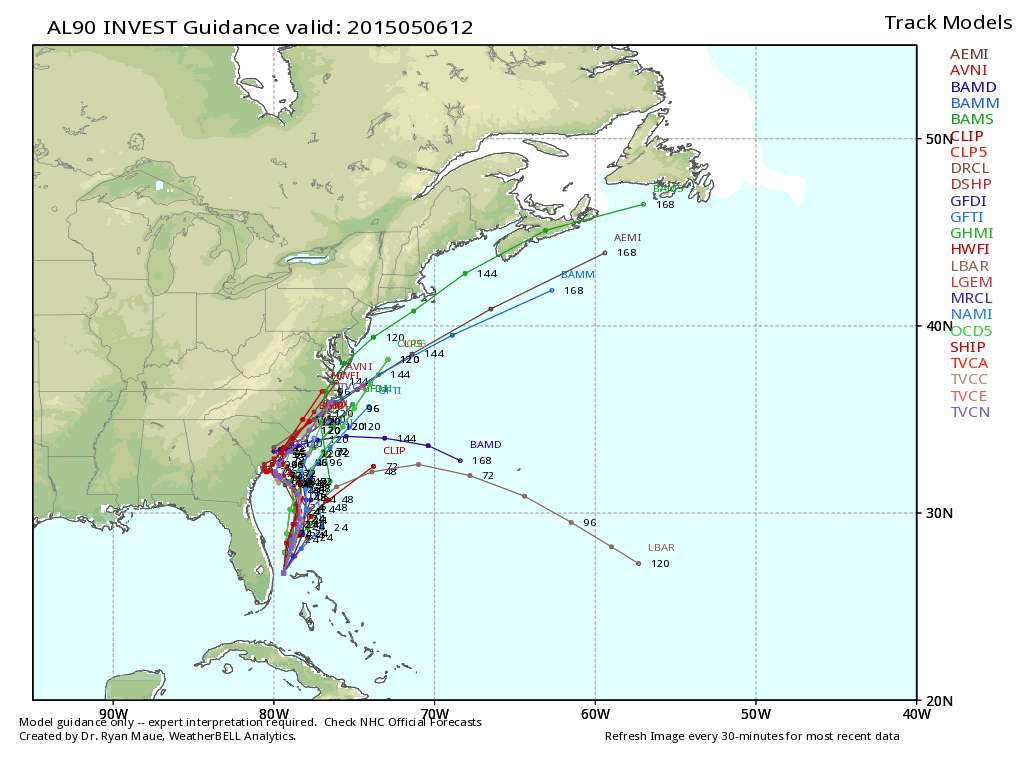
The following image represents the output of all current tropical models, also known as a spaghetti plot. From this, a visual mean of track can generally be deduced. Again, the South Carolina landfall impact is suggested for this Thursday-Friday:
Here is the latest tropical forecast discussion directly from the National Weather Service’s National Hurricane Center (NWS NHC):
ZCZC MIATWOAT ALL
TTAA00 KNHC DDHHMM

SPECIAL TROPICAL WEATHER OUTLOOK
NWS NATIONAL HURRICANE CENTER MIAMI FL
800 AM EDT WED MAY 6 2015

For the North Atlantic...Caribbean Sea and the Gulf of Mexico:

1. Disorganized showers and thunderstorms extending over portions of
Florida, the Bahamas, and adjacent waters are associated with an
upper-level trough and a weak surface low located over the
northwestern Bahamas.  The aircraft reconnaissance mission scheduled
for this afternoon has been cancelled.  However, conditions are
expected to become gradually more favorable for development over the
next day or so while the system moves slowly northward.  A
subtropical or tropical cyclone could form by Thursday or Friday,
and interests along the southeast coast of the United States should
monitor the progress of this system through the weekend. The next
Special Tropical Weather Outlook will be issued on this system by 8
PM EDT today. For additional information, see High Seas Forecasts
issued by the National Weather Service.
* Formation chance through 48 hours...medium...60 percent
* Formation chance through 5 days...medium...60 percent

High Seas Forecasts issued by the National Weather Service are
available under AWIPS header NFDHSFAT1, WMO header FZNT01 KWBC, and
on the Web at http://www.opc.ncep.noaa.gov/shtml/NFDHSFAT1.shtml

Forecaster Brennan
In English: Tropical Storm Ana (once formed) should not hit the NJ coast directly. It should instead, hit South Carolina and ride up the coast as remnant rainfall early next week. Be safe! JC
Jonathan Carr (JC) is the founder and sole operator of Weather NJ, New Jersey’s largest independent weather reporting agency. Since 2010, Jonathan has provided weather safety discussion and forecasting services for New Jersey and surrounding areas through the web and social media. Originally branded as Severe NJ Weather (before 2014), Weather NJ is proud to bring you accurate and responsible forecast discussion ahead of high-stakes weather scenarios that impact this great garden state of ours. All Weather. All New Jersey.™ Be safe! JC


LOCAL FORECAST | INTERACTIVE RADAR | LATEST NJ WEATHER ALERTS | WEDDING FORECAST| PRIVACY POLICY
© Copyright 2026 Weather NJ LLC. All Rights Reserved.
Some information that can be found on our website is provided by a private weather station and is not an officially recognized station for weather reporting. Though we always strive to achieve accurate reporting for our own use, it is important that you do NOT depend on the data provided here for any purpose.
