

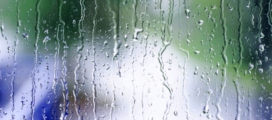
Mild and Wet for Most (Feb 3-7)
Discussion: In the upper-levels, anomalous ridging should dominate the pattern for the next 10 days. In some cases the ridging retrogrades W enough to pull some troughing down from SE Canada over our area. At the surface this means a very active pattern with a decent amount of rainfall this week. For the lower-2/3 of NJ rain is likely the primary form of precipitation. For NWNJ elevations things could get hairy between Wednesday and Friday especially during colder overnight hours. The greatest period of interest is N of I-78/NW of I-287 on Thursday. We’re possibly looking at an ice storm. Will have to play it by ear. The weekend then looks calmer once the Friday system moves out. Next week starts a series of storm signals with some of them now looking colder. Let’s see how they look at the end of this week.
Monday (Feb 3) high temperatures should reach into the 50s for most areas. Interior CNJ/SNJ would have the best chance to break 60. Skies should be mixed with sun and clouds. Winds should be light out of the W. Overnight lows should range from mid-30s to mid-50s NNJ to SNJ.
Tuesday (Feb 4) high temperatures should again reach into the 50s for most with interior CNJ/SNJ having the best shot at breaking 60. Skies should be mostly cloudy. Winds should be light out of the SW. Overnight lows should range from mid-30s to upper-40s NNJ to SNJ.
Wednesday (Feb 5) high temperatures should range from upper-30s to upper-40s NNJ to SNJ. Skies should be mostly cloudy with periods of drizzle and rain likely. Winds should be light out of the NE. Overnight lows should range from mid-20s to upper-30s NNJ to SNJ. Precipitation could become wintry (snow/sleet/freezing rain) for NNJ areas that dip below freezing overnight. Right now that looks like N of I-78/NW of I-287). I’ll update if needed.
Thursday (Feb 6) high temperatures should range from lower-30s to upper-40s NNJ to SNJ. Skies should be mostly cloudy with more rain likely. NNJ is subject to some snow but more concerningly icing. I’ll update this as needed as well. Winds should be light out of the NE. Overnight lows should range from near-freezing to mid-40s NNJ to SNJ as rain continues overnight.
Friday (Feb 7) high temperatures should reach well into the 40s for most areas. NNJ elevations could max out colder and closer to freezing. Rain is likely for most with extreme NWNJ possibly seeing wintry precipitation. Winds should start out of the SW and end out of the NW. Overnight lows should range from near-20 to near-30 NNJ to SNJ as conditions improve.
An early look at the weekend indicates highs generally in the 40s with lows near/slightly-below freezing. Once the Friday system moves out Saturday and Sunday should be drier despite some clouds still lingering. The unsettled pattern continues with a few stronger storm signals next week. Have a great week and please be safe! JC
Download the new free Weather NJ mobile app on Apple and/or Android. It’s the easiest way to never miss Weather NJ content. Our premium services go even further above and beyond at the hyper-local level. Looking for industrial-caliber long-range forecasting data that I personally recommend? Check out WeatherTrends360! Visit the Weather NJ Kaboom Shop for hoodies, tees and infant onesies.
Jonathan Carr (JC) is the founder and sole operator of Weather NJ, New Jersey’s largest independent weather reporting agency. Since 2010, Jonathan has provided weather safety discussion and forecasting services for New Jersey and surrounding areas through the web and social media. Originally branded as Severe NJ Weather (before 2014), Weather NJ is proud to bring you accurate and responsible forecast discussion ahead of high-stakes weather scenarios that impact this great garden state of ours. All Weather. All New Jersey.™ Be safe! JC


LOCAL FORECAST | INTERACTIVE RADAR | LATEST NJ WEATHER ALERTS | WEDDING FORECAST| PRIVACY POLICY
© Copyright 2026 Weather NJ LLC. All Rights Reserved.
Some information that can be found on our website is provided by a private weather station and is not an officially recognized station for weather reporting. Though we always strive to achieve accurate reporting for our own use, it is important that you do NOT depend on the data provided here for any purpose.

)