

Mixed Conditions (Aug 14-16)
Discussion: To address today (Thursday, Aug 13) real quick, we still have an area of convergence along a near-stationary frontal boundary positioned right over the I-95/NJTP corridor. This is producing more near-stationary downpours and thunderstorms for CNJ and SNJ capable of producing flash flooding. Conditions should remain unsettled into tomorrow (Friday, Aug 14).
The upper-jet and 500mb height anomalies look rather uneventful this weekend. The surface features should be most noticeable. We have a weak coastal disturbance forming near OBX tonight which should move offshore of NJ by tomorrow. The E flow on the north side of the low will team up with the E flow on the S side of a SE Canadian high to produce a strong E/NE flow for NJ Friday into Saturday. Conditions should improve statewide by Friday evening with Saturday looking dry. On Sunday another low pressure disturbance should push through to the S of NJ brining more downpours and thunderstorms. Next week looks like our first true sign of relief as a high drops out of Canada into the W Great Lakes area, producing cooler and drier NW flow statewide. This means lower temperatures and lower dew points (humidity). This should last for at least the first half of the week before we moderate back warmer and more humid.
Note: Unless specifically mentioned by location (Example: NNJ elevations, SENJ immediate coast, Interior CNJ/SNJ, etc.) assume the following forecast language is statewide for New Jersey. When I say “from elevations to sea” I mean from NWNJ mountains spreading down to SENJ coastal areas. Directions are shortened (N = North, S = South, W/SW = West/SouthWest, etc.).
Friday (Aug 14) high temperatures should reach the low-to-mid 80s with a humid feel. Showers and thunderstorms will likely be around for morning into afternoon hours with conditions improving through evening. Winds should be light out of the NE, perhaps a little breezier along the ECNJ/SENJ coast. Overnight lows should range from mid-60s to near-70 from elevations to sea.
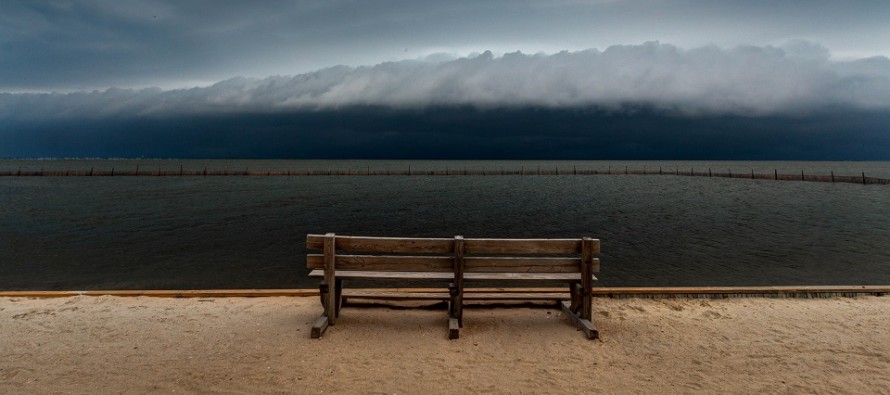
Saturday (Aug 15) high temperatures should reach near-80 with a less humid feel. Skies should be mixed with sun and clouds. Winds should be light out of the E/NE, perhaps a little breezier along the ECNJ/SENJ coast. With that said, the surf could be rough with rip currents. Overnight lows should range from mid-60s to near-70 from elevations to sea.
Sunday (Aug 16) high temperatures should reach the mid-to-upper 70s for most areas. Skies should be mostly cloudy with showers and thunderstorms around. Winds should be light out of the E/NE, perhaps a little breezier along the ECNJ/SENJ coast. Surf should remain rough with rip currents. Overnight lows should range from mid-60s to near-70 from elevations to sea.
An early look at next week indicates conditions a little more settled than this past week. I’m seeing highs just reaching into the lower-80s with lower humidity. Wednesday looks like the lowest humidity/coolest day with highs struggling to break 80.
Download the free Weather NJ mobile app on Apple and/or Android. It’s the easiest way to never miss Weather NJ content. Our premium services go even further above and beyond at the hyper-local level. Looking for industrial-caliber long-range forecasting data that I personally use and recommend? Check out WeatherTrends360!
Jonathan Carr (JC) is the founder and sole operator of Weather NJ, New Jersey’s largest independent weather reporting agency. Since 2010, Jonathan has provided weather safety discussion and forecasting services for New Jersey and surrounding areas through the web and social media. Originally branded as Severe NJ Weather (before 2014), Weather NJ is proud to bring you accurate and responsible forecast discussion ahead of high-stakes weather scenarios that impact this great garden state of ours. All Weather. All New Jersey.™ Be safe! JC


LOCAL FORECAST | INTERACTIVE RADAR | LATEST NJ WEATHER ALERTS | WEDDING FORECAST| PRIVACY POLICY
© Copyright 2026 Weather NJ LLC. All Rights Reserved.
Some information that can be found on our website is provided by a private weather station and is not an officially recognized station for weather reporting. Though we always strive to achieve accurate reporting for our own use, it is important that you do NOT depend on the data provided here for any purpose.

)