

Mixed Conditions Expected (Jan 12-14)
Real quick, today is the last day to purchase a KABOOM hoodie. The hoodie shop will close around 9PM tonight. A generous portion of proceeds are going to great causes. Thanks for you support!
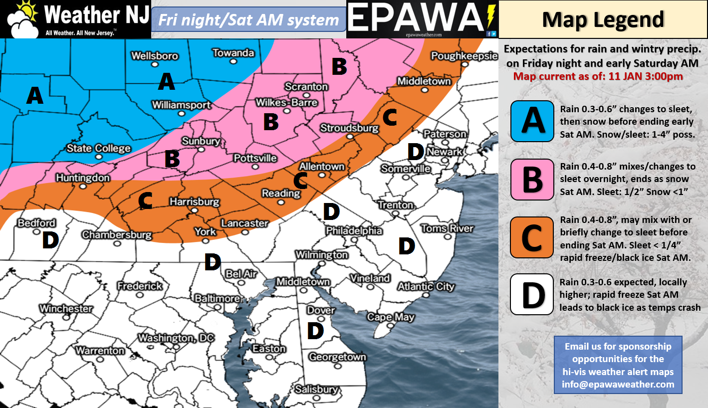
Discussion: Please click here for full resolution impact map! After an initial round of warm rain only (tonight through tomorrow) an Arctic front will push through the region between Friday and Saturday. Most precipitation should occur along and ahead of this front. Therefore we’re looking at a mostly rain event with points NW of 95 possibly ending as sleet or freezing rain, maybe even flurries. Little-to-no snow accumulation is expected however. The mostly likely scenario is that rain ends before the cold can catch up to it to produce the more wintry event. The rapid-freeze/black ice potential on Saturday is for real however. We’re then cold as an upper-level low floats through the E US ridging and brings a reinforcing shot of cold air out of the NW. This takes us through about next Friday. There is the potential for a snow event Tuesday into Wednesday but the setup is incredibly volatile given the closed-off aforementioned cut-off low. We’re likely looking at a surface low transfer which could have tremendous impact on the precipitation shield. Look for near-future articles and videos about this potential once I see a little more guidance and live-obs heading into the weekend. We should then return to warmer temperatures for next weekend…another transient January thaw period.
Friday (Jan 12) high temperatures should reach well into the 50s statewide. Parts of interior and SNJ might break into the lower-60s. Skies should be mostly cloudy with rain likely spilling over from Thursday night. A break in rain is expected between afternoon and evening hours. Rainfall should then continue overnight. Winds should be breezy out of the S. Overnight lows should fall into the 40s for most with NNJ likely dipping into the mid-to-upper 30s.
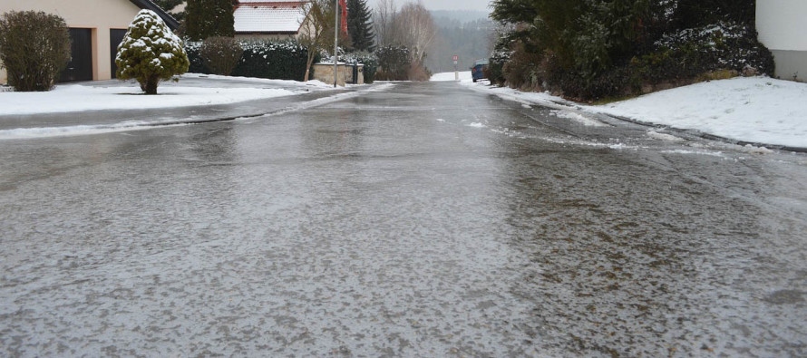
Saturday (Jan 13) high temperatures should reach their peak early in the AM hours just after midnight. This could range from 40s to 50s. Temperatures should then steadily drop throughout the day. Skies should start out mostly cloudy with overnight rainfall possibly ending as sleet/freezing rain/flurries NW of 95 (little-to-no accumulation expected). Areas SE of 95 will struggle to produce anything but plain rain. I wouldn’t rule out a few boomers early Saturday morning, especially for NNJ. Precipitation should end by late-morning if not earlier. We might see some blue sky before sunset but no promises. Winds should be breezy-to-gusty out of the W/NW. Overnight lows should range from 10-20 NNJ to SNJ. Watch out for standing puddles and wet surfaces that haven’t evaporated by afternoon as such surfaces will likely freeze. For this reason, black ice from rapid-freezing is very possible on Saturday.
Sunday (Jan 14) high temperatures should struggle to escape the 20s statewide. Skies should be mostly sunny. Winds should be light out of the NW. Overnight lows should range from single-digits to teens NNJ to SNJ.
An early look at next week indicates another cold day on Monday followed by a possible snow event Tuesday into Wednesday. We’ve been geeking out on this for some time in the premium forum and will soon address publicly in-detail as guidance evolves heading into the weekend. As of right now it looks like a light event but the upper-level dynamics are somewhat impressive so we’ll have to watch this. After that Wednesday night through Friday should stay on the colder side with NW flow behind the low. Next weekend then looks to feature another transient January thaw warm-up.
For comprehensive and interactive hyper-local analysis that goes way above and beyond the detail of this public forecast, check out our premium services which include text notifications and forum access.
Jonathan Carr (JC) is the founder and sole operator of Weather NJ, New Jersey’s largest independent weather reporting agency. Since 2010, Jonathan has provided weather safety discussion and forecasting services for New Jersey and surrounding areas through the web and social media. Originally branded as Severe NJ Weather (before 2014), Weather NJ is proud to bring you accurate and responsible forecast discussion ahead of high-stakes weather scenarios that impact this great garden state of ours. All Weather. All New Jersey.™ Be safe! JC


LOCAL FORECAST | INTERACTIVE RADAR | LATEST NJ WEATHER ALERTS | WEDDING FORECAST| PRIVACY POLICY
© Copyright 2026 Weather NJ LLC. All Rights Reserved.
Some information that can be found on our website is provided by a private weather station and is not an officially recognized station for weather reporting. Though we always strive to achieve accurate reporting for our own use, it is important that you do NOT depend on the data provided here for any purpose.

)