

Mixed Conditions for Memorial Day Weekend
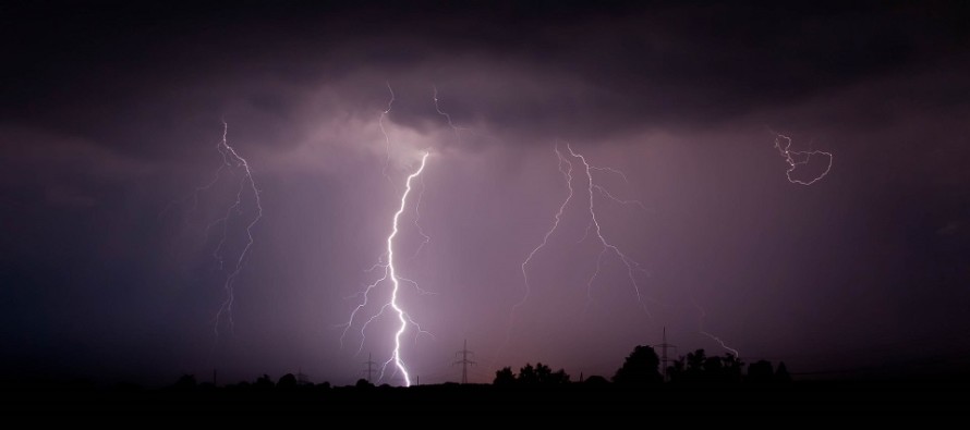
Discussion: As someone vested in outdoor BBQ interests this weekend, like many of you, I’ve been monitoring this weekend’s weather forecast like a hawk. At first (from fantasy range) there was a potential hurricane capable of bringing remnants up the coast. That fell off the table as we entered the long range forecasting period (this past weekend). At that point, we were looking dry and clear the entire weekend behind a cold frontal passage this Friday. Since early this week, the developing trend has been for an upper-level low cut off and follow/meander behind the cold front…rather than move away to the NE like the primary surface low. As we all know cut-off upper level lows are next to impossible to forecast correctly since they chaotically track like an amoeba. We also know that an upper low means a condensed atmosphere where moisture has to travel upwards shorter before condensing into rain/storms (think fall looking skies vs summery skies). Therefore the atmosphere is unsettled under an upper low. Well it does look like the upper low will break off and track through NJ. However the upper low will take a beating from the Atlantic Ocean ridge. If it looked to hold form then we’d be talking washout. But it will be fizzling. What does this mean?
It means Thursday and Friday look warm and muggy (warm sector) during the day. Thursday looks okay but at some point during Friday PM hours, the cold front will push a period of rain and thunderstorms through. This should clear by early Saturday AM. Saturday then looks pretty good aside from isolated showers and thunderstorms that could form beneath the upper low. It could very well be a waste of concern (ends up being a nice dry day) or you could get stuck under a passing isolated cell. I am not confident in expressing that Saturday will be rain free. Believe me I am hoping it is. But the science says what it says about the unsettled nature of an upper low. Sunday then looks even better with only a super isolated chance of something, if anything. The upper low should be almost fully dissolved but possibly not 100%. Monday is the only day that looks confidently rain-free. So the holiday weekend overall should transition from stormy Friday night to great by Memorial Day. This is the best I can do.
Friday (May 27) high temperatures should reach the mid-to-upper 70s for most areas. Probably low-to-mid 80s for interior CNJ/SNJ. Skies should clear, with a humid feel, but gradually increase in cloud coverage especially during PM hours. Rain and thunderstorms are likely from late-afternoon through overnight hours. Winds should be light-to-breezy out of the S for most but possibly breezy-to-gusty along the immediate SNJ coast. Overnight lows should stay in the 60s as rain pushes offshore.
Saturday (May 28) high temperatures should reach the mid-to-upper 70s for most areas. Skies should be mixed with sun and clouds. Isolated showers and thunderstorms are possible during afternoon/evening hours. Winds should be light out of the W/SW. Overnight lows should fall to near-60.
Sunday (May 29) high temperatures should reach the mid-to-upper 70s for most areas. Skies should be mixed (mostly sunny – some clouds). Most likely outcome is a great day but cannot rule out super isolated and quick moving shower or t-storm. Winds should be light out of the W/NW. Overnight lows should make it down to about 60 again.
Monday (May 30 – Memorial Day) high temperatures should reach the low-to-mid 80s for most. Immediate coastal regions could hang in the 70s. Skies should be mostly sunny. Winds should be light out of the S. Overnight lows should once again fall to near-60.
An early look at the rest of next week indicates more 70s and 80s with mostly dry conditions to start…maybe some t-storms by Thurs-Fri period. Let’s take a closer look in a few days. Have a great holiday weekend, honor those who have fallen for our country, and please be safe! JC
Premium Services
KABOOM Club offers inside info forecast discussion, your questions answered, and early storm impact maps (ahead of the public). At a buck per month, it’s an extremely feasible way to show support.
My Pocket Meteorologist (MPM), in partnership with EPAWA Weather Consulting, offers professional/commercial interests, whose businesses depend on outdoor weather conditions (snow plowing, landscaping, construction, etc.), with hyper-local text message alerts/forecasts and access to the MPM premium forum—the most comprehensive and technical forecast discussion available for PA and NJ.
Jonathan Carr (JC) is the founder and sole operator of Weather NJ, New Jersey’s largest independent weather reporting agency. Since 2010, Jonathan has provided weather safety discussion and forecasting services for New Jersey and surrounding areas through the web and social media. Originally branded as Severe NJ Weather (before 2014), Weather NJ is proud to bring you accurate and responsible forecast discussion ahead of high-stakes weather scenarios that impact this great garden state of ours. All Weather. All New Jersey.™ Be safe! JC


LOCAL FORECAST | INTERACTIVE RADAR | LATEST NJ WEATHER ALERTS | WEDDING FORECAST| PRIVACY POLICY
© Copyright 2025 Weather NJ LLC. All Rights Reserved.
Some information that can be found on our website is provided by a private weather station and is not an officially recognized station for weather reporting. Though we always strive to achieve accurate reporting for our own use, it is important that you do NOT depend on the data provided here for any purpose.
