

Mixed Conditions Reload Cooler Drier Pattern
Discussion: So, August 2025 came in about 2-4 degrees below average. Sure, August had a couple of hot waves here and there but you can’t deny the prolonged periods of pleasant-to-warm days and cool dry nights. We’ve been continuously placed under the w side of a series of upper-low/troughs swinging through…behind surface low after surface low. This has allowed cooler and drier Canadian air to feed into the air over NJ. The drier air has allowed daytime temps to pop but still with low humidity. Then, we’ve been seeing drops into the 40s/50s overnight. Woke up cold a few mornings. My own experience would say that it felt more like mid-to-late September weather rather than early September FWIW. Today, we find ourselves in one of those transient (few-day long) periods of warmer temperatures and higher humidity. It ends with the cold front during Sunday AM hours but it keeps an uncomfortable feel around today (Friday) and at least the first half of Saturday. We’re currently in a warm sector and a series of lifting will make for unsettled conditions Saturday across NJ. The morning looks alright but noon-forward looks questionable. There’s lifting/rain along the approaching cold front, along a daytime pre-frontal trough, and out near a developing coastal low offshore. Between those areas of lift will be sinking air that inhibits rain and storms. With that said, it’s hard to estimate timing of rain and storms Saturday but the time period for the best chances are afternoon through evening into Sunday morning. The rain and clouds are expected to collapse behind the cold front sometime between early Sunday AM and maybe 11AM. After that, it’s nothing but improvement for Sunday PM hours. A bunch of zonal W and W/NW flow next week should produce glorious conditions next week, possibly through the weekend…more warm but comfortable days and cool nights. 91L is a weak invest that could approach the Lesser Antilles next week if it can get going. About all that can be said for it for now.
Forecast
Friday (Sept 5) high temperatures, as of about 3:30pm, are maxing in the mid-to-upper 80s along the I-95/NJTP corridor. A few spots could reach 90. Otherwise, cooler in the 75-80 range for NNJ elevations and ECNJ/SENJ coastal areas. Humidity is up, allowing heat indices of just over 90 in a few SENJ spots. Skies should remain mostly clear this evening with a stiff S/SW breeze, especially along the coast. Overnight lows should fall to the 65-70 range with humidity lingering into Saturday.
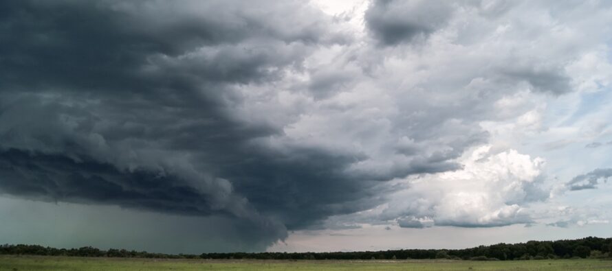
Saturday (Sept 6) high temperatures should be similar to Friday, upper-80s along the corridor and 25 miles on each side of such, closer to 80 along the immediate coast and for elevations. Expect a breezy and humid start to the day with mixed sun and clouds. Then showers and thunderstorms are possible from afternoon-forward. Like Thursday night, shower and thunderstorm activity favors NWNJ over SENJ. A good chance for all but a higher chance NW of I-95/NJTP. Shower and storm chances persist into overnight hours as lows fall to the 55-65 range NNJ to SNJ.
Sunday (Sept 7) high temperatures should max in the mid-70s for most NJ locations. Looks like a breezy, possibly still rainy, start but with much improvement afternoon-forward. Cold front coming through to reload the cool and dry pattern. Winds will eventually switch to the NW and drive overnight temps down into the 40s/50s for most NJ locations.
An early look at next week (Sept 8-12) indicates great conditions. Low-to-mid 70s away from the ocean. Mid-to-upper 70s along the coast. Low humidity and pleasant feel. Might last right into next weekend. Watching a developing system in the tropics but no threat to NJ as of now. Will advise accordingly if that changes. Have a great weekend and please be safe! JC
Premium Services
KABOOM Club offers ad-free content, inside info forecast discussion, your questions answered, and early storm impact maps and video releases (ahead of the public). At two bucks per month, it’s an extremely feasible way to show additional support for Weather NJ. Think of it as a tip jar with perks. Available onFacebook or Patreon.
My Pocket Meteorologist (MPM), in partnership with EPAWA Weather Consulting, offers professional/commercial interests, whose businesses depend on outdoor weather conditions (snow plowing, landscaping, construction, etc.), with hyper-local text message alerts/forecasts and access to the MPM premium forum—the most comprehensive and technical forecast discussion available for PA and NJ.
Jonathan Carr (JC) is the founder and sole operator of Weather NJ, New Jersey’s largest independent weather reporting agency. Since 2010, Jonathan has provided weather safety discussion and forecasting services for New Jersey and surrounding areas through the web and social media. Originally branded as Severe NJ Weather (before 2014), Weather NJ is proud to bring you accurate and responsible forecast discussion ahead of high-stakes weather scenarios that impact this great garden state of ours. All Weather. All New Jersey.™ Be safe! JC


LOCAL FORECAST | INTERACTIVE RADAR | LATEST NJ WEATHER ALERTS | WEDDING FORECAST| PRIVACY POLICY
© Copyright 2026 Weather NJ LLC. All Rights Reserved.
Some information that can be found on our website is provided by a private weather station and is not an officially recognized station for weather reporting. Though we always strive to achieve accurate reporting for our own use, it is important that you do NOT depend on the data provided here for any purpose.
