

Mixed Weather Expected (July 8-10)
We’ll likely remain unsettled through Saturday with Sunday looking like the best day of the weekend. Let’s break it down:
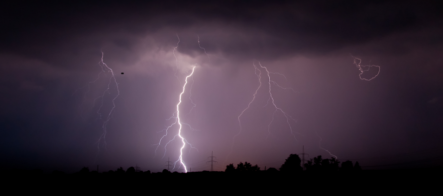
Friday (July 8) high temperatures should level off around 90 away from the ocean and up in the NNJ elevations. The coast should be held to the mid-80s. Skies should feature sun and clouds with elevated humidity. Thunderstorms are possible between early evening and overnight hours. Winds should be generally light out of the SW (unless of course a storm is over you). Overnight lows should struggle to fall below 70 statewide with the exception of NNJ elevations. A classic humid summer night.
Saturday (July 9) high temperatures should reach well into the 80s statewide. Interior SNJ/CNJ could flirt with 90. Skies should remain humid and mixed with sun and clouds. Isolated-to-scattered thunderstorms are possible in hit-or-miss fashion. Not an all day washout. Winds should be light out of the W. Overnight lows should fall into the 60s for most. Parts of CNJ/SNJ could bottom out only around 70.
Sunday (July 10) high temperatures should reach the low-to-mid 80s for most. It might just break 80 for NNJ elevations. Skies should be partly-to-mostly sunny, not as warm and have a slightly drier feel. Winds should be breezy out of the W/NW. Overnight lows should fall into the 60s for most and possibly even the upper-50s for NNJ elevations.

An early look at next week indicates another nice day on Monday with heat and humidity returning by mid-week. Have a great weekend and be safe! JC
Jonathan Carr (JC) is the founder and sole operator of Weather NJ, New Jersey’s largest independent weather reporting agency. Since 2010, Jonathan has provided weather safety discussion and forecasting services for New Jersey and surrounding areas through the web and social media. Originally branded as Severe NJ Weather (before 2014), Weather NJ is proud to bring you accurate and responsible forecast discussion ahead of high-stakes weather scenarios that impact this great garden state of ours. All Weather. All New Jersey.™ Be safe! JC


LOCAL FORECAST | INTERACTIVE RADAR | LATEST NJ WEATHER ALERTS | WEDDING FORECAST| PRIVACY POLICY
© Copyright 2026 Weather NJ LLC. All Rights Reserved.
Some information that can be found on our website is provided by a private weather station and is not an officially recognized station for weather reporting. Though we always strive to achieve accurate reporting for our own use, it is important that you do NOT depend on the data provided here for any purpose.

)