

Mixed Weather Expected (May 1-5)
Tonight looks warm and stormy but the rest of the week looks cooler with a wet finish. Let’s break it down…
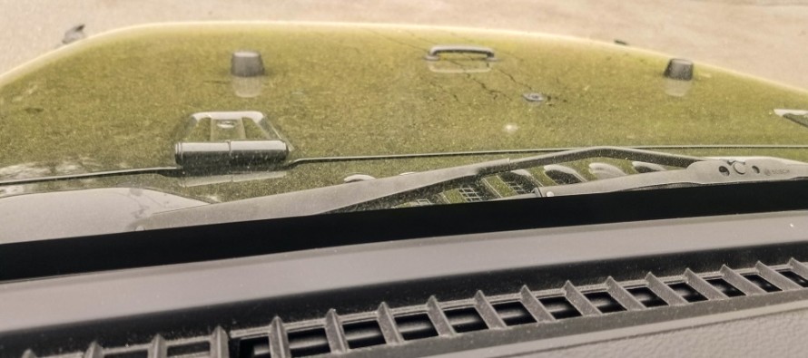
Discussion: As you can see by the photo I took of my Jeep this morning, the pollen struggle this week is for real. Today looks like the last warmer day for a bit. A strong upper-level low will track from the Midwest US through the Great Lakes and into SE Canada over the next 48 hours. This should power a surface low beneath that drags a cold front through the E US. A strong moisture tap from the Gulf of Mexico is modeled to ride this frontal boundary towards the low. Therefore, we’re on the hook for a passing line of rain and possibly thunderstorms this evening (Monday evening). While this may provide a temporary pollen rinse for Tuesday, levels return to high by Wednesday. Thunderstorm dynamics are far more impressive to our W for areas between the Ohio Valley and the Delaware River. Therefore I expect thunderstorm activity to start strong today for PA and fizzle for NJ. They might not fizzle quick enough, however, to avoid some NJ disruption. For now, my gut says most NJ thunderstorm activity remains under severe criteria mainly from marine stabilization. Isolated instances of severe criteria are possible with WNJ favored over ENJ. Timing tonight (Monday) appears to fall between 9pm and the early AM hours of tomorrow. Tuesday through Thursday appear drier and cooler. Thursday night into Friday morning, we should warm a bit ahead of another synoptic system. Then widespread rainfall is expected through most of Friday. Saturday and Sunday look cool behind the cold front and generally unsettled.
Monday (May 1) high temperatures should reach into the 70s for most, possibly 80 away from the ocean. Skies should be partly sunny for most of the day. Rain and thunderstorms are possible between sunset and midnight (will be monitoring this evening). WNJ timing before midnight and ENJ timing closer to midnight/a few hours after midnight. A quick half-inch of rain could fall despite the very-thin modeled storm line. Some could be severe but in general activity should weaken once E of the Delaware. Winds should be breezy-to-gusty out of the S/SW. Overnight lows should hang in the lower-60s for most. NNJ elevations could dip into the 50s.
Tuesday (May 2) high temperatures should reach the upper-60s/lower-70s statewide. Skies should feature a mixed bag of sun and clouds. Winds should be breezy-to-gusty out of the W/SW. Overnight lows should fall into the 50s for most and possibly the 40s for NNJ elevations.
Wednesday (May 3) high temperatures should reach the upper-50s/lower-60s statewide. Skies should be mostly sunny. Winds should be breezy-to-gusty out of the W/NW. Overnight lows should fall into the 40s for most and possibly the 30s for NNJ elevations (possible frost).
Thursday (May 4) high temperatures should reach the upper-50s/lower-60s statewide. Skies should start mostly sunny but increase in cloud coverage throughout the day. Winds should be light-to-breezy out of the E/SE. Overnight lows should fall into the 50s during/just after sunset. However southerly flow could warm the region later overnight ahead of the approaching rain system.
Friday (May 5) high temperatures should reach into the 60s for most. Skies should be mostly cloudy with widespread rainfall likely. Winds should be light to breezy out of the S/SE. Overnight lows should fall into the lower-50s statewide with marine temperature buffering likely the culprit.
An early look at the weekend indicates cooler and mostly cloudy conditions. Highs in the 60s. Lows in the 40s. Possible scattered light precipitation/remnants in the wake of the the widespread Friday system. Let’s take a closer look on Thursday evening. I’ll be posting thunderstorm updates for tonight throughout today. Otherwise everyone have a great week and please be safe! JC
Jonathan Carr (JC) is the founder and sole operator of Weather NJ, New Jersey’s largest independent weather reporting agency. Since 2010, Jonathan has provided weather safety discussion and forecasting services for New Jersey and surrounding areas through the web and social media. Originally branded as Severe NJ Weather (before 2014), Weather NJ is proud to bring you accurate and responsible forecast discussion ahead of high-stakes weather scenarios that impact this great garden state of ours. All Weather. All New Jersey.™ Be safe! JC


LOCAL FORECAST | INTERACTIVE RADAR | LATEST NJ WEATHER ALERTS | WEDDING FORECAST| PRIVACY POLICY
© Copyright 2026 Weather NJ LLC. All Rights Reserved.
Some information that can be found on our website is provided by a private weather station and is not an officially recognized station for weather reporting. Though we always strive to achieve accurate reporting for our own use, it is important that you do NOT depend on the data provided here for any purpose.

)