

Monday SNJ Snow Chances Increasing
Discussion: I wanted to wait until the 00Z NAM run tonight (just ran) before putting out today’s article. And I’m glad I did.
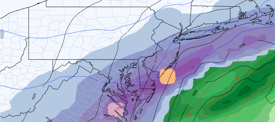
The GFS has always led the way with this system as the most aggressive (snowiest outcome) model. Last night and this morning, the GFS was sort of an outlier…the only model left showing the system. Today, the Euro, Canadian GGEM and RGEM, and now the NAM are caving towards the GFS solution meaning a snowier outcome for NJ areas SE of the turnpike/95 corridor. Here are snapshots from each of the latest model runs. Blue is snow and green is rain.
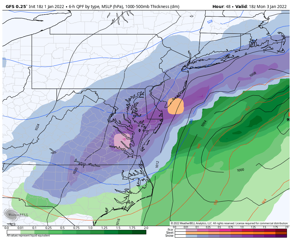
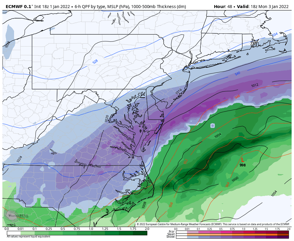
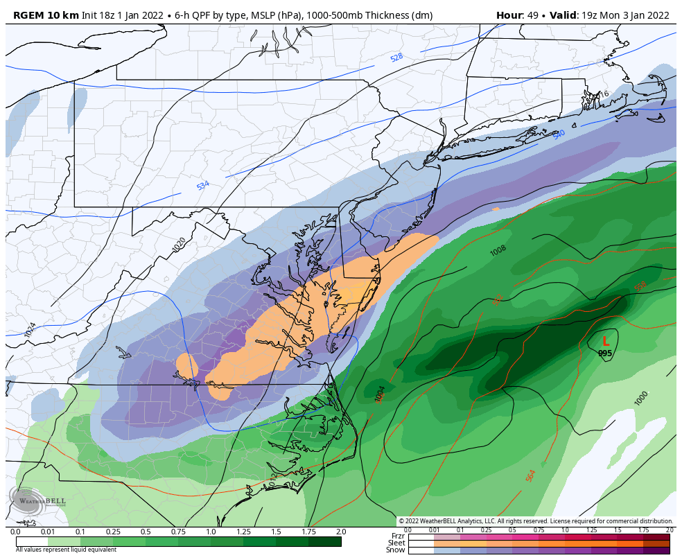
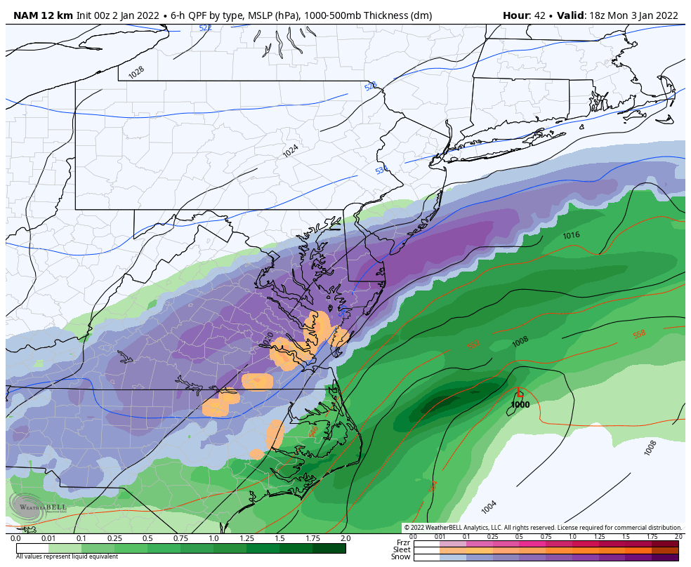
Meteorologically, this is because the models are latching onto the idea of better separation between the N and S branches of energy. This is allowing the S branch to wrap up better with stronger cyclonic vorticity and a trough axis more neutral than positive. We also have the favorable teleconnection profile that I’ve mentioned in the last week or so. I’ve always liked this signal for those reasons. It’s still looking like a SE of I-95 system though with little to nothing modeled NW of 95. Air will be rising from the two branches of energy and falling between (subsidence). For that reason, the Poconos, Catskills, EPA and NWNJ will likely see sinking air (cold and clearer conditions). Perhaps some trace accums can happen along and just NW of 95/NJTP but the jackpot is still heavily favoring SNJ/SENJ as the above comprehensive guidance indicate. The cover image shown at the top of the article is the latest GFS output and indicates the northernmost modeled solution. I think the N and W extent of impact will likely be closer to the other pictured guidance given the suppression that will exist.
Per a casual, from the hip, blend of the latest data this evening, SNJ/SENJ could be looking at a 2-4 possibly 3-6 type event especially for Cape May, Cumberland, Atlantic, Salem, and at least S Ocean. From there it would taper down to just trace accums near-95 with a sharp cutoff for NWNJ. This will likely happen between Monday morning and Monday afternoon once temperatures have crashed behind Sunday/Sunday night’s milder rain.
NWNJ and the 95 corridor shouldn’t get too comfortable missing the snow IMO as the January 7 (Friday) signal is strengthening and starting to target said areas. It could be a snowy week for all of NJ between the two signals/systems.
In English: Chances of plowable snow are increasing SE of the turnpike/95 axis, especially for SNJ/SENJ. It’s looking like trace accumulations near-95 and possibly 2-4/3-6 for areas further SE. Tomorrow, we’ll have a detailed map out with expected amounts and specific timing. But it’s starting to look like the Monday morning South Jersey express is a go.
Download the free Weather NJ mobile app on Apple or Android. It’s the easiest way to never miss Weather NJ content. Our premium services go even further above and beyond at the hyper-local level.
Jonathan Carr (JC) is the founder and sole operator of Weather NJ, New Jersey’s largest independent weather reporting agency. Since 2010, Jonathan has provided weather safety discussion and forecasting services for New Jersey and surrounding areas through the web and social media. Originally branded as Severe NJ Weather (before 2014), Weather NJ is proud to bring you accurate and responsible forecast discussion ahead of high-stakes weather scenarios that impact this great garden state of ours. All Weather. All New Jersey.™ Be safe! JC


LOCAL FORECAST | INTERACTIVE RADAR | LATEST NJ WEATHER ALERTS | WEDDING FORECAST| PRIVACY POLICY
© Copyright 2025 Weather NJ LLC. All Rights Reserved.
Some information that can be found on our website is provided by a private weather station and is not an officially recognized station for weather reporting. Though we always strive to achieve accurate reporting for our own use, it is important that you do NOT depend on the data provided here for any purpose.
