

Monitoring Messy Monday Morning
Discussion: I’ve been watching model guidance trend colder and colder, for this coming Sunday PM-Monday AM storm system, so it’s time for an update.
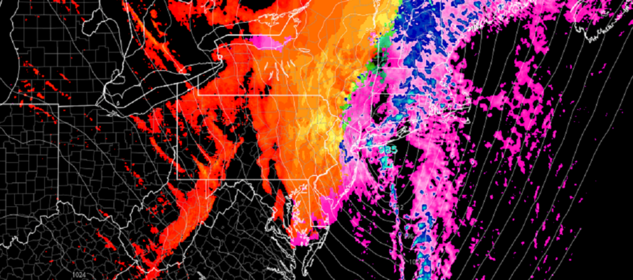
Up until today, the data suggested a mostly rain system for New Jersey. This was because the two different pieces of upper energy were phasing earlier and sending a surface low into the E lakes. NJ was in the warm sector for most of the precipitation period which produced rain. The trend in the upper levels today has been a less robust interaction of the upper level pieces of energy. They never actually phase on the latest runs. Therefore, the projected surface low has slipped quite a bit (a few hundred miles) to the SE. This significantly increases the chance of a rain-to-snow situation for parts of New Jersey, especially NNJ elevations.
This is a very dynamic system approaching. Regardless of precipitation type, we have a strong low tracking just SE of Atlantic City. I would expect gusty winds from different directions depending on the phase. Early in the system (Sunday afternoon/evening hours) winds will be out of the S/SE. Wind direction should then rock to the NE by early Monday AM and then ultimately N/NW by sunrise Monday. ECNJ/SENJ should take the highest winds of the system with 40-60mph gusts off the ocean. Areas away from the ocean should see less winds but still gusty. All NJ areas should feel the N/NW gusts Monday morning. Wind-related power outages are likely throughout the entire system.
As far as rain goes, most models project an average of 1.5-2 inches widespread across New Jersey. This could produce flash flooding in areas with poor drainage.
Coastal flooding interests are favored by a quick moving system and lower astronomical tides. A small window of minor coastal flooding possible Sunday night.
Back to precipitation type. I’m seeing a wild temperature gradient. Sunday night should range from 32 to 65 from State College PA area to Atlantic City. Cyclonic winds should mix this gradient around counterclockwise between Sunday night and Monday morning. Most of New Jersey’s surface is still roasted out of snow accumulations. Areas NW of 95, especially NNJ elevations have the best chance to see light snow accumulations and mostly on natural/untreated surfaces. The chances of at least a snowy burst to end this system are continuing to increase. Here’s the snow map we issued earlier today representing our bet guess for now. Tomorrow morning will be final adjustments to forecast:
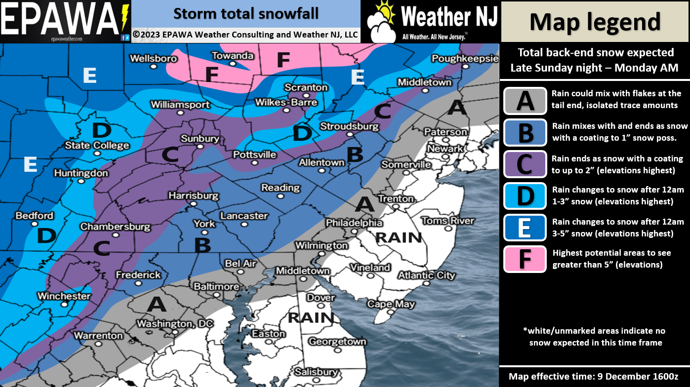
In English: Moderate-to-heavy rainfall, gusty winds, and possible snow accumulation are all becoming likely for New Jersey tomorrow (Sunday) through Monday morning. The system starts warm, rainy and windy Sunday afternoon, stays that way overnight, and then changes to cold, snowy, and windy Monday morning. Our snow map above is out best guess at this point but conditions have trended colder from what they were yesterday morning. Be safe! JC
Premium Services
KABOOM Club offers inside info forecast discussion, your questions answered, and early storm impact maps (ahead of the public). At a buck per month, it’s an extremely feasible way to show support.
My Pocket Meteorologist (MPM), in partnership with EPAWA Weather Consulting, offers professional/commercial interests, whose businesses depend on outdoor weather conditions (snow plowing, landscaping, construction, etc.), with hyper-local text message alerts/forecasts and access to the MPM premium forum—the most comprehensive and technical forecast discussion available for PA and NJ.
Get your KABOOM Inside Out pajamas and more at the KABOOM shop!
Jonathan Carr (JC) is the founder and sole operator of Weather NJ, New Jersey’s largest independent weather reporting agency. Since 2010, Jonathan has provided weather safety discussion and forecasting services for New Jersey and surrounding areas through the web and social media. Originally branded as Severe NJ Weather (before 2014), Weather NJ is proud to bring you accurate and responsible forecast discussion ahead of high-stakes weather scenarios that impact this great garden state of ours. All Weather. All New Jersey.™ Be safe! JC


LOCAL FORECAST | INTERACTIVE RADAR | LATEST NJ WEATHER ALERTS | WEDDING FORECAST| PRIVACY POLICY
© Copyright 2026 Weather NJ LLC. All Rights Reserved.
Some information that can be found on our website is provided by a private weather station and is not an officially recognized station for weather reporting. Though we always strive to achieve accurate reporting for our own use, it is important that you do NOT depend on the data provided here for any purpose.
