

Monitoring the Tropics
Discussion: Well, it’s right smack in the middle of peak hurricane season and the Atlantic Hurricane basin is active. Up until now, an otherwise quiet tropical cyclone season for the US east coast and Gulf of Mexico interests.
First let’s get Gaston out of the way. Gaston is heading W with the mid-latitude westerlies towards the Azores. A non-issue for anyone here in NJ (or the US).
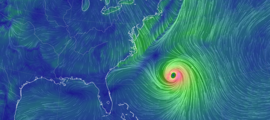
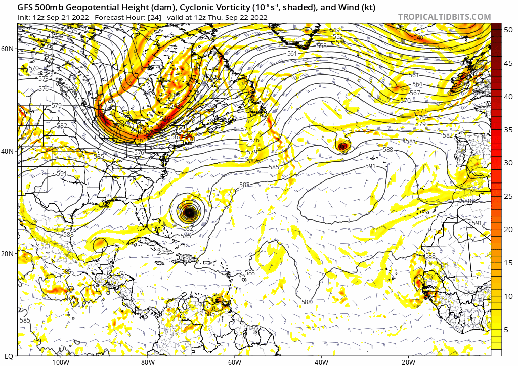
Fiona is currently a category 4 storm NW of the Bahamas. It did a little number on the NE Caribbean. From its current location, Fiona will track N to the N/NE and pass well offshore of New Jersey however inside of Bermuda. I would expect decent surf and riptides over the next few days as Fiona passes through our latitude OTS. Fiona should then become a Sandy-like situation for the area between Scandinavia and Nova Scotia this weekend. Check out this modeled “trough capture of a hurricane” from the latest GFS model run:
This weekend configuration of the atmosphere should pull a jet of cold and dry air into NJ starting Thursday night through all of Friday and into a good part of Saturday. The red arrow represents the pressure gradient-driven flow:
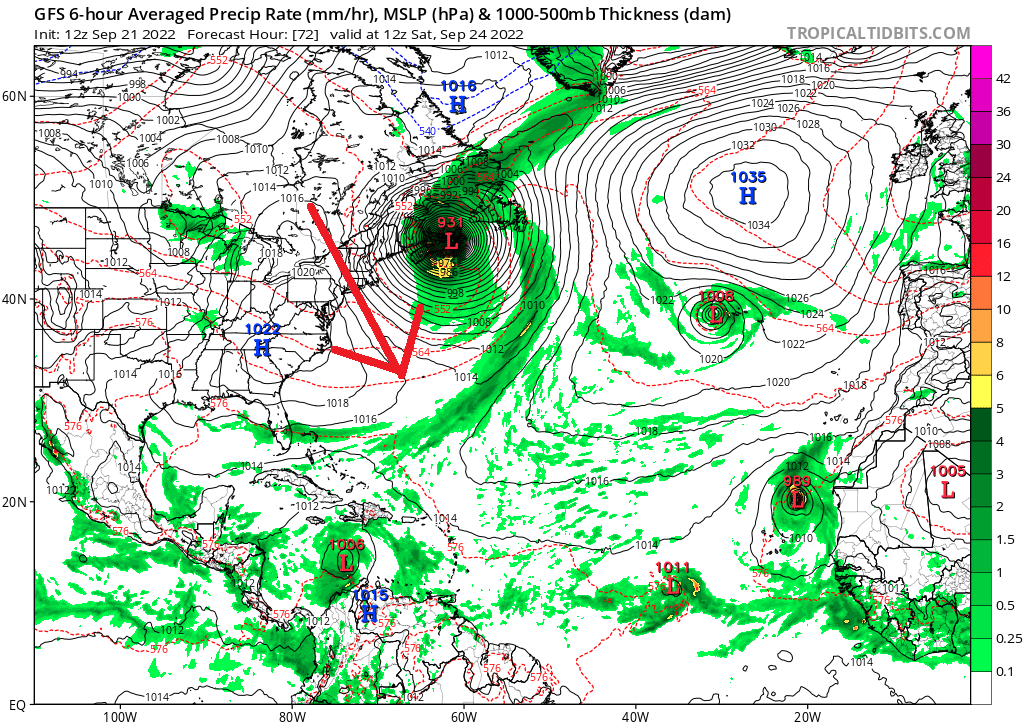
For this reason, the Thursday cold front should be a very strong one. It’s hard to read which areas will see the best rain/storms. But one can only theorize meteorologically that a cold mass will be plunging into/lifting air ahead of the front for rain and storm generation. I’ll probably post tomorrow morning about what better to expect tomorrow evening with the front. Friday and Saturday morning look very chilly…like back-side of a hurricane/capture/phase chilly. Obviously below-average temperatures. We moderate Sunday.
Once Fiona and the colder trough are through, all eyes turn to Invest 98L approaching the SE Caribbean. This system will likely be named Ian. This system should enter the E Caribbean very far to the S near Trinidad later tonight/tomorrow morning. From there, it’s expected to track to the W/NW, across the sea, and exit somewhere in the NW Caribbean. This specific track has the highest focus over the next several days as it will ultimately determine the track through the Gulf of Mexico. Someone in the N gulf states could be looking at an ugly start to October. If, and only if, remnants slide up the east coast, New Jersey would be looking at remnants around the Oct 2-5 timeframe depending on storm speed. Let’s not get ahead of ourselves. For now, I’m closely monitoring Invest 98L’s development and track through the Caribbean.
In English: Fiona will only impact the NJ beaches in the next few days, but with possibly heavy surf and dangerous rip currents. Rain/storms Thursday PM (more on this tomorrow morning) then bring a period of colder and drier air Thursday night through Saturday. Moderation Sunday. I’m monitoring the system entering the SE Caribbean to later determine any possible US impacts from what would become Ian to start October. We have some time. But this is the current state of things in the tropics. Be safe! JC
Premium Services
KABOOM Club offers inside info forecast discussion, your questions answered, and early storm impact maps (ahead of the public). At a buck per month, it’s an extremely feasible way to show support.
My Pocket Meteorologist (MPM), in partnership with EPAWA Weather Consulting, offers professional/commercial interests, whose businesses depend on outdoor weather conditions (snow plowing, landscaping, construction, etc.), with hyper-local text message alerts/forecasts and access to the MPM premium forum—the most comprehensive and technical forecast discussion available for PA and NJ.
Jonathan Carr (JC) is the founder and sole operator of Weather NJ, New Jersey’s largest independent weather reporting agency. Since 2010, Jonathan has provided weather safety discussion and forecasting services for New Jersey and surrounding areas through the web and social media. Originally branded as Severe NJ Weather (before 2014), Weather NJ is proud to bring you accurate and responsible forecast discussion ahead of high-stakes weather scenarios that impact this great garden state of ours. All Weather. All New Jersey.™ Be safe! JC


LOCAL FORECAST | INTERACTIVE RADAR | LATEST NJ WEATHER ALERTS | WEDDING FORECAST| PRIVACY POLICY
© Copyright 2026 Weather NJ LLC. All Rights Reserved.
Some information that can be found on our website is provided by a private weather station and is not an officially recognized station for weather reporting. Though we always strive to achieve accurate reporting for our own use, it is important that you do NOT depend on the data provided here for any purpose.
