

Mostly Nice Weekend Expected (Aug 5-7)
We’re going to deal with a period of unsettled weather along a cold front on Saturday. Otherwise, the weekend doesn’t look too bad. Let’s break it down:
Disco: A low pressure system in Canada will drag two areas of lifting through our region. First will be a pre-frontal trough Friday night into Saturday morning. I don’t expect much along this pre-frontal trough other than clouds and possibly a few sprinkles. The second area of lifting will be the cold front itself which should move through New Jersey between afternoon and evening hours on Saturday. I don’t see a solid line of thunderstorms forming along this, only a broken line of showers and thunderstorms. This should only present a few hour nuisance period on Saturday, not a total washout. EPA and NWNJ should see the strongest storms during afternoon hours while the SENJ coast should see weakened storms (possibly just showers) during late-afternoon/early-evening hours.

Friday (Aug 5) high temperatures should reach the low-to-mid 80s statewide. Skies should be mostly sunny with somewhat of a pleasant feel. Humidity will begin trickling back in from the S however. Winds should be light out of the S. Overnight lows should fall into the 60s away from the ocean and up in the NNJ elevations. Coastal regions should hold in the 70s overnight due to southerly flow over 70+ ocean temps. Clouds and a very small possibility of sprinkles are possible overnight, especially for SNJ. NNJ/CNJ should stay mostly dry overnight.
Saturday (Aug 6) high temperatures should reach the mid-to-upper 80s statewide. I wouldn’t be surprised to see 90 flirted with considering the warmer and more humid SW flow ahead of the cold front. Skies should feature mixed sun and clouds for most of the day. A 2-3 hour period of rain and thunderstorms is possible between afternoon and evening hours. This activity will be moving along/ahead of the cold front. Best estimate on timing is 1-4PM for NW of the I-95 corridor (stronger storms/heavy downpours) and 4-8PM SE of the I-95 corridor (weaker storms/showers). Winds should be light out of the SW. Overnight lows should fall into the 60s for most with the exception of the SENJ coast which could stay in the lower-70s. Conditions should clear and improve overnight.
Sunday (Aug 7) high temperatures should reach the mid-to-upper 80s statewide. Skies should be mostly sunny with decreased humidity. Remember, a cold frontal passage this time of year has much more impact on humidity than temperatures. So while it will still be pretty warm, it will feel much better. Winds should be light out of the NW. Overnight lows should fall into the 50s for NNJ elevations and 60s for the rest of New Jersey
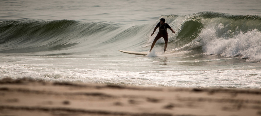
Marine: Water temperatures along the NJ beaches are still running in the mid-70s which are a few degrees warmer than average for this time of year. Wave heights should vary between 1-3/2-4 feet this weekend. While the waves should not be rough overall, watch out for rip currents and listen to lifeguards about swimming safety guidance.
Tropics: Earl should continue to dissipate over S Mexico and should be fully extinguished by Saturday as just remnant showers. No direct threats exist for the US east coast at this time however there are a few tropical waves in the Cape Verde<->E. Caribbean traditional hurricane highway. I’ll be keeping an eye on these in the next week.
Stargazing: Friday night could pose a problem with the pre-frontal trough possibly keeping it cloudy. Saturday night would be a much better night with the cold front through. The moon is in its evening crescent phase which should set just after sundown both nights so lunar light pollution will be at a minimum. Again, Saturday is the best night for stargazing.

An early look at next week indicates warm, dry and pleasant conditions lasting through at least Tuesday. We should then see humidity trickle back in from the S Wednesday-forward bringing back unsettled conditions heading into the next Friday. Have a great weekend and be safe! JC
Jonathan Carr (JC) is the founder and sole operator of Weather NJ, New Jersey’s largest independent weather reporting agency. Since 2010, Jonathan has provided weather safety discussion and forecasting services for New Jersey and surrounding areas through the web and social media. Originally branded as Severe NJ Weather (before 2014), Weather NJ is proud to bring you accurate and responsible forecast discussion ahead of high-stakes weather scenarios that impact this great garden state of ours. All Weather. All New Jersey.™ Be safe! JC


LOCAL FORECAST | INTERACTIVE RADAR | LATEST NJ WEATHER ALERTS | WEDDING FORECAST| PRIVACY POLICY
© Copyright 2026 Weather NJ LLC. All Rights Reserved.
Some information that can be found on our website is provided by a private weather station and is not an officially recognized station for weather reporting. Though we always strive to achieve accurate reporting for our own use, it is important that you do NOT depend on the data provided here for any purpose.

)