

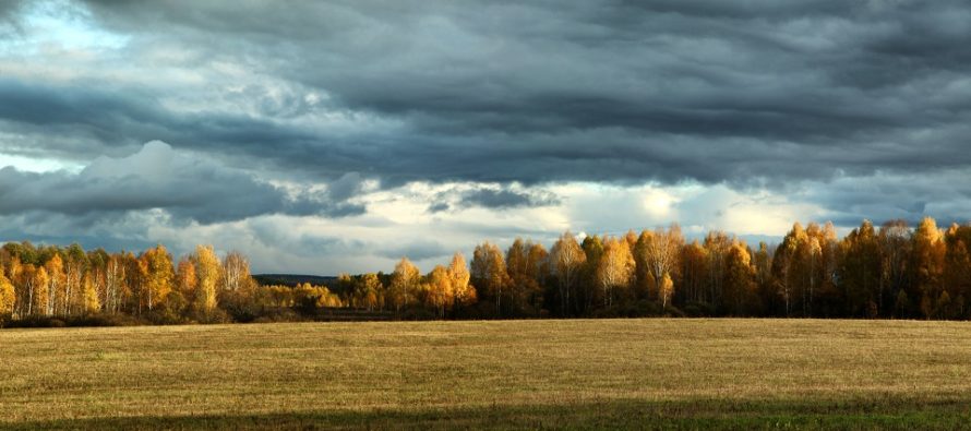
Mostly Nice
Discussion: The upper-levels appear to support a colder pattern for the foreseeable near-future. The upper jet should be positioned S of NJ around a series of troughs expected to swing through before returning to a zonal pattern next week. Geopotential heights are lower for the next two weeks, outside of a transient ridge early next week. At the lower levels, this looks like high pressure dominating the US through about Thursday, a stormfront Thursday, and then back to high pressure domination for this weekend. The Thursday night/Friday morning stormfront should span from the Gulf of Mexico to Canada meaning most of the E US should see it. It should be attached to a strong low in Canada that is expected to occlude a bit. These dynamics could allow for some gusty/damaging winds to make it down to the surface during the few hour period of moderate-to-possibly heavy rainfall. Right now, Thursday PM hours are the best I can do on timing of the stormfront arrival with departure by early Friday morning. I should be able to do better on timing in tomorrow’s update. But once that is out, the weekend looks great with a weak disturbance possibly dropping some rain on Monday. After that, it looks like some even colder dynamics could set up as we head through the second half of October.
Tuesday (Oct 11) high temperatures should reach near-70 for most areas give or take a few degrees. Skies should be mostly sunny. Winds should be light out of the W/SW. Overnight lows should fall back into the 40s for most areas with coastal regions likely hugging the lower-50s.
Wednesday (Oct 12) high temperatures should reach the low-to-mid 70s for most areas. Skies should be mixed with sun and clouds. Likely a small bump in humidity with S winds becoming breezier throughout the day. Overnight lows should stay in the 50s or above.
Thursday (Oct 13) high temperatures should reach into the 70s early. It’s should kind of spike ahead of expected afternoon-evening cold front (stormfront). A safe expectation are periods of heavy rainfall and high/gusty winds. Some wildcards on the table are lightning, hail, and possibly tornados. Will have to revisit this as we closer approach. But Thursday PM will feature a stormfront that should dominate the weather pattern for the entire day. Warm and soupy before, stormy during, cold afterward into Friday. There’s no sense drilling down any further than that. I’ll try to get a better handle of timing by Wednesday.
Friday (Oct 14) high temperatures should reach the 60s for most areas. Skies should transition from cloudy to clear from morning through afternoon. Winds should be light-to-breezy out of the NW. Overnight lows should range from 30s to 40s elevations to coasts.
An early look at the weekend indicates more great conditions in the wake of Thursday’s front. In general it looks like highs in the 60s, lows in the 40s, with clear skies and low humidity. NWNJ elevations a little colder. SENJ coasts a little warmer. You know how Jersey Jerseys. I’ll be checking back in tomorrow with some better anticipated timing on Thursday’s cold front/stormfront. Have a great week and please be safe! JC
Premium Services
KABOOM Club offers inside info forecast discussion, your questions answered, and early storm impact maps (ahead of the public). At a buck per month, it’s an extremely feasible way to show support.
My Pocket Meteorologist (MPM), in partnership with EPAWA Weather Consulting, offers professional/commercial interests, whose businesses depend on outdoor weather conditions (snow plowing, landscaping, construction, etc.), with hyper-local text message alerts/forecasts and access to the MPM premium forum—the most comprehensive and technical forecast discussion available for PA and NJ.
Jonathan Carr (JC) is the founder and sole operator of Weather NJ, New Jersey’s largest independent weather reporting agency. Since 2010, Jonathan has provided weather safety discussion and forecasting services for New Jersey and surrounding areas through the web and social media. Originally branded as Severe NJ Weather (before 2014), Weather NJ is proud to bring you accurate and responsible forecast discussion ahead of high-stakes weather scenarios that impact this great garden state of ours. All Weather. All New Jersey.™ Be safe! JC


LOCAL FORECAST | INTERACTIVE RADAR | LATEST NJ WEATHER ALERTS | WEDDING FORECAST| PRIVACY POLICY
© Copyright 2026 Weather NJ LLC. All Rights Reserved.
Some information that can be found on our website is provided by a private weather station and is not an officially recognized station for weather reporting. Though we always strive to achieve accurate reporting for our own use, it is important that you do NOT depend on the data provided here for any purpose.
