

Nicole’s Remnants Eyeing New Jersey
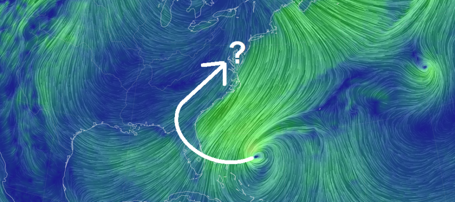
Discussion: Did anyone get to see the lunar eclipse this morning? Certainly, a more traditional fall feel this morning compared to the last few days. We’ll stay dry and clear for a few days (through Friday) as we gradually warm into the weekend With that said, we’re still a few days away from Nicole’s remnants sliding up the E US and impacting New Jersey. Nicole still has to graduate/strengthen into a hurricane for the N Bahamas tomorrow, make landfall/impact Florida on Thursday, and ultimately track northward through the SE US on Friday before reaching us here in New Jersey. Some trends are emerging on model guidance which I believe are starting to see the correct idea.
First is an earlier rain start and rain end time. The reason for this is because the models are suggesting a later cold front which allows Nicole’s remnants to turn and push through the Mid-Atlantic US without any slowing influence from the front. Instead it is allowed to follow the weakness behind the departing ridge/in front of approaching trough. Up until last night/overnight data, models were pushing the front and remnants through closer together. But now we are leaning towards the rain being faster/non-frontal and completely synoptic from Nicole’s remnants. Therefore, the rain timing has shifted from [late-Friday night through Saturday afternoon] to [Friday afternoon through Saturday morning]. Most models are indicating a range of .5” to 2” of rain depending on where the jackpot rain bands set up across NJ. The latest data is favoring NWNJ for the higher end of that range and SENJ for the lower end of that range.
I’m not too concerned about synoptic wind. There’s always that funky energy in the NE quadrant of an on-land tropical origin cyclone that is capable of producing thunderstorms and tornadoes. But that energy should be mostly held to the SE US (S of us). I’ll be watching to see if that concern creeps further up the east coast. Synoptically, the low is expected to pass to the W and N of NJ now, not off OBX. And now that the front is holding up a bit, the center of circulation from Nicole is able to track further inland in the E US. This would mean S/SW winds (in the warm sector) switching to W/NW or NW winds once the front is through. NJ would therefore see S/SW winds during the heaviest rainfall (Friday-Saturday) before drying out and seeing the switch (Saturday-Sunday). There is no prolonged onshore wind component which should keep tidal/coastal flooding concerns to a minimum (minor stage at most). There could be some higher water levels on Wednesday from pre-event onshore flow but that should diminish by Thursday when winds become S/SW. The SWNJ and SENJ coasts would be most vulnerable during the rain from the S/SW winds meeting areas of poor drainage/flash flooding.
So basically, Nicole’s remnants are now modeled to move in and out of New Jersey quicker while the overall environment remains mild and muggy through Saturday afternoon/evening. The cold front would then come through between late Saturday night and Sunday morning. I imagine most of NJ will struggle to escape the 40s on Sunday even in early afternoon sunlight. Should be a noticeably turn towards a wintry feel as most, if not all, of NJ falls below freezing overnight into Monday. The colder pattern is then expected to last through at least the following weekend.
Lastly, let’s talk about snow. There’s no crippling snowstorm on the horizon yet. At this point, it’s all about just seeing the first snowflakes of the colder months which will probably struggle to stick given the warmer climatological surface temp profile this time of year. We have a few chances for this. First would be Sunday night right behind the departing system and frontal passage. Models have been hinting at a few pieces of coastal low activity between Sunday and Wednesday. It’s a little too early to tell which piece will become the dominant one and get closest to NJ. But again, we would likely be dealing with below freezing temps aloft and above freezing temps at the surface. Most likely outcome would be cold rain with some snow mixing in with little-to-no accumulations. The other possibilities for first flakes would be from the cold W/NW jet over the still-warm Great Lakes. Monday and Thursday looks like the best days for such. So for first flakes of the season (between Sunday Nov 13 and the following weekend ~Nov 20), NWNJ would be most favored and SENJ the least.
In English: We’ll stay cool, clear, and dry today and tomorrow. We’ll warm up with returning humidity Thursday and Friday but remain dry through Friday morning. Rain could then begin as early as Friday afternoon and fall overnight through late Friday morning. It now appears that rain could clear for most of Saturday (late-morning and on). It will remain warm and muggy during the rain due to tropical origins (remnants of Nicole). As of right now, rain and wind appears run-of-mill for NJ (a few inches of rain and moderate winds near SNJ coasts). I don’t think we’re into the power outage/damaging wind/coastal flooding categories IMO. By Sunday morning, a cold front will push through NJ and likely create December-like conditions for NJ (highs in 40s lows in 20s). At the very least, cold days and nights for most of next week…but possibly first snowflakes for some without accumulation. We’ll see. I’ll check back tomorrow with an update for the weekend system. Have a great rest of your Tuesday and be safe! JC
Premium Services
KABOOM Club offers inside info forecast discussion, your questions answered, and early storm impact maps (ahead of the public). At a buck per month, it’s an extremely feasible way to show support.
My Pocket Meteorologist (MPM), in partnership with EPAWA Weather Consulting, offers professional/commercial interests, whose businesses depend on outdoor weather conditions (snow plowing, landscaping, construction, etc.), with hyper-local text message alerts/forecasts and access to the MPM premium forum—the most comprehensive and technical forecast discussion available for PA and NJ.
Jonathan Carr (JC) is the founder and sole operator of Weather NJ, New Jersey’s largest independent weather reporting agency. Since 2010, Jonathan has provided weather safety discussion and forecasting services for New Jersey and surrounding areas through the web and social media. Originally branded as Severe NJ Weather (before 2014), Weather NJ is proud to bring you accurate and responsible forecast discussion ahead of high-stakes weather scenarios that impact this great garden state of ours. All Weather. All New Jersey.™ Be safe! JC


LOCAL FORECAST | INTERACTIVE RADAR | LATEST NJ WEATHER ALERTS | WEDDING FORECAST| PRIVACY POLICY
© Copyright 2026 Weather NJ LLC. All Rights Reserved.
Some information that can be found on our website is provided by a private weather station and is not an officially recognized station for weather reporting. Though we always strive to achieve accurate reporting for our own use, it is important that you do NOT depend on the data provided here for any purpose.
