

NNJ/CNJ Winter Storm Detected
Discussion: As expected, yesterday’s light snow event was not a big deal. Some saw anything from flurries to snow showers with little-to-no accumulation. Some northern areas saw trace accumulations mostly on natural surfaces. This was a great example of conversational snowfall. Now onto the next event.
Temps will fall a bit Monday as the zonal boundary sinks southward ahead of initial warm air advection. We’ll still get up to near-40 degrees but then temps will fall through sunset/evening hours. This system is a double barrel low setup which will approach Monday evening and clear through by noonish Tuesday. One low into the Great Lakes, the other across S Delmarva. The SW flow of the lakes low’s SE side will meet the NE flow of the Delmarva low’s NW side. These meeting forces will converge and generate additional lifting as well as keep the boundary in a colder position within the Mid-Atlantic US. Without the Delmarva low, the SW flow of the lakes low would roast out all of NJ. But because of the stalemate flow situation, the boundary should allow at least NNJ (N of I-78) to see a light-to-significant snow event.
There’s nothing special about the upper levels with this next system. The zonal pattern remains in place with cold air to the N of it and warmer air to the S. This will all come down to where the two lows will track exactly to. 700mb and above will be cold enough to support snow. The 850-925mb layers are fluctuating on model data between I-195 and I-78 for the general line of freezing which will ultimately determine if any sneaky warm layers will stunt snowfall for areas N of I-195. The surface line of freezing should be closer to I-78. With that said, I think snowfall makes it down to I-195 however any decent accumulations might only make it down to the I-78 latitude. We’ll see. But a more confident anticipation is mostly rain S of I-195 and possibly even S of I-78. As to whether or not NNJ will see mostly snow or ice, will be determined mostly by the 850mb line of freezing. That’s what I’ll be watching in real-time as the system closer approaches tomorrow afternoon-evening.
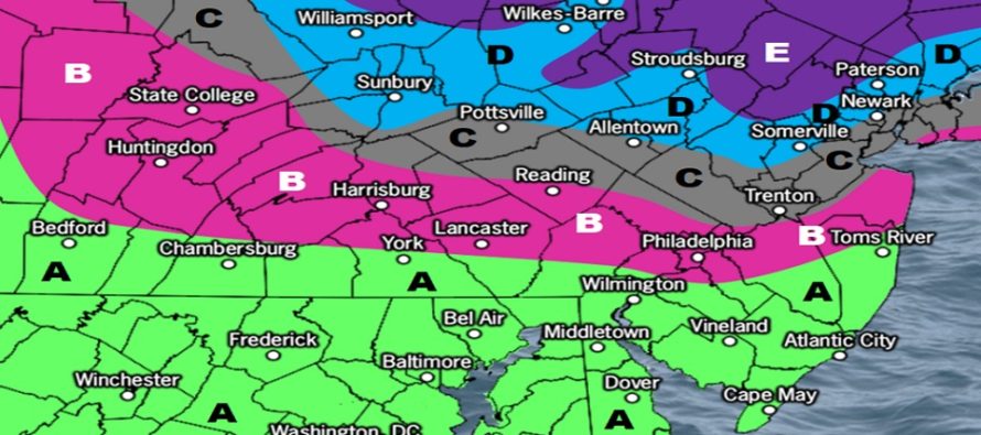
The below snow map represents our initial forecast thoughts for Monday evening into Tuesday morning. We will fine tune tomorrow ahead of the approaching precipitation if any changes are needed:
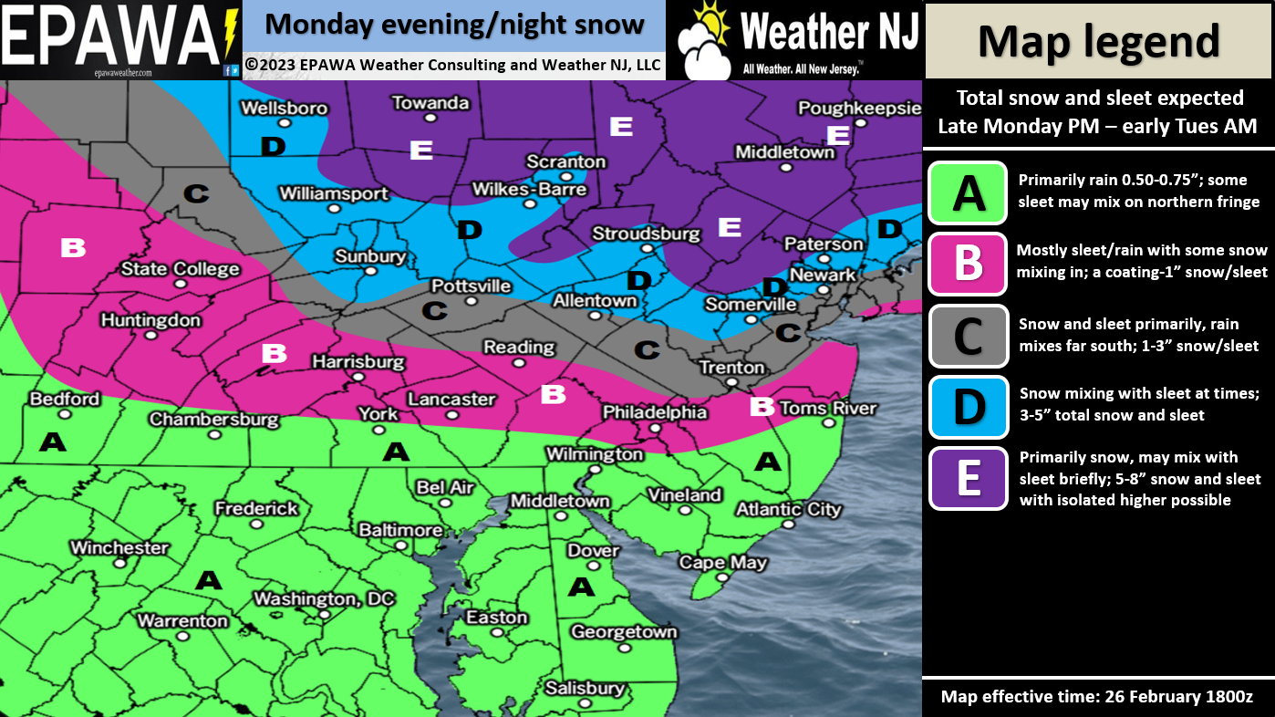
Click here to see full-resolution snow map!
After this system, all eyes turn towards the Friday-Saturday (March 3-4 event). The Euro has been the coldest (statewide snow) while the GFS has been the warmest (snow for NNJ, rain for CNJ/SNJ). The Canadian is somewhere between. I would like to let this more immediate Monday night-Tuesday system pass through before taking any forecasts seriously for Friday-Saturday. I know that is difficult for snow fans but let’s focus on the snow in front of us first.
In English: Expect snow for NNJ and rain for SNJ tomorrow evening (Monday) into Tuesday morning. CNJ could go either way (Mainly between I-195 and I-78) and has the best chance for sleet to work in. Basically, not a big deal S of I-78 but could be NNJ’s (I-80 corridor jackpot) largest snow of the season (which isn’t saying that much). See the above snow map for our current expectations. I don’t see any wind or coastal flooding problems with this system so the biggest safety hazard is snow and ice for NNJ/CNJ. Then expect a calmer Tuesday PM through Thursday before all eyes turn to the March 3-4 storm signal. Be safe! JC
Premium Services
KABOOM Club offers inside info forecast discussion, your questions answered, and early storm impact maps (ahead of the public). At 99 cents per month, it’s an extremely feasible way to show support.
My Pocket Meteorologist (MPM), in partnership with EPAWA Weather Consulting, offers professional/commercial interests, whose businesses depend on outdoor weather conditions (snow plowing, landscaping, construction, etc.), with hyper-local text message alerts/forecasts and access to the MPM premium forum—the most comprehensive and technical forecast discussion available for PA and NJ.
Jonathan Carr (JC) is the founder and sole operator of Weather NJ, New Jersey’s largest independent weather reporting agency. Since 2010, Jonathan has provided weather safety discussion and forecasting services for New Jersey and surrounding areas through the web and social media. Originally branded as Severe NJ Weather (before 2014), Weather NJ is proud to bring you accurate and responsible forecast discussion ahead of high-stakes weather scenarios that impact this great garden state of ours. All Weather. All New Jersey.™ Be safe! JC


LOCAL FORECAST | INTERACTIVE RADAR | LATEST NJ WEATHER ALERTS | WEDDING FORECAST| PRIVACY POLICY
© Copyright 2026 Weather NJ LLC. All Rights Reserved.
Some information that can be found on our website is provided by a private weather station and is not an officially recognized station for weather reporting. Though we always strive to achieve accurate reporting for our own use, it is important that you do NOT depend on the data provided here for any purpose.
