

Nor’easter Begins to Wind Down
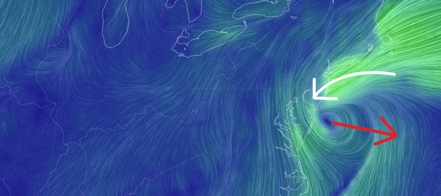
Discussion: We’re finally to the point where we have a coastal surface low stationed off the coast of SENJ/Delmarva as shown in the below surface pressure level chart from NWS SPC Mesoscale Analysis.
The low is weak at ~1008-1006mb but as I said earlier this week, its not about the intensity but more about the duration and track/behavior of the low. This low crawled up the coast via transfer with a few wobbles, stalled in its location and even came in towards the coast a little (retrograde). It will now weaken some more and either transfer back towards the primary coastal (that was sitting off NC all day yesterday) or slowly depart to the E or SE. It’s kind of like cooking. An 800-degree grill will cook your burger in a few minutes. A 150-degree grill could take an hour or longer to cook your burger. Both results will be a cooked burger. A 975mb low will mess up beaches and dunes in a few hours. A 1004mb low will mess up beaches and dunes over a few days. And speaking of cooking, a lot of you inquired about my KABOOM Pot Roast recipe that I like to make as comfort food during weather like this. I’m going to release a reel on Facebook and Instagram later today showing my recipe and results. It’s not weather related but sort of is. If you are one of those “Stick to the weather, please” folks, you are free to ignore it.
At 1:30pm on Monday, I believe we’ve reached/just finished peak intensity wind and will gradually subside from this point on through Tuesday morning. I saw a 67mph gust clocked at Barnegat Inlet early this AM, a 62mph gust clocked at IBSP, and many cases of gusts in the 55-59mph range between yesterday evening and this morning which met the 40-60+mph expectation. Now, wind gusts are chilling in the 35-49mph range along the immediate coasts and again, I expect gradual decay of such over the next 24 hours. Those of you away from the ocean and up in NNJ saw much less wind values as expected…more like breezy at times in the general 20-30mph range.
Rainfall totals are generally in the 1.5-2.5 inch range up and down the ECNJ/SENJ coast with Ocean County seeing the most. I expect this to swell to the 2-3 inch range when all is said and done Tuesday morning. Areas away from the ocean and up in NNJ saw much less rainfall with this system and will struggle to even meet .25 inches of total system rainfall.
Coastal flooding has always been the primary concern with this nor’easter. Yesterday’s afternoon high tide was the first high tide subject to the intensifying E fetch. The overnight high tide was the second. This afternoon (next few hours) could be the worst high tide because water from the first two high tides has had inadequate drainage channels (forcing against the surge and fighting inlets of incoming water). But this should be the last high tide of concern since winds are starting to rock from E/NE to N/NE and ultimately N. Expect gradual water level reduction tonight into Tuesday…but not before this afternoon’s high tide which could be a doozy for anyone who saw rough conditions from the first two.
So, expect all conditions to improve tonight through tomorrow despite the last of the rainfall and decreasing N winds persisting through tomorrow morning. Tuesday seems transitional as conditions improve even more. We then look dry and colder Wed-Fri with moderation and a much nicer weekend expected this weekend than what we just saw. After that, we will continue to step downwards in temperature as we head towards snow tracking season…which is only 4-6 weeks away realistically for NWNJ (sometimes sooner) and 6-8 weeks away for all of NJ.
In English: Rain and wind from the nor’easter has peaked overnight and will now gradually wind down between today (Monday) and tomorrow (Tuesday morning). Coastal flooding remains a concern this afternoon/evening (the 3rd of the three high tides of concern) but will also subside as a threat overnight into Tuesday. We then dry and out turn colder Wed-Fri and moderate for a dryer weekend. I’ll return to the traditional weekly outlook tomorrow. One more post coming later today which will be my KABOOM Pot Roast recipe (the ultimate inclimate weather comfort food) in the form of a Facebook/Instagram Reel – @myWeatherNJ if you are following – (not a weather article). This will not be weather related so please ignore if you are only here for the weather. Otherwise, give the recipe a try yourself and you might find your friends/family requesting you to make it the next time it’s soup/comfort food weather. Have a great rest of your Monday and please be safe! JC
Premium Services
KABOOM Club offers ad-free content, inside info forecast discussion, your questions answered, and early storm impact maps and video releases (ahead of the public). At $1.99 per month, it’s an extremely feasible way to show additional support for Weather NJ and you can turn it on and off for however many months you wish. Think of it as a tip jar with perks. Available onFacebook or Patreon.
My Pocket Meteorologist (MPM), in partnership with EPAWA Weather Consulting, offers professional/commercial interests, whose businesses depend on outdoor weather conditions (snow plowing, landscaping, construction, etc.), with hyper-local text message alerts/forecasts from real meteorologists and access to the MPM premium forum—the most comprehensive and technical forecast discussion available for PA and NJ.
Jonathan Carr (JC) is the founder and sole operator of Weather NJ, New Jersey’s largest independent weather reporting agency. Since 2010, Jonathan has provided weather safety discussion and forecasting services for New Jersey and surrounding areas through the web and social media. Originally branded as Severe NJ Weather (before 2014), Weather NJ is proud to bring you accurate and responsible forecast discussion ahead of high-stakes weather scenarios that impact this great garden state of ours. All Weather. All New Jersey.™ Be safe! JC


LOCAL FORECAST | INTERACTIVE RADAR | LATEST NJ WEATHER ALERTS | WEDDING FORECAST| PRIVACY POLICY
© Copyright 2026 Weather NJ LLC. All Rights Reserved.
Some information that can be found on our website is provided by a private weather station and is not an officially recognized station for weather reporting. Though we always strive to achieve accurate reporting for our own use, it is important that you do NOT depend on the data provided here for any purpose.
