

North Jersey Winter Storm Developing
Discussion: After a lengthy analysis of this thread-the-needle system, we are ready to make an actual forecast. I’m going to start this article the same way I did the last two…with an expectation set. 1 – This storm is still pre-pattern change. It’s the last system before we enter a more favorable pattern for snowstorm development albeit the last part of winter. That means that this system does not have a true solid cold air injection that would be needed to bring snow down into SNJ. This also presents a problem at the surface for CNJ and even NNJ regarding accumulation potential. 2 – Because this system is thread-the-needle, there is high volatility involving two separate streams of energy timing together to produce a wintry outcome. Even though models are converging on a faster southern stream (forcing the N shift), there is still the chance for this to trend either N or S between now and tomorrow, and even right up until it gets going later tomorrow night. With that said, this is our first call and a second call will be made tomorrow to account for any last-minute changes:
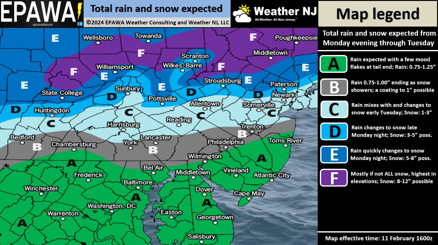
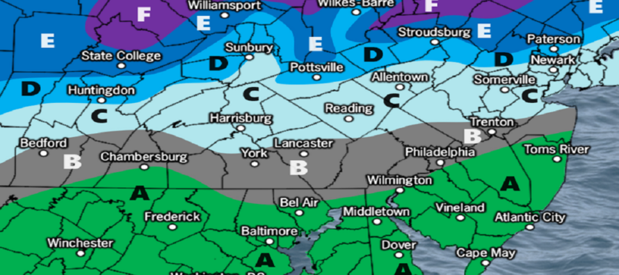
Zones F, E, and D are expected to see the highest wintry impact in New Jersey. These areas likely start out as snow or a wintry mix later Monday night and then become a steady heavy wet snow for the remainder of the event—through all of Tuesday morning with last flakes probably Tuesday afternoon/evening. I have no doubt that a foot of snow will fall for these areas. But given the surface temperature profile, less than a foot will stick. As far as how much sticks of what falls, this fraction is a bit uncertain for these northern areas. But I will say that these zones (F, E, and D) have the best chance to over-perform vs our map’s expectations. Please keep in mind that a heavier wet snow in these areas could mean a greater chance for power outages related to tree limbs snapping/etc.
Zone C is the most uncertain area of this forecast. A slightly colder solution and zone C behaves like areas N of I-80. A slightly warmer solution and zone C behaves like zone A or B. What we have here is basically an average of extremes with regard to the volatile model outputs we’ve been seeing. But we do know this zone C area will have a warmer surface than zones F, E, and D and therefore will take longer to cool after the changeover (from rain to snow). So if a snowier outcome did come into fruition where zones F, E, and D saw close to a foot of snow, then zone C would probably see half of that because of the extra time needed to cool the surface. This zone is very much still yet TBD IMO but we should be more certain with tomorrow’s final snow map and forecast.
Zone B and A are basically going to be too warm for snow accumulation even after rain changes to snow, especially as we get further into Tuesday high temperature. These areas should start out as rain Monday night, stay rain for most of Tuesday morning and then maybe change to snow to finish Tuesday afternoon/evening. Zone B has a better chance to see ending snowflakes than zone A but both zones are going to have a very tough time accumulating anything. To cover the possibility, we’re allowing for a coating to an inch or so of snow after the changeover in zone B. Zone A will be the warmest zone and has the best chance to see rain start to finish.
Moving forward, there are a few storm signals starting to show in the more favorable snow pattern. There are 1-2 clipper/wave systems in the Feb 16-18 period and then a larger signal early next week in the Feb 19-21 period. I will start to look at these in more detail once this immediate system clears the region.
In English: Rain should move in for most New Jersey areas late Monday night. Extreme NNJ might start as snow. A snow/rain line should then slowly push southward from NNJ through CNJ and into SNJ between early Tuesday morning and afternoon/evening. NNJ is most favored for significant-to-possibly-major snow accumulations. CNJ is very uncertain but likely a rain-to-snow situation with light-to-significant accumulations possible. SNJ should see the most rain/least snow of New Jersey. It should all end by Tuesday evening and then the more favorable snow pattern begins to close out winter. A few signals already showing for next week and beyond. A reminder that we are in the 7th inning of this ballgame with two full innings to go until the mid-March cut-off I like to generally adhere to. Please see our snow map above and have a great rest of your Sunday. Be safe! JC
Premium Services
KABOOM Club offers inside info forecast discussion, your questions answered, and early storm impact maps (ahead of the public). At a buck per month, it’s an extremely feasible way to show support.
My Pocket Meteorologist (MPM), in partnership with EPAWA Weather Consulting, offers professional/commercial interests, whose businesses depend on outdoor weather conditions (snow plowing, landscaping, construction, etc.), with hyper-local text message alerts/forecasts and access to the MPM premium forum—the most comprehensive and technical forecast discussion available for PA and NJ.
Get your KABOOM Inside Out pajamas and more at the KABOOM shop!
Jonathan Carr (JC) is the founder and sole operator of Weather NJ, New Jersey’s largest independent weather reporting agency. Since 2010, Jonathan has provided weather safety discussion and forecasting services for New Jersey and surrounding areas through the web and social media. Originally branded as Severe NJ Weather (before 2014), Weather NJ is proud to bring you accurate and responsible forecast discussion ahead of high-stakes weather scenarios that impact this great garden state of ours. All Weather. All New Jersey.™ Be safe! JC


LOCAL FORECAST | INTERACTIVE RADAR | LATEST NJ WEATHER ALERTS | WEDDING FORECAST| PRIVACY POLICY
© Copyright 2025 Weather NJ LLC. All Rights Reserved.
Some information that can be found on our website is provided by a private weather station and is not an officially recognized station for weather reporting. Though we always strive to achieve accurate reporting for our own use, it is important that you do NOT depend on the data provided here for any purpose.
