

Nov 12: Arctic Cold has Arrived
Discussion: Our Arctic frontal boundary has pushed through as expected and we’re now under the influence of an air mass that originated over the Arctic Ocean. The Arctic high that dropped out of Canada over ~North Dakota has opened the gates, with it’s front-side anti-cyclonic flow for this cold to spill southward. The departing low has reinforced the southward spill via back-side cyclonic flow.
This brings up a few concerns for tonight. First is the immediate flash freeze potential. As the sun sets temperatures should continue falling below freezing. Everyone is at least dropping into the 20s tonight. The colder spots like NNJ elevations, WNJ and some SNJ Pine Barren locations will likely drop into the teens. Any moisture on the ground that has not yet evaporated will absolutely freeze. This should be less of a concern for areas where precipitation ended earlier today. Those areas have had adequate time for evaporation. I’m actually more concerned with areas along and SE of the turnpike especially SENJ. Cape May for example is just wrapping their precipitation up now. This will no doubt leave roads, sidewalks and other paved surfaces of travel wet in a freezing environment. Please take this into consideration when driving or walking tonight. If it looks wet consider it frozen. And this problem won’t go away by tomorrow morning unless treated. Otherwise I hope for optimal evaporation for all with little-to-no issues. Definitely worth mentioning though.
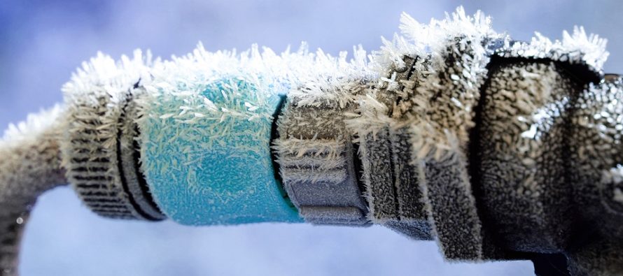
The other concern is the intensity of cold. This is frostbite material especially between late-tonight and early tomorrow morning. Strong NW flow (winds) will likely make it feel colder via wind chill factor. As I’ve emphasized leading up to this please check on elders or those who normally require assistance. Don’t let your pets outside for long if they absolutely have to go out. Disconnect hoses from your house and shut off any water valves that you can easily access. You might want to trickle run your sinks overnight if your plumbing has outside exposure or typically freezes in cold environments like this.
Moving forward the pattern remains very active. A coastal storm is trying to organize for this weekend which includes upper-level energy currently in the SW US meeting up with some surface energy over the SE US. High pressure positioning to our N combined with this low, likely to our S, could generate some strong onshore flow. Enter the coastal flooding concerns. Right now the system looks slightly too warm for snow so rain would likely be the form of precipitation. The ocean is still in the upper-50s along the Jersey shore so with an easterly wind component that will likely kill the chances for snow. There are a few more storm signals throughout the rest of November that I will be watching however. Again…super active pattern!
In English: Please be careful of icy roads and sidewalks tonight through tomorrow morning. This should be less of an issue for NNJ, CNJ and SWNJ. SENJ has the best chance for this as they only just finished up with precipitation. If it looks wet consider it frozen! Please take tonight’s cold seriously for health concerns and make any last-minute winterization preparations now. This weekend looks unsettled with a coastal storm off the SE US (likely rain and coastal flooding). Also there are a few storm signals I am watching through the end of November. You know I’ll be tracking. Have a great night, stay warm and please be safe! JC
Download the new free Weather NJ mobile app on Apple and/or Android. It’s the easiest way to never miss Weather NJ content. Our premium services go even further above and beyond at the hyper-local level. Looking for industrial-caliber long-range forecasting data that I personally recommend? Check out WeatherTrends360!
Jonathan Carr (JC) is the founder and sole operator of Weather NJ, New Jersey’s largest independent weather reporting agency. Since 2010, Jonathan has provided weather safety discussion and forecasting services for New Jersey and surrounding areas through the web and social media. Originally branded as Severe NJ Weather (before 2014), Weather NJ is proud to bring you accurate and responsible forecast discussion ahead of high-stakes weather scenarios that impact this great garden state of ours. All Weather. All New Jersey.™ Be safe! JC


LOCAL FORECAST | INTERACTIVE RADAR | LATEST NJ WEATHER ALERTS | WEDDING FORECAST| PRIVACY POLICY
© Copyright 2026 Weather NJ LLC. All Rights Reserved.
Some information that can be found on our website is provided by a private weather station and is not an officially recognized station for weather reporting. Though we always strive to achieve accurate reporting for our own use, it is important that you do NOT depend on the data provided here for any purpose.
