

Nov 13: Winter Storm Detected
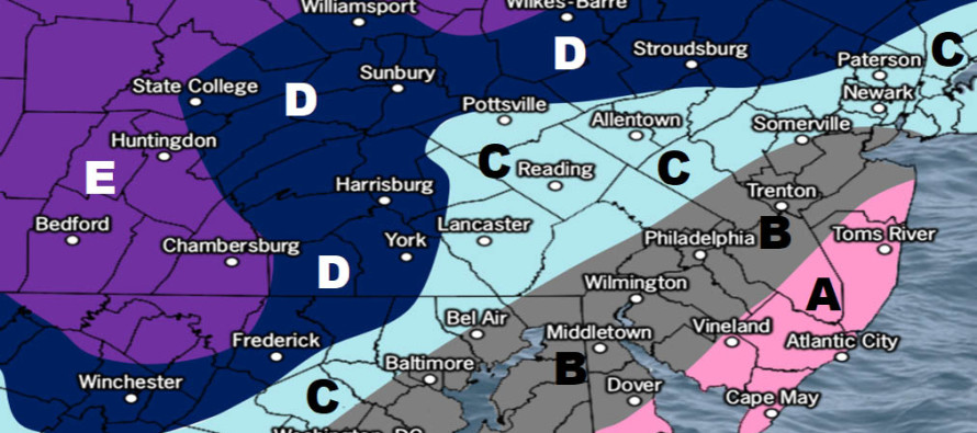
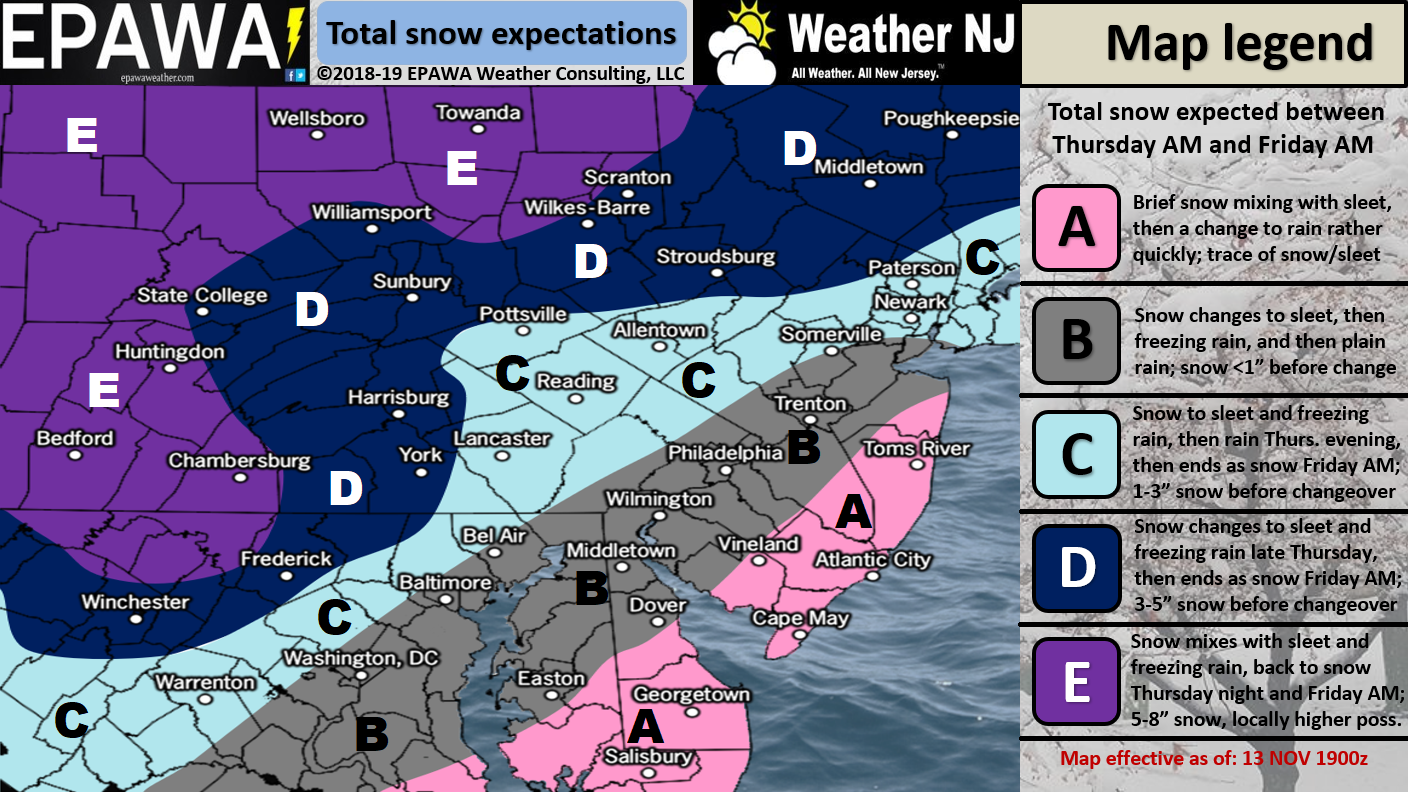
Please click here for full-resolution snow map!
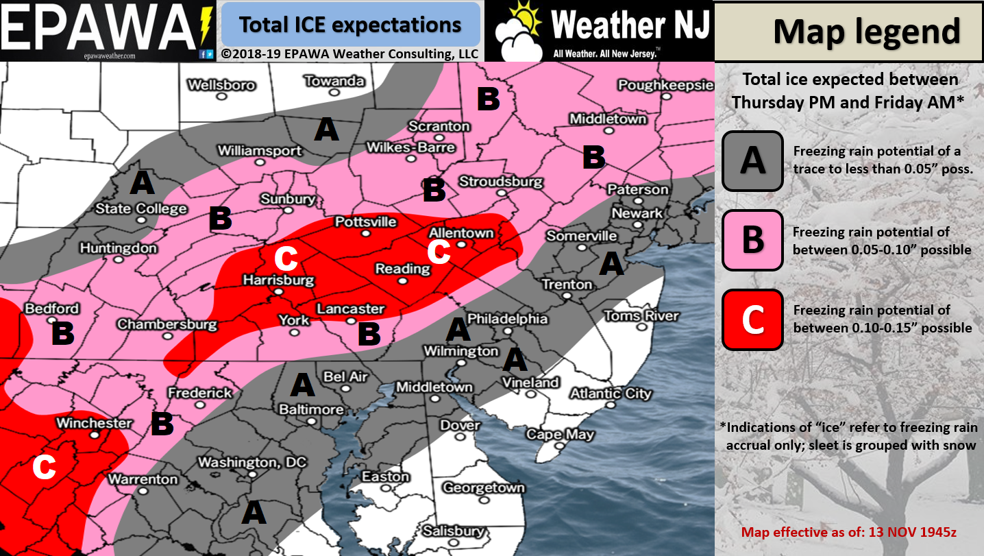
Please click here for full-resolution ice map!
Discussion: A piece of upper-level energy will break off from a C US trough and form a cut-off 500mb low. This low should crawl through the TN/KY area and enhance a surface low moving up the coast between late Thursday morning and late Friday morning. At the same time we will have high pressure moving across New England (likely crossing over Maine) which will stall the system a little and add some cold air in at the surface. However, once the high and low team up, there will be a strong onshore flow component that should keep most areas along and SE of the turnpike too warm for wintry precipitation. With that said areas like SENJ/SNJ and ECNJ will transition to cold rain the quickest and that’s if they even start wintry at all. Areas like WCNJ and NENJ should also go to rain but slower meaning more potential for snow and ice to start. Areas like NWNJ have the best chance to start and stay wintry. For these reasons this is a much higher wintry concern for NWNJ than SENJ.
The onshore flow component could elevate tidal waters slightly on Thursday. Given the short duration of onshore flow, it shouldn’t be that big of a deal…minor coastal flooding at most.
In English: A storm system will pass over/nearby New Jersey this Thursday morning through Friday morning. The problem is that it will be very cold statewide Wednesday night into Thursday morning for most areas NW of the turnpike. The surface will likely still be below freezing to the N of I-78 and NW of I-287 when the precipitation starts on Thursday and that highlights the area of highest wintry concern. For areas SE of the turnpike this should likely be an all cold rain scenario with maybe some snow mixed in very early. I’m just not excited about snow accumulation anywhere SE of the turnpike. NWNJ however is staring at the jackpot for most potential snow before any kind of changeover to ice/rain occurs (if any). The lower elevations of NNJ and some parts of CNJ will likely see less snow to start and more ice before transitioning to rain. Again this all occurs between late Thursday morning and late Friday morning with Thursday holding most of the wintry threat potential. The above impact maps demonstrate our best guess for a first call. We’ll refine the forecast and impact maps tomorrow for our second and likely final call. Have a great evening and please be safe! JC
Jonathan Carr (JC) is the founder and sole operator of Weather NJ, New Jersey’s largest independent weather reporting agency. Since 2010, Jonathan has provided weather safety discussion and forecasting services for New Jersey and surrounding areas through the web and social media. Originally branded as Severe NJ Weather (before 2014), Weather NJ is proud to bring you accurate and responsible forecast discussion ahead of high-stakes weather scenarios that impact this great garden state of ours. All Weather. All New Jersey.™ Be safe! JC


LOCAL FORECAST | INTERACTIVE RADAR | LATEST NJ WEATHER ALERTS | WEDDING FORECAST| PRIVACY POLICY
© Copyright 2026 Weather NJ LLC. All Rights Reserved.
Some information that can be found on our website is provided by a private weather station and is not an officially recognized station for weather reporting. Though we always strive to achieve accurate reporting for our own use, it is important that you do NOT depend on the data provided here for any purpose.
