

Nov 14: Longer Term…Cold to Relax…But Perhaps Not for Long!
After last’s night’s cheap thrill with big wet snow flakes and some accumulation in places, we set our sights on the next event for late weekend and early next week. This to me looks like a mostly rain event. However the cold air mass coming in is going to be the coldest of the season so far. Tuesday and Wednesday many places will not be getting out of the 30s for highs creating anomalies of 15 or more degrees below normal. If that cold air comes in fast there could be a change at the end. I’m not to bullish on this idea now as it is too early and rain to snow events with passing lows to the east are very tough to pull off. So we will deal with that later in the weekend
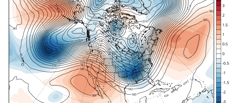
In the meantime let us take a look at the longer term and see what exactly is happening or isn’t happening. We start off with the 500mb map (they call it the Jet Stream in TV land) at 168 hrs from now which is a week from today and move out to 240 hrs which is 10 days from today. Beyond lets say day 5 it is important to recognize that you look at the overall trend in a general sense and not focus on specifics. That the models show a major storm here and a cold front there on any particular guidance series means you wind up not seeing the bigger picture.
Take a look at the first 2 maps and there are a number of things that stand out. Firstly is the vortex in Canada which is basically undergoing a typical rotation where it moved south toward the US earlier and the migrates east, then north and then back west in typical restrengthen-reload fashion. Also note in the Pacific where the Aleutian low in the Gulf of Alaska establishes a pretty strong Pacific jet that runs west to east into California. In fact a nice little disturbance is showing moving into California on day seven.
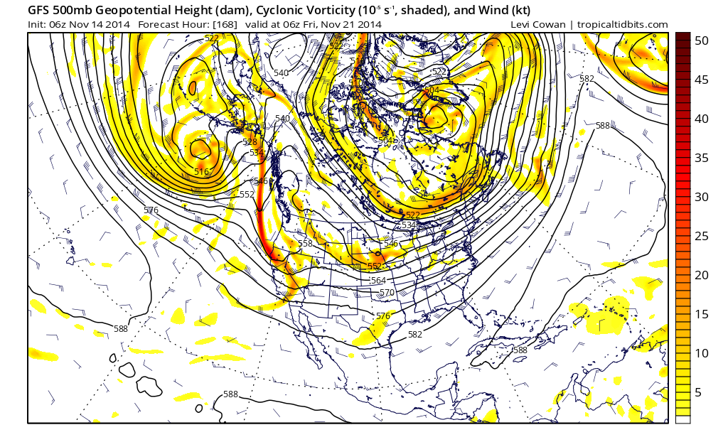
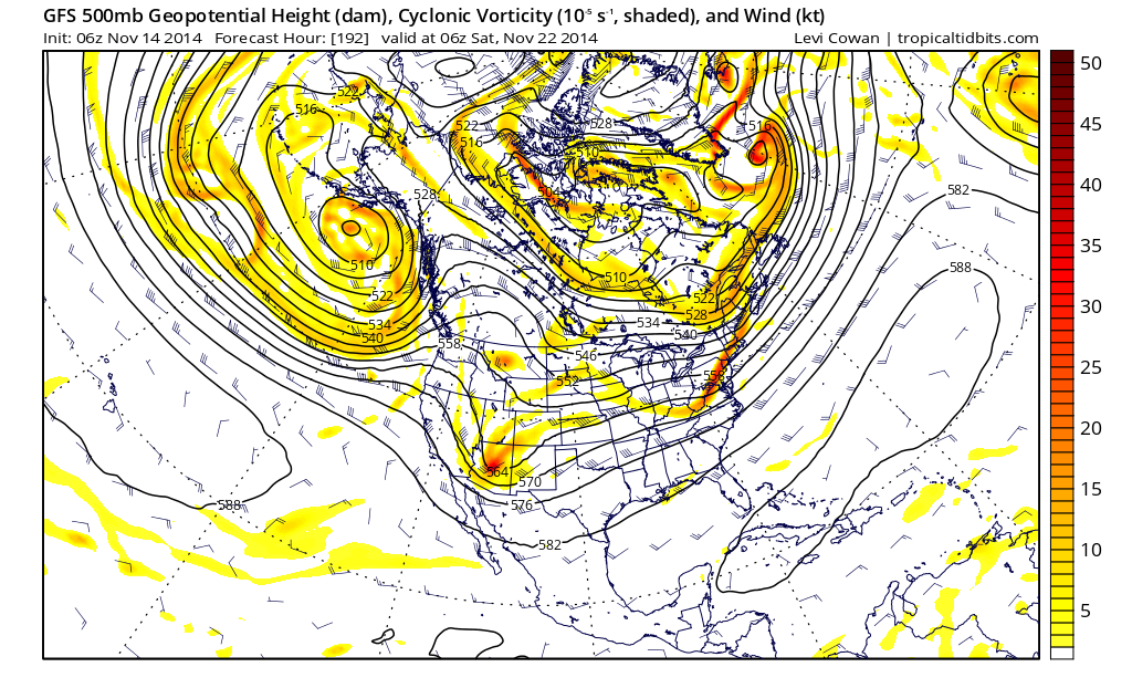
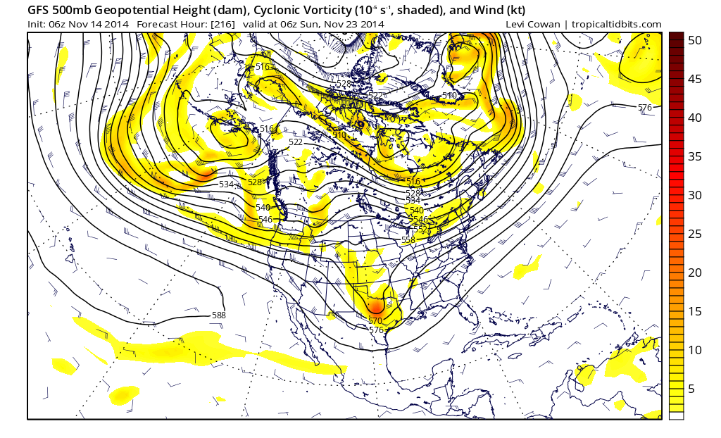
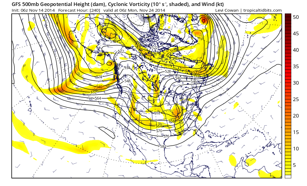
The southern stream system moves along and then makes a turn to effect the northeast. But look at what happens to the overall flow. The vortex in Canada rather than continuing its rotation/reload begins to stretch and pull out into the Atlantic south of Greenland. The result is the flow across Canada becomes more west east which is at 90 degrees difference to what it is now which is north south. Cold air masses now retreat northward putting the US only on the fringe while at the same time a strong Pacific jet appears to take hold which will start bringing in systems into California and then push them along eastward.
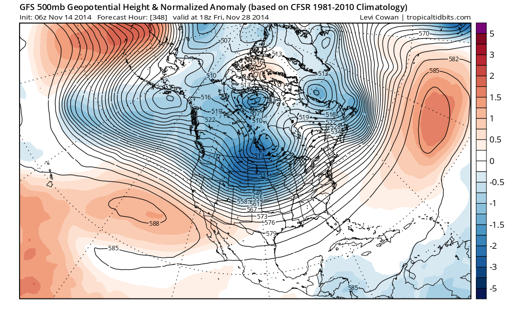
This is basically a pattern relaxation. Bear in mind what we just saw simply can’t last long. The atmosphere can only hold on to an extreme for a certain amount of time before it just has to at least relax. And this is what this model is implying at least on the last couple of runs. It would be logical to expect that setups that bring temperatures to -20 to -30 below normal just can’t last more than several days or a week in mid November so the behavior of the atmosphere is simply following form.
Now what happens after this? Well here is what this model says. The question is whether what we are seeing now is the beginning of something long long term or just a short term blip. Well at least from the standpoint of the GFS model it is telling us that it is NOT a short term blip. Jumping out to day 15 and 16 and again we do not care about specifics here just trends and the look. Notice that the pattern is forecast to revert back to what we are seeing now which is a deep strong flow from Canada southward into the United States, a well established low in the Aleutians/Gulf of Alaska and a strong ridge in the west/trough in the east.
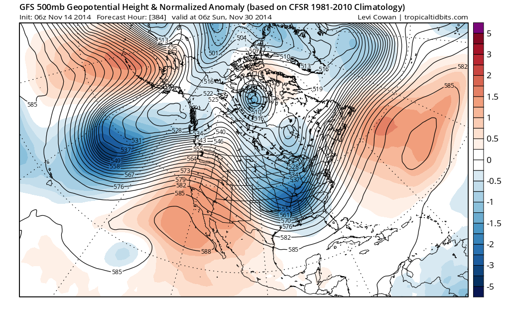
In English: The conclusion from all of this is far from certain and of course as days move on from here we are likely to see changes in one direction or another. But at least from this standpoint and from this model, the colder pattern we are seeing now may take a break, but we are at the beginning of something that may be around for the longer term and that this extreme cold setup for mid November is not going to be the last one.
Joe Cioffi has been a meteorologist in the New Jersey/New York area for the last 30 years on NJ 101.5 radio and WPIX TV in New York. You can follow him on facebook (facebook.com/meteorologistjoecioffi) and Twitter (@joecioffi) or visit his website at www.meteorologistjoecioffi.com.
Jonathan Carr (JC) is the founder and sole operator of Weather NJ, New Jersey’s largest independent weather reporting agency. Since 2010, Jonathan has provided weather safety discussion and forecasting services for New Jersey and surrounding areas through the web and social media. Originally branded as Severe NJ Weather (before 2014), Weather NJ is proud to bring you accurate and responsible forecast discussion ahead of high-stakes weather scenarios that impact this great garden state of ours. All Weather. All New Jersey.™ Be safe! JC


LOCAL FORECAST | INTERACTIVE RADAR | LATEST NJ WEATHER ALERTS | WEDDING FORECAST| PRIVACY POLICY
© Copyright 2026 Weather NJ LLC. All Rights Reserved.
Some information that can be found on our website is provided by a private weather station and is not an officially recognized station for weather reporting. Though we always strive to achieve accurate reporting for our own use, it is important that you do NOT depend on the data provided here for any purpose.
