

Nov 14: Winter Storm Approaching
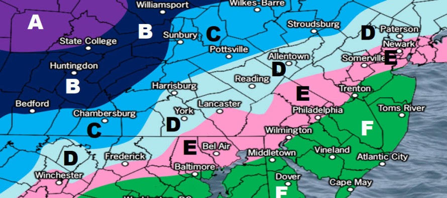
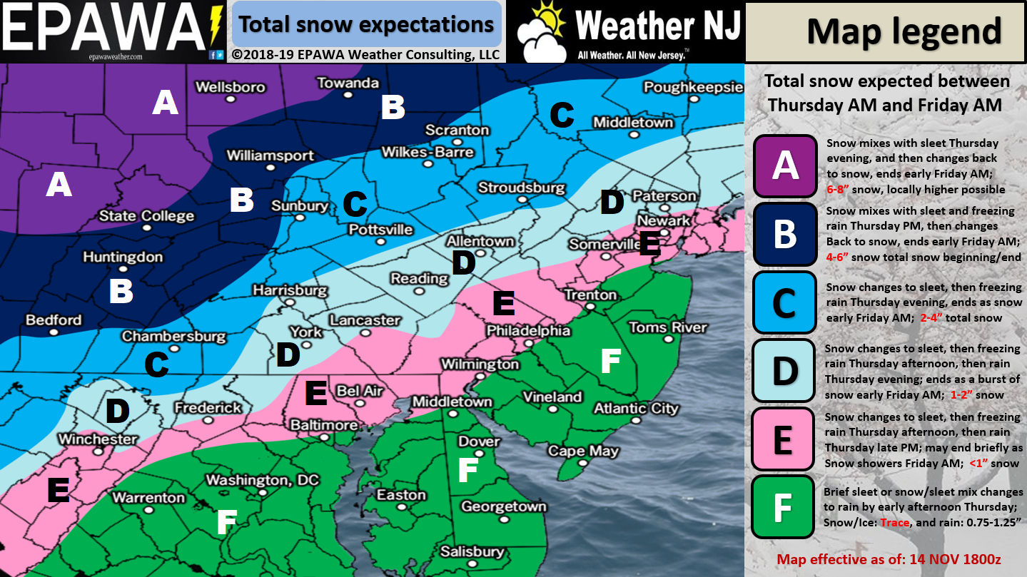
Please click here for full-resolution snow map!
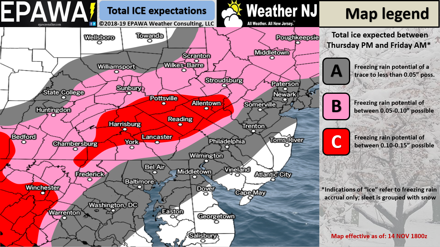
Please click here for full-resolution ice map!
Discussion: The general dynamics of this system have not changed. We still have an upper-level low breaking off from a C US trough and enhancing a surface low crawling up the coast tomorrow-Friday. We still have a high that will back-peddle through New England from W to E ahead of the surface low. This will slow the low and allow for cold air to filter in.
We know that this high low setup will produce a tight pressure gradient which will enhance a period of onshore flow. What we’re coming to terms with today is that the warm air surge associated with the warmer marine air mass will likely inhibit winter accumulations for most of the lower 2/3 of NJ. Therefore this seems like a cold rain event for everyone along and SE of I-95 despite possibly starting as non-accumulating wintry precipitation (sleet likelier than snow). Areas N of I-78 are the areas of highest concern for snow and/or ice. As the snow map indicates only extreme NWNJ has a concern for possibly significant accumulations and that’s only with(if) minimal warm air interference. This is just not a big wintry event however its enough to bring wintry safety hazards.
In English: The above snow and ice maps represent our final call heading into this winter 2018-2019 kickoff event. Precipitation should move in from the SW between mid-to-late Thursday morning. Most of SENJ (SE of I-95/NJ Turnpike) especially coastal areas should see a cold rain with only a small chance of starting wintry away from the ocean. Areas along and immediately NW of I-95 should see a little more of a wintry start before changing to cold rain. Areas N of I-78 and NW of I-287 have the best chance for higher impact wintry weather between the late-morning and evening hours of Thursday. Extreme NWNJ has the best chance to remain wintry the entire time (Thursday morning through early Friday morning). Let’s allow for precipitation to taper off by mid-to-late Friday morning statewide. The weekend still looks colder but seasonal in the wake of the departing system. Nowcasting begins early tomorrow morning. Have a great night and please be safe! JC
Jonathan Carr (JC) is the founder and sole operator of Weather NJ, New Jersey’s largest independent weather reporting agency. Since 2010, Jonathan has provided weather safety discussion and forecasting services for New Jersey and surrounding areas through the web and social media. Originally branded as Severe NJ Weather (before 2014), Weather NJ is proud to bring you accurate and responsible forecast discussion ahead of high-stakes weather scenarios that impact this great garden state of ours. All Weather. All New Jersey.™ Be safe! JC


LOCAL FORECAST | INTERACTIVE RADAR | LATEST NJ WEATHER ALERTS | WEDDING FORECAST| PRIVACY POLICY
© Copyright 2026 Weather NJ LLC. All Rights Reserved.
Some information that can be found on our website is provided by a private weather station and is not an officially recognized station for weather reporting. Though we always strive to achieve accurate reporting for our own use, it is important that you do NOT depend on the data provided here for any purpose.
