

Nov 15: Winter Storm Surprises
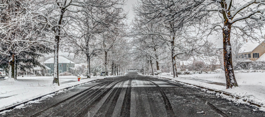
Discussion: Well, we knew there was a winter storm coming but sometimes mother nature throws a curve-ball. My expectations heading into this system included snow for NWNJ and snow-to-ice-to-rain for mostly everyone else in NJ. Today’s precipitation arrived early and strong due to intense moisture convergence, freakish lifting, a slow-to-establish E wind component and dry air to start. The moisture convergence was stronger because of the stronger Gulf of Mexico tap combining with a stronger Atlantic tap. The freakish lifting allowed for heavier precipitation to bring down colder air aloft. The low and high have finally established the pitching machine wheel effect of wind into the ENJ coast but later than expected. The dry air allowed for a lower wet bulb point.
All of these factors resulted in a MUCH snowier solution than expected for the Washington DC/Baltimore/SWNJ. Extreme SENJ went about as expected but still with a bit more ice accrual than originally anticipated. Right now CNJ and NNJ are experiencing the more-wintry outcome. When all is said and done, I imagine all areas will have a few more inches of snow/ice accrual than expected.
Another wildcard might be setting up in the form of a dry slot. If this comes into fruition then instead of ending as rain, some areas might just go from snow to nothing with minimal ending rain. We will have to see. Either way, travel conditions should remain very dangerous through this evening’s rush hour and into overnight hours tonight. The snow/ice/rain line is trying to advance N and W but the dynamics continue to put up a ridiculous fight. If the dry slot wildcard occurs then you will see precipitation shut off from S to N on radar. Let’s see how it unfolds. All precipitation should taper off by mid-to-late tomorrow morning.
Now that the high and low are aligned for the E wind component, coastal and areas just inland should experience the higher gusts of the system. I would expect gusts in-excess of 40mph at times along the immediate coast, possibly higher. This should help warm the lower-levels of the atmosphere and assist the changeover but again, the changeover has been slow as molasses. This onshore flow component could also generate minor-to-moderate coastal flooding. I’m leaning towards minor but wouldn’t be surprised to see some flood gauges trip the moderate criteria.
In English: Old Man Winter has made a statement. That statement is basically “How you like me now?!” Expect the more-wintry solution to continue with more snow and ice than rain for many areas. One of two things will happen from S to N now: 1) Precipitation will change from snow/ice to rain or 2) Precipitation will shut-off all-together with minimal rain. Either way, at least NNJ and CNJ have a long night ahead. SNJ is just starting to switch-over. Heck of a kick-start to the 2018-2019 snow season. Stay warm and be safe! JC
Jonathan Carr (JC) is the founder and sole operator of Weather NJ, New Jersey’s largest independent weather reporting agency. Since 2010, Jonathan has provided weather safety discussion and forecasting services for New Jersey and surrounding areas through the web and social media. Originally branded as Severe NJ Weather (before 2014), Weather NJ is proud to bring you accurate and responsible forecast discussion ahead of high-stakes weather scenarios that impact this great garden state of ours. All Weather. All New Jersey.™ Be safe! JC


LOCAL FORECAST | INTERACTIVE RADAR | LATEST NJ WEATHER ALERTS | WEDDING FORECAST| PRIVACY POLICY
© Copyright 2026 Weather NJ LLC. All Rights Reserved.
Some information that can be found on our website is provided by a private weather station and is not an officially recognized station for weather reporting. Though we always strive to achieve accurate reporting for our own use, it is important that you do NOT depend on the data provided here for any purpose.
