

Nov 21: Watching Thanksgiving Period for Snow!
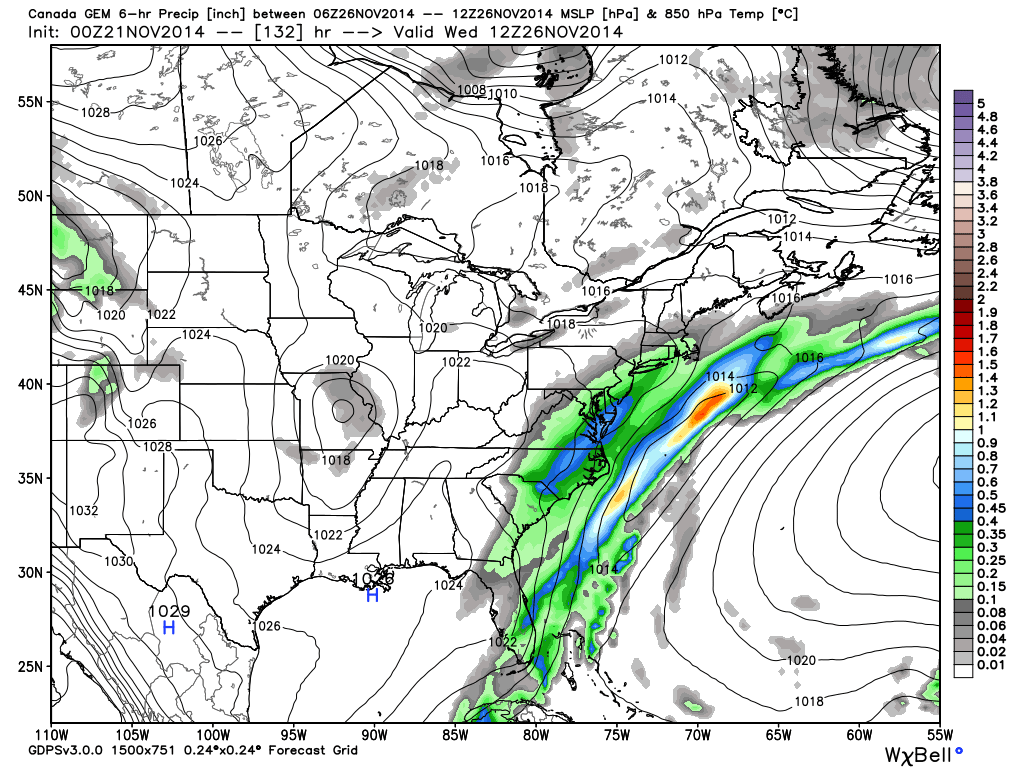
The warm period that will start this Sunday might be shorter lived than expected. A coastal low pressure system is now showing on most weather models that could threaten New Jersey with snow in the Wednesday-Thursday period. We’re a ways out and this is not a forecast. Track and timing are uncertain between different models but they are all showing it. Lets go right to guidance. First is the Canadian which has the system impacting New Jersey the earliest (Wednesday morning-afternoon). This map shows 850mb pressure and precipitation (in liquid inches). Remember…x 10 for snowfall amounts:
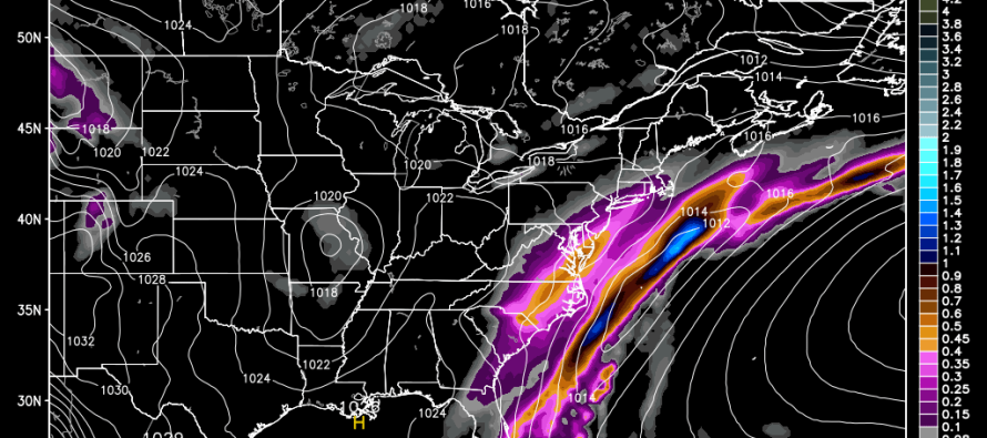
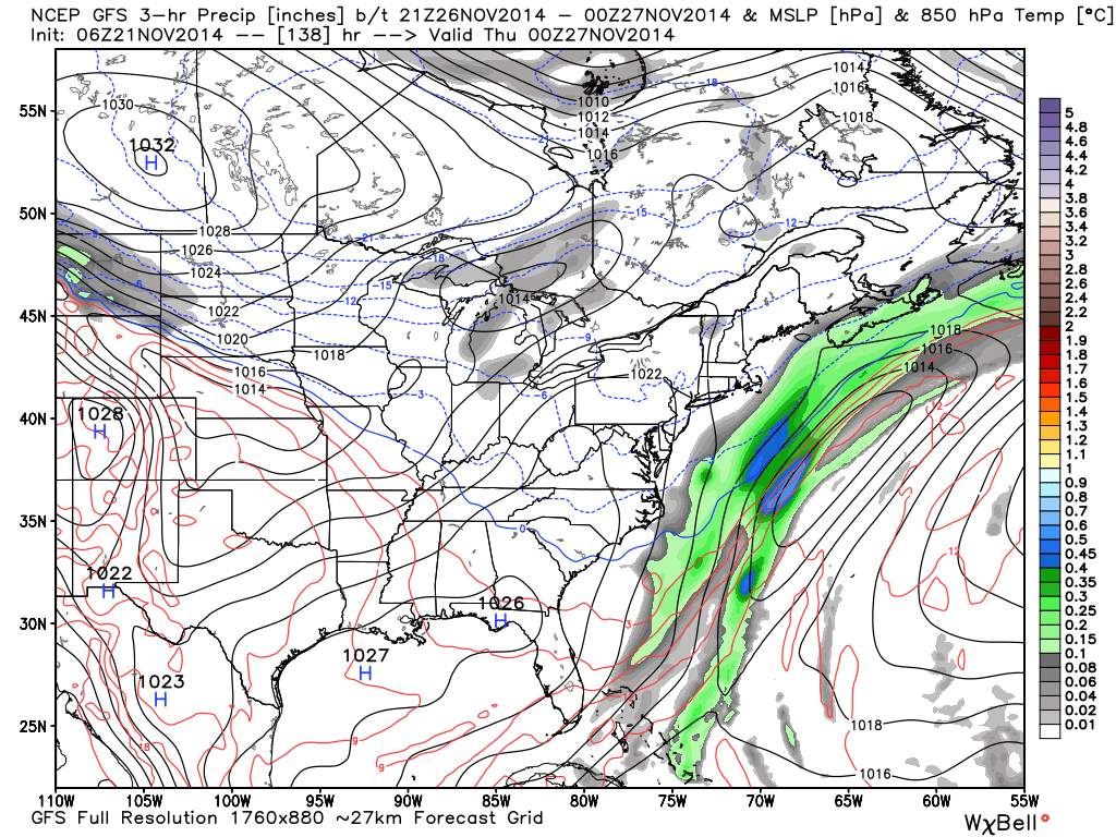
The European model is also showing the storm but almost 24 hours later—impacting New Jersey on Thanksgiving morning-afternoon. The GFS has the coastal energy but further offshore. In more cases than not, the GFS has a southeast track/out to sea bias so keep that in mind (actual storm track ends up being where Canadian and Euro suggest). Here is the GFS showing the system passing by late Wednesday night into early Thanksgiving morning (same parameters as Canadian model above):
In English: The Euro, Canadian, and GFS weather models are all showing a coastal storm that could bring snow to New Jersey in the Wednesday-Thursday period. With exact track and timing still uncertain, I will continue to monitor and adjust expectations as we get closer to a solid consensus. At this point, expected accumulation totals cannot be confidently made. Also keep in mind that ocean temperatures this time of year are still warm so NW of I-95/NJTP has a better chance than SE of I-95/NJTP for snow and accumulations. It can still happen for SENJ this time of year but it’s rare. In the meantime stay warm today and tomorrow, stay dry on Monday, enjoy the mild conditions Monday-Wednesday and be safe! JC
Jonathan Carr (JC) is the founder and sole operator of Weather NJ, New Jersey’s largest independent weather reporting agency. Since 2010, Jonathan has provided weather safety discussion and forecasting services for New Jersey and surrounding areas through the web and social media. Originally branded as Severe NJ Weather (before 2014), Weather NJ is proud to bring you accurate and responsible forecast discussion ahead of high-stakes weather scenarios that impact this great garden state of ours. All Weather. All New Jersey.™ Be safe! JC


LOCAL FORECAST | INTERACTIVE RADAR | LATEST NJ WEATHER ALERTS | WEDDING FORECAST| PRIVACY POLICY
© Copyright 2026 Weather NJ LLC. All Rights Reserved.
Some information that can be found on our website is provided by a private weather station and is not an officially recognized station for weather reporting. Though we always strive to achieve accurate reporting for our own use, it is important that you do NOT depend on the data provided here for any purpose.
