

Nov 22: Winter Storm Detected!

Model guidance continues to suggest a coastal low pressure disturbance riding up the coast in the Wednesday-Thursday period. As far as expected accumulation amounts and where the snow/rain line will set up, we’re going to have to monitor very closely. Given the time of year with warmer ocean temperatures, coastal/SENJ will need a lot to happen for accumulations. Areas of New Jersey further inland (5-10 miles west of the Garden State Parkway in SNJ and NW of the NJTP in CNJ/NNJ), it will be cold enough for snow to fall and stick.
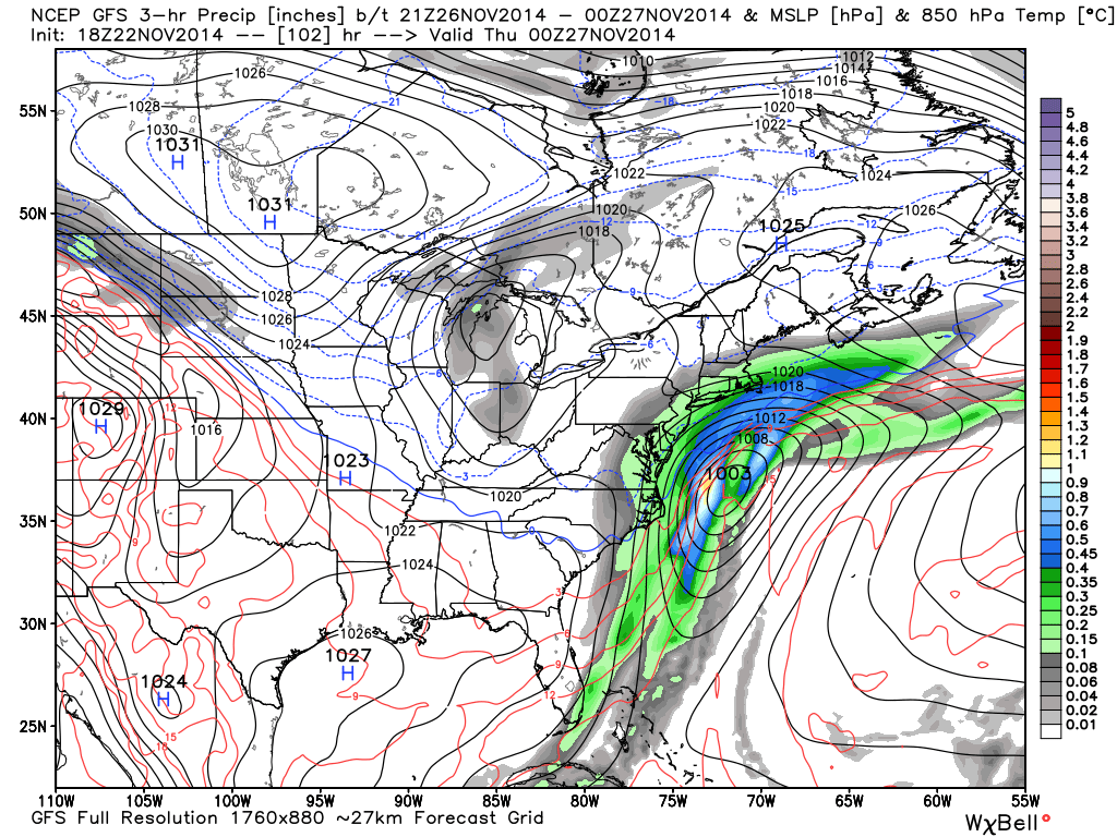
Lets talk about the latest guidance. The latest 12Z Euro drops 6-12 inches of snow along the entire I-95 corridor (with mixing issues at the coast). That seems a little aggressive for now but this solution has been showing a few runs now. Can’t argue with the king of models if that solution is still showing after a few more runs. The GFS, on the other hand, is a little bit east of the Euro but still a light snow event for most of New Jersey. That’s pretty much where we are at this point…Euro (significant snow hit with mixing issues at the coast) vs. GFS (light snow event for mostly coastal and SE New Jersey). This is the latest GFS showing 850mb pressure, temperature, and precipitation between Wednesday afternoon and Wednesday evening. Precipitation then tapers off early Thanksgiving morning:
In English: You should probably start getting ready for anything from a wintry mix/dusting to a significant I-95/NJTP snow storm this Wednesday-Thursday. I’ll be watching like a hawk in the next few days and will make an initial snow map on Monday if the status quo is kept on model guidance. Be safe! JC
And suddenly you find yourself by Greg Molyneux Photography
Jonathan Carr (JC) is the founder and sole operator of Weather NJ, New Jersey’s largest independent weather reporting agency. Since 2010, Jonathan has provided weather safety discussion and forecasting services for New Jersey and surrounding areas through the web and social media. Originally branded as Severe NJ Weather (before 2014), Weather NJ is proud to bring you accurate and responsible forecast discussion ahead of high-stakes weather scenarios that impact this great garden state of ours. All Weather. All New Jersey.™ Be safe! JC


LOCAL FORECAST | INTERACTIVE RADAR | LATEST NJ WEATHER ALERTS | WEDDING FORECAST| PRIVACY POLICY
© Copyright 2026 Weather NJ LLC. All Rights Reserved.
Some information that can be found on our website is provided by a private weather station and is not an officially recognized station for weather reporting. Though we always strive to achieve accurate reporting for our own use, it is important that you do NOT depend on the data provided here for any purpose.
