

Oct 12: Windy Period Detected!
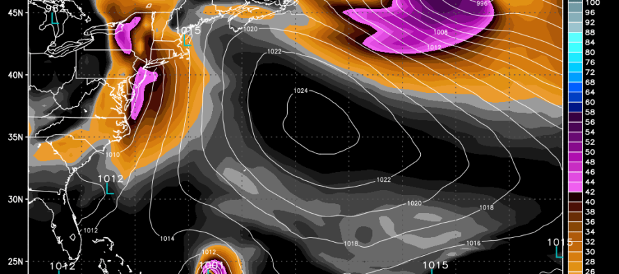
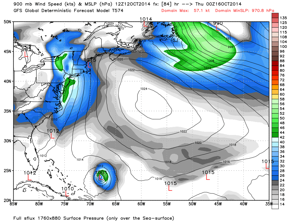
Over the next 3-5 days a low pressure system will slowly advance eastward from the midwest to the east coast. High pressure currently responsible for today’s nice weather will depart into the ocean slower than the low moves eastward. This means that later this week the east coast will be subject to heavy rain and strong winds for a period of time when sandwiched between cyclonic and anti-cyclonic flow. Timing is uncertain. While the Euro has most rain and wind occurring on Thursday, the GFS has it starting as early as Wednesday evening. This model shows wind speed in knots and pressure in mb:
You will probably hear news in the midwest about this system tomorrow and Tuesday. Just keep in mind that east coast conditions will be weaker than what happens to our west. This is the kind of system that can drop a quick inch or two of rain in a 3-6 hour period with sustained winds of 30-40mph (gusts to 60). I’ll be monitoring this system all week. Be safe! JC
Jonathan Carr (JC) is the founder and sole operator of Weather NJ, New Jersey’s largest independent weather reporting agency. Since 2010, Jonathan has provided weather safety discussion and forecasting services for New Jersey and surrounding areas through the web and social media. Originally branded as Severe NJ Weather (before 2014), Weather NJ is proud to bring you accurate and responsible forecast discussion ahead of high-stakes weather scenarios that impact this great garden state of ours. All Weather. All New Jersey.™ Be safe! JC


LOCAL FORECAST | INTERACTIVE RADAR | LATEST NJ WEATHER ALERTS | WEDDING FORECAST| PRIVACY POLICY
© Copyright 2026 Weather NJ LLC. All Rights Reserved.
Some information that can be found on our website is provided by a private weather station and is not an officially recognized station for weather reporting. Though we always strive to achieve accurate reporting for our own use, it is important that you do NOT depend on the data provided here for any purpose.
