

Oct 16: Coastal Storm Begins
Discussion: Our coastal storm is just getting started. The upper-level low is intensifying over the Great Lakes with an initial surface low directly underneath. This Great Lakes surface low will transfer to the surface energy currently moving up the coast (over NC/SC). The end result will be a full transfer and upper-level phase of a powerful October mid-latitude cyclone. The cyclone should form tonight off coastal NJ and track to the N/NE over coastal New England. A reminder that NJ will only deal with the initial formation of this cyclone today and tonight followed by the back-end winds of the cyclone once mature over coastal New England. Coastal New England is in for a heck of a nor’easter tomorrow into the weekend. New Jersey impacts should be as follows:
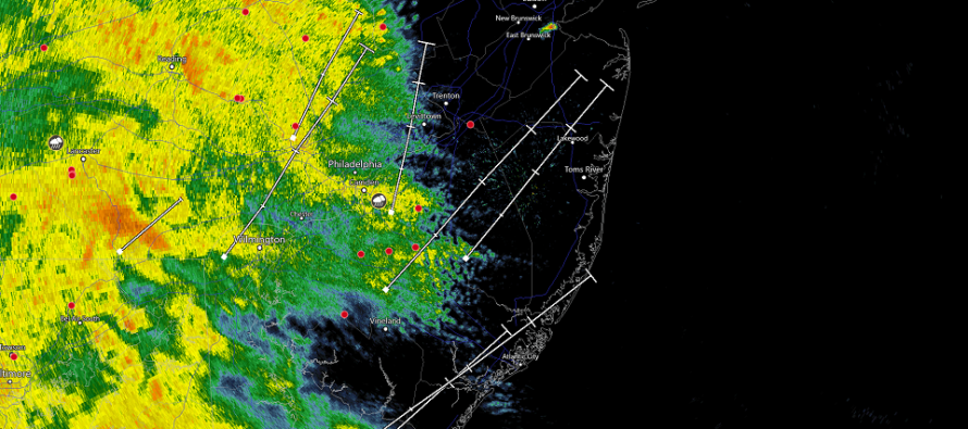
Rain: Based on a diversified blend of model guidance the most realistic range of rainfall quantity is between .75 inches and 2 inches. The guidance favors NNJ (especially NENJ) for the higher end of that range and SNJ (especially SWNJ) for the lower end of that range. Should reality over-perform the model data then I suppose 2-3 inches of rain are possible. Either way this is a decent amount of rainfall that should fall between now and late-tonight/early Thursday AM. Flash flooding is possible for areas of strongest downpour and/or poorest drainage. The rain should end by 2-3 AM Thursday morning at the latest.
Wind: Throughout today and tonight’s rainfall the flow will be generally out of the S/SE. The cyclone won’t be matured until later tonight/tomorrow morning. Therefore today we should expect breezy, occasionally gusty, conditions out of the S/SE and most felt along the SENJ coast. As we get later into overnight hours tonight the cyclone should mature and ramp up wind gusts. At that point it will be to NJ’s due E which means N flow for NJ initially/temporarily. Tomorrow the cyclone will be further to the N/NE over coastal New England. This will mean NW winds for NJ. The N winds tonight and NW winds tomorrow however should be quite strong with gusts of 40-50mph possible (20-30mph sustained). This won’t be for the coast-only either. This will be statewide and might not subside until Friday afternoon/evening. Thursday should feature the peak winds though.
Flooding: Given the lighter S/SE flow with the rainfall only minor levels of coastal flooding are possible from now through tonight. The highest risk/form of flooding remains flash flooding from heavy statewide rainfall. The flash flooding risk will subside when rain shuts off by late-tonight or early Thursday AM.
In English: Rainfall is now into SWNJ and will spread statewide through afternoon/evening hours. Rainfall should be heavy at times this afternoon/evening and taper off by late-tonight/early tomorrow AM. Winds should be breezy out of the S/SE during the rainfall and then very gusty out of the NW from the point the rain ends (late-tonight/early Thursday AM) through at least Friday morning. Coastal flooding concerns are minor but flash flooding concerns are more of a concern given the amount of rainfall that should dump during PM hours today. You should see on the news how strong this nor’easter will become for coastal New England tomorrow through the weekend. Luckily for NJ we only deal with the initial formation and back-end winds of a very powerful classic October coastal storm.
Download the new free Weather NJ mobile app on Apple and/or Android. It’s the easiest way to never miss Weather NJ content. Our premium services go even further above and beyond at the hyper-local level. Looking for industrial-caliber long-range forecasting data that I personally recommend? Check out WeatherTrends360!
Jonathan Carr (JC) is the founder and sole operator of Weather NJ, New Jersey’s largest independent weather reporting agency. Since 2010, Jonathan has provided weather safety discussion and forecasting services for New Jersey and surrounding areas through the web and social media. Originally branded as Severe NJ Weather (before 2014), Weather NJ is proud to bring you accurate and responsible forecast discussion ahead of high-stakes weather scenarios that impact this great garden state of ours. All Weather. All New Jersey.™ Be safe! JC


LOCAL FORECAST | INTERACTIVE RADAR | LATEST NJ WEATHER ALERTS | WEDDING FORECAST| PRIVACY POLICY
© Copyright 2026 Weather NJ LLC. All Rights Reserved.
Some information that can be found on our website is provided by a private weather station and is not an officially recognized station for weather reporting. Though we always strive to achieve accurate reporting for our own use, it is important that you do NOT depend on the data provided here for any purpose.
