

Oct 2: Matthew is Slowing Down
Impacts to beyond Jamaica, E Cuba, Haiti and the Bahamas remain fairly uncertain but a few positive trends (for NJ) have taken shape…
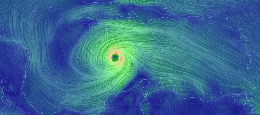
Matthew is a strong category 4 hurricane in the middle of the Caribbean Sea. He has slowed down and is now crawling NW at 5mph. This impacts our New Jersey timing downstream by pushing any atmospheric symptoms that may occur closer to the end of this coming weekend and possibly early next week. He has nowhere to go but north between the lower heights over the Gulf of Mexico and the higher heights over the western side of the Bermuda Triangle. That places his most probable track through the windward passage (between Cuba and Haiti). This places Jamaica, especially E Jamaica, E Cuba, Haiti and most of the Bahamas on high alert through the early part of next week as a major hurricane tracks through. If the eye threads the needle and stays over water within the windward passage then more locations will luck out but the overall wind field should pretty much affect all aforementioned areas.

Once N of 25N, the uncertainty begins to branch. A small jog W and E Florida through coastal Georgia, South Carolina and the Outer Banks of North Carolina will be put on high alert. The represents the furthest W track of current guidance as the majority of others have a track just off the SE US coast but ironically paralleling the coast line.
Once N of 35N, the uncertainty spirals out however most models turn Matthew out to sea. This is because the upper-level low, that has brought us this current prolonged period of dreary weather, moves out to the E but then re-develops close enough to Matthew to tug him out to sea. The other player is the trough approaching from the NW (over the US). If this trough swings through quick enough, it could pull Matthew to the NE and even phase with him. Of all the model solutions showing this, the storm re-curves back into the N Atlantic Coast between Cape Cod and Nova Scotia. This would keep Matthew far enough out to sea for New Jersey to avoid damaging conditions but still might bring some rain, wind and minor-to-moderate coastal flooding. However if the trough is not quick enough to capture then it will have a shoving effect on Matthew and take him further out to sea. So these are the positive trends I’ve seen over the last 24 hours of guidance.
In all honesty, I think models are going to continue to swing back and forth with regard to impacts N of the Bahamas. With the increase in time comes the increase in uncertainty. While it’s nice to see positive trends today, we really have to keep the door open for possibilities. I believe the possibilities will fall between the following two storm tracks…
![]()
Scenario A: The Bermuda Triangle ridge pushes Matthew’s initial track slightly westward and threatens the SE US coast from the NE Florida coast to the Outer Banks of North Carolina. The system would then continue to disrupt the Delmarva Peninsula, New Jersey, New York City and most of New England with rain, wind and flooding this coming weekend into early next week. The more land crossed over, the faster the storm would loose strength. At the current time, this scenario has little model support but given the uncertainty in long-range North American synoptics, I’m not prepared to take it completely off the table yet.
Scenario B: This is the scenario that most model guidance is now supporting. This would mean that the upper-low initially moves away to the E but then redevelops and pulls Matthew out to sea. It could also mean that the approaching trough provides a boot instead of a capture. Again though, with the uncertainty in long-range North American synoptics, it would be foolish to place your eggs in this basket at this point in time. It is however nice to see some consistency in model guidance leaning this way. Hopefully that trend continues.

In English: A is becoming less likely but still on the table as a small possibility. B is becoming more likely as most models now support this idea. This is a great positive trend however, we are still a long way away. Nightly updates will continue for educational purposes but there is no reason to panic at this point in time. I will continue to monitor as Matthew delivers historic impact to the islands and as forecast confidence increases for New Jersey latitudes over the coming days. Have a great night and please be safe! JC
Jonathan Carr (JC) is the founder and sole operator of Weather NJ, New Jersey’s largest independent weather reporting agency. Since 2010, Jonathan has provided weather safety discussion and forecasting services for New Jersey and surrounding areas through the web and social media. Originally branded as Severe NJ Weather (before 2014), Weather NJ is proud to bring you accurate and responsible forecast discussion ahead of high-stakes weather scenarios that impact this great garden state of ours. All Weather. All New Jersey.™ Be safe! JC


LOCAL FORECAST | INTERACTIVE RADAR | LATEST NJ WEATHER ALERTS | WEDDING FORECAST| PRIVACY POLICY
© Copyright 2026 Weather NJ LLC. All Rights Reserved.
Some information that can be found on our website is provided by a private weather station and is not an officially recognized station for weather reporting. Though we always strive to achieve accurate reporting for our own use, it is important that you do NOT depend on the data provided here for any purpose.
