

Oct 31: Weekend Storm Update
TRICK TO THE SATURDAY FORECAST… **INVERTED TROUGH**, CHILLY RAIN & WIND… COAST = BRUNT… READ IT ALL…
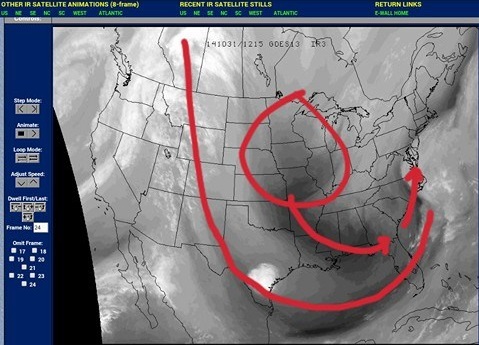
Our energy that will develop into our main coastal Low for Saturday is diving through the Midwest this AM as seen in Water Vapor in 1st image – below. You can see the trough becoming negatively tilted as well (I drew in trough):
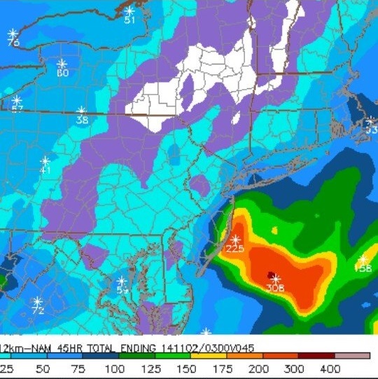
A combination (merging) of 3 lows will begin to strengthen off of VA/NC waters before tracking NE offshore of NJ Saturday. As this occurs, periods of Rain will be thrown to the coast starting SAT AM, but an inverted trough (see image #2 – below; you can see thin band of heavier rain) looks to try and set up along our coast. This is where it gets tricky…
What is an inverted trough? Typical troughs in mid-latitudes of the Northern Hemisphere are characterized by decreasing atmospheric pressure from south to north, while inverted troughs are characterized by decreasing pressure from north to south. These are very very tricky to forecast (majority do not develop), but a couple computer models (NAM, CMC, ECMWF) are suggesting we see this set up along NJ coast. Like turning on a thin atmospheric hose and aiming it at one location. This can drastically change rainfall amounts for those who experience it. Have to watch it very closely.
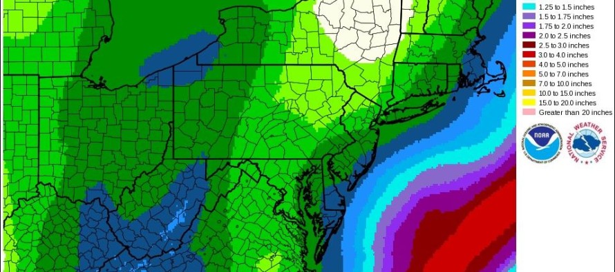
**EXPECTED RAINFALL ALONG NJ COAST (image #3 – below): 1/2″-1″, maybe more depending on inverted trough set-up. Heaviest SENJ:
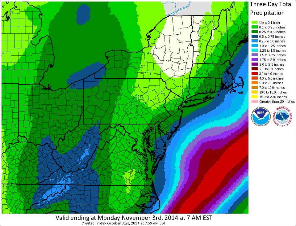
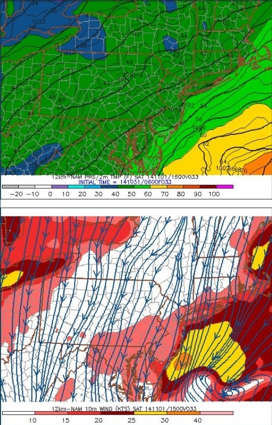
As the storm develops offshore, a tighter pressure gradient (stronger winds) will result between this Low & High Pressure to the west. Winds NNE@15-25mph, with gusts up to 35mph along the coast (bottom of image #4 – below). Minor tidal flooding is possible with high tide Saturday. Highs low-mid 50’s (top of image #4 – below), lows ~40°, wind chills in the 20’s. Dress accordingly!!
Jonathan Carr (JC) is the founder and sole operator of Weather NJ, New Jersey’s largest independent weather reporting agency. Since 2010, Jonathan has provided weather safety discussion and forecasting services for New Jersey and surrounding areas through the web and social media. Originally branded as Severe NJ Weather (before 2014), Weather NJ is proud to bring you accurate and responsible forecast discussion ahead of high-stakes weather scenarios that impact this great garden state of ours. All Weather. All New Jersey.™ Be safe! JC


LOCAL FORECAST | INTERACTIVE RADAR | LATEST NJ WEATHER ALERTS | WEDDING FORECAST| PRIVACY POLICY
© Copyright 2026 Weather NJ LLC. All Rights Reserved.
Some information that can be found on our website is provided by a private weather station and is not an officially recognized station for weather reporting. Though we always strive to achieve accurate reporting for our own use, it is important that you do NOT depend on the data provided here for any purpose.
