

Oct 4: Coastal Flooding Update
Here’s the latest on the east coast pattern that’s been occurring. Hurricane Joaquin is just, and I mean just, missing Bermuda to the west. The latest wind numbers I’ve seen for Bermuda itself is 44mph sustained with gusts to 60mph. The latest update from the National Hurricane Center indicates that 100mph sustained winds with gusts to 120mph are tightly wrapped around Joaquin’s warm tropical core. Bermuda is seriously is dodging a bullet so long as the eye of Joaquin maintains N/NE movement over the next 12-24 hours.
With the obvious missed phase with the upper level low, Joaquin is pivoting around the low centered in South Carolina. Think of a yo-yo that got its string cut instead of winding back up into your hand. The yo-yo (Joaquin) will now fly off to the NNE then NE. High pressure is on its way from the NW which will push both systems out to sea (the yo-yo and the yo-yo-er). This will relax the onshore flow which we’ve endured for far too long now. I’m sure you’ve seen some results in South Carolina on all forms of media. It’s sad and there is more rain to come through tomorrow and possibly some of Tuesday.
For us, I would expect conditions to gradually improve starting tomorrow and heading into the weekend. It won’t be a sudden switch back to normal. First will be the return of sunshine for coastal areas tomorrow as most rain is now finished. Onshore flow and coastal flooding will then subside accordingly through Thursday over multiple tidal cycles. I do think the peak winds and tidal levels are behind us but until Joaquin is steaming off into the northern Atlantic, there will still be gusty winds and above-average high tides. The surf should definitely be dangerous for the first half of this week, or as surfers say up.
Obviously, these remnant symptoms of the general pattern improving will be more felt along the coastal regions of New Jersey than interior regions and elevations. I’ll have the full Monday-Friday Outlook posted tomorrow morning but for now, we’re over the hill. Be safe! JC
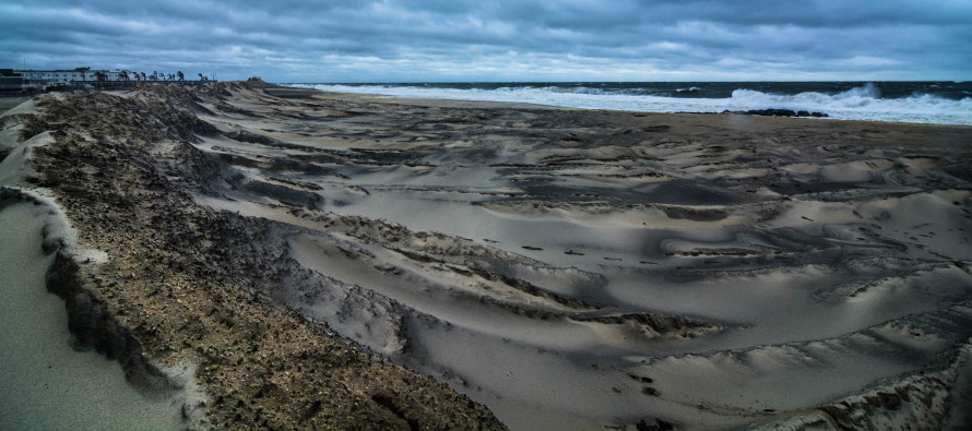
Image credit: Grzegorz Wysoczanski shared this photo to Weather NJ’s facebook page.
Jonathan Carr (JC) is the founder and sole operator of Weather NJ, New Jersey’s largest independent weather reporting agency. Since 2010, Jonathan has provided weather safety discussion and forecasting services for New Jersey and surrounding areas through the web and social media. Originally branded as Severe NJ Weather (before 2014), Weather NJ is proud to bring you accurate and responsible forecast discussion ahead of high-stakes weather scenarios that impact this great garden state of ours. All Weather. All New Jersey.™ Be safe! JC


LOCAL FORECAST | INTERACTIVE RADAR | LATEST NJ WEATHER ALERTS | WEDDING FORECAST| PRIVACY POLICY
© Copyright 2026 Weather NJ LLC. All Rights Reserved.
Some information that can be found on our website is provided by a private weather station and is not an officially recognized station for weather reporting. Though we always strive to achieve accurate reporting for our own use, it is important that you do NOT depend on the data provided here for any purpose.
