

One Storm Starting. More Storms Detected!
Discussion: This article will address a few things: The storm beginning now, the windstorm for Tues-Wed, and what to start expecting for the next few weeks. The embedded video is still relevant as we have no changes to yesterday’s snow map nor forecast.
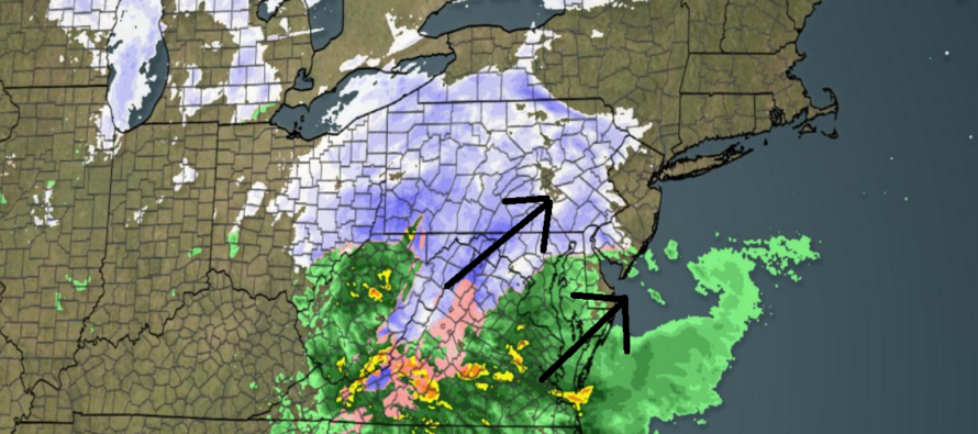
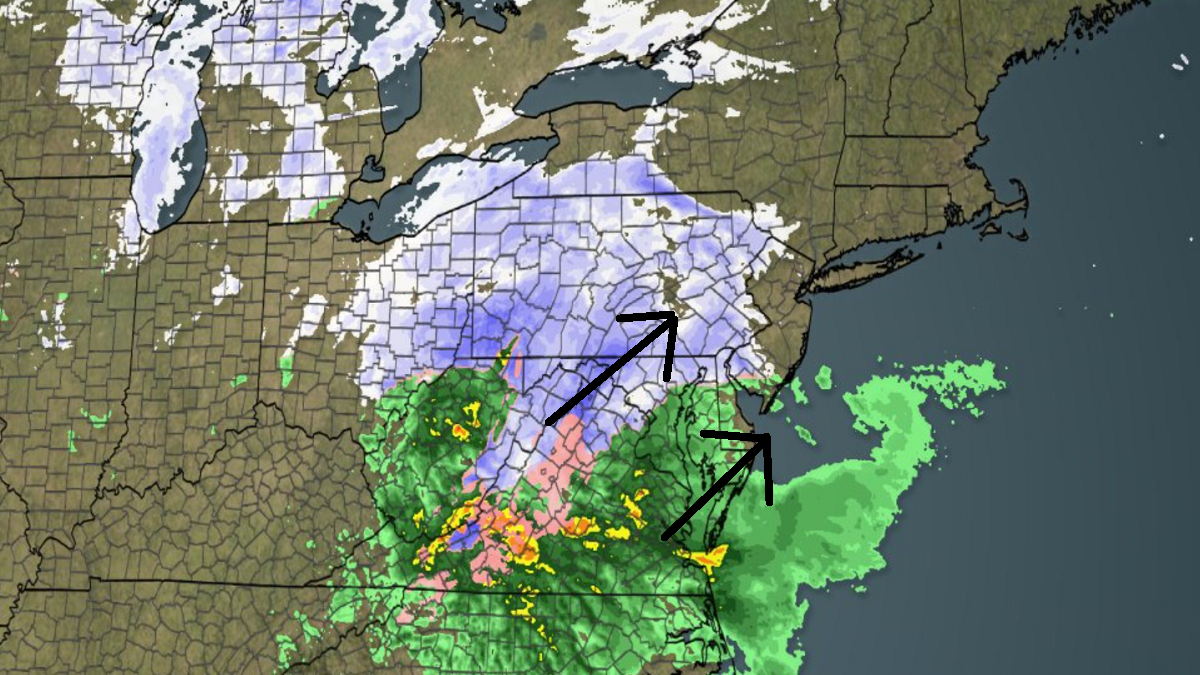
The current storm is just now showing radar returns entering parts of W and SE NJ. Some of the up-front returns might fall as virga (show that evaporates before hitting ground prior to saturation). But it will soon make it to the ground. Looks like a tiny bow area of SWNJ (from Delaware Memorial Bridge to about Trenton and eastward to maybe Cherry Hill/Marlton will see a little more up-front snow before rainfall washes most of it away. Otherwise, all other areas look good against our final call yesterday. We are still thinking 9-12 is a good bet for the jackpot zone in NWNJ and even some lower areas of NNJ. We still think it will be a sharp cut-off from plowable snow to nothing somewhere near or just NW of I-95. And we still think all areas SE of I-95 will predominantly see rain with coastal areas taking the highest wind gusts to the face. Conditions should gradually deteriorate for the rest of today and into this evening. Storm conditions should peak between about 10pm tonight (Saturday) and 7am tomorrow (Sunday) before gradually tapering off and away by noon tomorrow (Sunday). Here’s a recent radar shot of the system approaching.
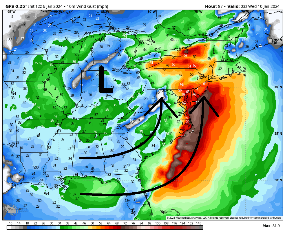
The next storm system of interest will likely be non-wintry for New Jersey. A mostly rain event for everyone with a few inches possible. It’s the wind that appears to be the most hazardous aspect of it. Basically, a major synoptic storm system will cut towards the Great Lakes which will produce a massive warm sector for most of the US east coast. Assuming there will be a centralized low pressure system over the Great Lakes that deepens to sub-990mb, this will generate strong S flow over New Jersey. Immediate SNJ coasts (both along the Delaware Bay and Atlantic Ocean (SWNJ/SENJ) will take it to the face but a lot of NJ is on the hook for high, possibly dangerous wind gusts levels. This storm system will span from this coming Tuesday into Wednesday (January 9-10) and I will talk more about it tomorrow night once we get through this existing system. I know the focus has been on this weekend, but we should start thinking about a wind storm for this Tuesday-Wednesday. Here is some sample output of modeled wind gusts showing values greater than 60 mph out of the S late Tuesday night. 70 mph + would be possible if any convective rain bands can bring down some of the screaming Lower Level Jet (LLJ) down to the surface.
The last thing I’d like to talk about is the rest of January. There is gaining confidence that a Sudden Stratospheric Warming Event (SSWE) will split the Stratospheric Polar Vortex as shown below. Basically, the stratosphere will warm and expand (as seen below on stratospheric heights). This will condense the troposphere below it with no where for the coldest air of the NH to go but into N America and W Russia.
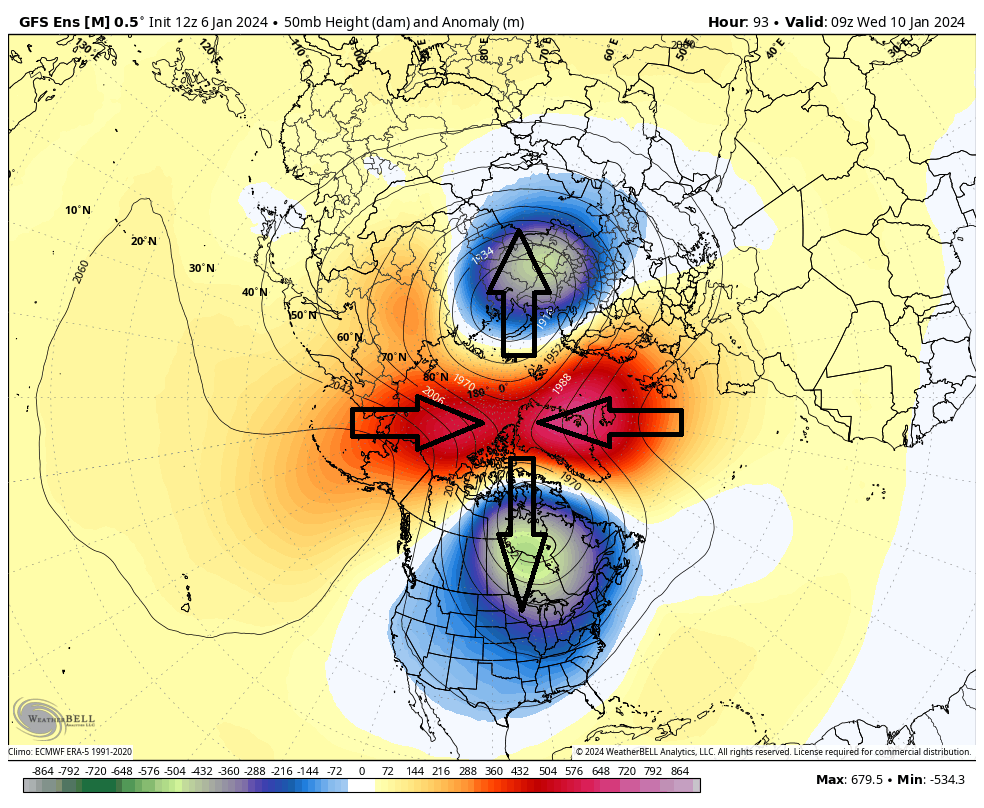
This should shove the coldest air of the N Hemisphere into both North America and W Russia. Obviously, we are only most impacted by the N America lobe. This insanely cold air mass will first drop into the NW US and NC US around January 15 and propagate eastward towards the NE US and Mid-Atlantic US by around January 20. The bottom line: We’re going to have some very cold air around from Jan 15-forward with an active subtropical jet trying to collide with it. I’m seeing 4-5 more storm systems after this weekend occurring almost every 3-5 days for the next few weeks. A good part of me is saying buckle up because I think winter is about to violently snap back from the warmer and rainy December. We will also discuss this expected colder pattern change in coming days/weeks. But for now, lets take one system at a time.
In English: No changes to our snow map or forecast for tonight-tomorrow morning’s system. Accumulating snow for NWNJ/NNJ, sloppy mix along I-95 and just NW of, and then all rain and wind for the coastal plain including all of SNJ and most of CNJ. It’s starting now and will end tomorrow morning. Another storm is then expected next Tuesday-Wednesday (Jan 9-10) which should be all rain but with very gusty S winds. Then several more storm systems as the pattern turns colder. As a snow lover, I am starting to gain some hope back that I lost in the rainy warmer December. For now, let’s focus on the current approaching system. With radar returns appearing over NJ in parts of W and SW NJ, live observations begin now. Be safe! JC
Premium Services
KABOOM Club offers inside info forecast discussion, your questions answered, and early storm impact maps (ahead of the public). At a buck per month, it’s an extremely feasible way to show support.
My Pocket Meteorologist (MPM), in partnership with EPAWA Weather Consulting, offers professional/commercial interests, whose businesses depend on outdoor weather conditions (snow plowing, landscaping, construction, etc.), with hyper-local text message alerts/forecasts and access to the MPM premium forum—the most comprehensive and technical forecast discussion available for PA and NJ.
Get your KABOOM Inside Out pajamas and more at the KABOOM shop!
Jonathan Carr (JC) is the founder and sole operator of Weather NJ, New Jersey’s largest independent weather reporting agency. Since 2010, Jonathan has provided weather safety discussion and forecasting services for New Jersey and surrounding areas through the web and social media. Originally branded as Severe NJ Weather (before 2014), Weather NJ is proud to bring you accurate and responsible forecast discussion ahead of high-stakes weather scenarios that impact this great garden state of ours. All Weather. All New Jersey.™ Be safe! JC


LOCAL FORECAST | INTERACTIVE RADAR | LATEST NJ WEATHER ALERTS | WEDDING FORECAST| PRIVACY POLICY
© Copyright 2026 Weather NJ LLC. All Rights Reserved.
Some information that can be found on our website is provided by a private weather station and is not an officially recognized station for weather reporting. Though we always strive to achieve accurate reporting for our own use, it is important that you do NOT depend on the data provided here for any purpose.
