

Onshore Flow Pattern to Break
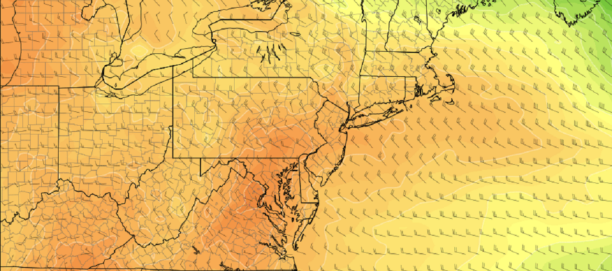
Discussion: Today (Tuesday) and tomorrow (Wednesday) will continue the onshore flow pattern at the surface due to the stubborn Rex Block configuration in the lower-mid levels. Again, that’s a high (NE US) to the N of a low (SE US) with an onshore fetch in the middle. This allowed for beautiful conditions N of the general Mason Dixon line and not so great conditions S of such for this past weekend. It will be the reason why the coast is so cool today and tomorrow while areas away from the ocean reach much higher in temperature. The Rex Block pattern should then break down by Thursday morning and allow a transient warm environment to move in for Thursday and Friday. That will allow parts of NJ to push towards breaking 90 degrees and possibly set a few records. With expected dew points in the 40s and 50s Thursday and Friday, it will feel like a dry heat, not a humid heat. While this will feel better, it constitutes an extended forest fire threat. A colder air mass will then settle in from the N/NE for the weekend due to an upper-low formation over Nova Scotia. This should knock NJ daytime highs down into the 70s for Saturday and Sunday. The cooler pattern should then push into next week. Don’t get me wrong, we’re talking about beautiful conditions. Slightly below average for June are still immaculate conditions. It’s not like April or early May where temps max in the 50s. We’re talking about 70s instead of 80s. In looking down the road, it appears that a more traditional summer-like heat wave wants to move in around the June 10 period. This would be more of a tropical feel with traditional hot and humid SW flow. What I am not seeing is a lot of rainfall in the next few weeks. This, along with the drier atmosphere, spells more bad news for forest fire risk.
Tuesday (May 30) high temperatures will max in the 60s along the coast but reach into the upper-70s/lower-80s away from the marine influence. Skies are mixed with more sun than clouds. Winds are still stiff out of the E/NE and therefore are felt more than areas away from the ocean. Overnight lows should range from lower-40s to lower-50s from NNJ elevations to SNJ coasts.
Wednesday (May 31) high temperatures should again range from 60s along the coast to near-80 away and to the N of the ocean. Much of NJ in the 70s. Skies should be mixed with sun and clouds but could be hazy from the forest fires. Winds should be breezy out of the NE, breeziest along the coast. Overnight lows should range from 45 to 60 from NNJ elevations to SNJ coasts.
Thursday (June 1) high temperatures should reach well into the 80s for most NJ locations. W side of NJ could flirt with breaking 90. Coastal areas should push well into the 70s. Skies should be mixed with more sun than clouds. Winds should be light out of the SE. Overnight lows should fall to the 55-60 range for most NJ locations.
Friday (June 2) high temperatures should reach or exceed 90 for many NJ locations away from the ocean. Immediate coastal areas should reach into the mid-70s. Skies should be mixed with sun and clouds. Winds should be light out of the S/SE. Overnight lows should hang in the upper-50s for most NJ locations.
An early look at the weekend indicates a cooldown from the Thursday-Friday warmup. Looks like 70s for most areas and slightly unsettled (mostly nice with isolated pop-up shower/t-storm activity). Let’s take a closer look in a few days. Everyone have a great week as we welcome a warm June start. Be safe! JC
Premium Services
KABOOM Club offers inside info forecast discussion, your questions answered, and early storm impact maps (ahead of the public). At a buck per month, it’s an extremely feasible way to show support.
My Pocket Meteorologist (MPM), in partnership with EPAWA Weather Consulting, offers professional/commercial interests, whose businesses depend on outdoor weather conditions (snow plowing, landscaping, construction, etc.), with hyper-local text message alerts/forecasts and access to the MPM premium forum—the most comprehensive and technical forecast discussion available for PA and NJ.
Jonathan Carr (JC) is the founder and sole operator of Weather NJ, New Jersey’s largest independent weather reporting agency. Since 2010, Jonathan has provided weather safety discussion and forecasting services for New Jersey and surrounding areas through the web and social media. Originally branded as Severe NJ Weather (before 2014), Weather NJ is proud to bring you accurate and responsible forecast discussion ahead of high-stakes weather scenarios that impact this great garden state of ours. All Weather. All New Jersey.™ Be safe! JC


LOCAL FORECAST | INTERACTIVE RADAR | LATEST NJ WEATHER ALERTS | WEDDING FORECAST| PRIVACY POLICY
© Copyright 2026 Weather NJ LLC. All Rights Reserved.
Some information that can be found on our website is provided by a private weather station and is not an officially recognized station for weather reporting. Though we always strive to achieve accurate reporting for our own use, it is important that you do NOT depend on the data provided here for any purpose.
