

Pattern Discussion
Discussion: I’ll put the routine weekend outlook out tomorrow but wanted to discuss an early weekend expectation as well as where we’re going in the future. There’s nothing major showing but I’m sensing many of you are becoming curious about outdoor conditions as we approach the warmer season.
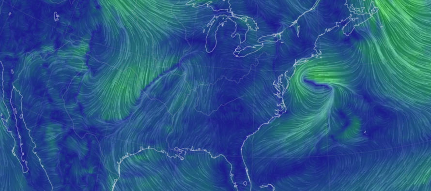
Today is a good example of what’s known as a Back Door Cold Front (BDCF). As we know, areas of high pressure produce synoptic-scale anti-cyclonic (clockwise) flow around their center, in the Northern Hemisphere. Well, today we have high pressure over New England (to the N of NJ) which means NJ is subject to the onshore flow on the S side of the high pressure swirl. Put it all together and we have 50-degree ocean air pushing into NJ from the E (off the ocean). Since the cold front arrives from the E instead of traditional W, it’s a BDCF. BDCF’s, especially this time of year, have many nicknames, some of them funny some of them not depending on their impact… The beach bum, the t-shirt/shorts wrecker, the picnic ruiner, you get the idea. I’ve seen families unpack full picnics on the beach in April and May, dressed in warm weather clothes…only to then panic and run around collecting everything blowing around the beach in the 50-degree onshore flow surprise. Everyone screaming at each other, blaming each other, etc. It cracks me up honestly until it’s me in that position. It can go from 70-80 with sun to 40-50 with dense fog in a matter of 15-20 minutes when a BDCF hits. Sometimes you can make out roll clouds along the leading edge of the front coming off the ocean. Either way, it’s very much a real thing and it’s occurring today.
While much of NJ is currently near ocean temps (a few degrees on either side of 50), NNJ is more in the 40s due to even colder flow that doesn’t pass over the ocean. On the other hand, some warmer air is trying hard to push into Salem, Cumberland, and Cape May Counties from the S/SW. This should allow said counties to exceed 60 today but the rest of NJ will have to file this as a cold and raw-feeling day.
We were locked into a relentless rainy pattern up until about 1-2 weeks ago. Seriously! …coming out of winter into early spring has been historically wet with who knows how many inches your specific town is above average in rainfall. We have turned the corner on rainfall amounts at least. We might still have periods of frequent and nuisance rainfall as we progress further through spring. But I’m not seeing the 2-4 inch rainfall events stacking up every few days. With that said, I still feel like we’re pulling away from the rainy pattern.
Why isn’t it warm yet? To this I answer: Relax! It’s mid-April. The ocean is still ~50 degrees. Therefore, unless we have winds out of the SW quadrant (W, SW, or S), it’s going to be a chilly day in NJ. Winds between W/NW and N/NE will bring colder continental air to NJ. Winds between NE and S/SE will bring 50-degree ocean air to NJ. Even a due S wind will chill out most of ECNJ/SENJ. So, can we get a few days where temps bust into 60s, 70s, even 80s this time of year? Sure, we just saw that last week, but so long as winds hold between W and S which is typically hard to see for more than a few days at a time. April is a very transitional month in NJ folks…especially for our four seasons climate. In April, I’ve seen anything from heavy accumulating snow to near-90 depending on the air masses in place and wind direction. I think we continue our various and mixed weather patterns through the rest of April…a few warm days here and there, a few colder days here and there, the rest near average which isn’t warm! Some longer-range temp analysis indicates a summer heat smack job as soon as May opens. You might want to enjoy and even bottle the current air mass for soon many will be claiming, “it’s too hot out.” Jury is out on how long that warmer air mass will hang around. But at least a transient hot shot is likely.
Rain is a shorter-range forecast than temperature trends. As most of you know, I do not like to look at precip events beyond 7 days. For now and this weekend, we have some weak/light rain departing NJ which should allow a break in precipitation for the rest of this evening (Thursday) and Friday. Not sure about extent of sunshine for Friday but at least a mostly dry day. The next batch of rain is expected for late Friday night into early Saturday morning and it’s very light and weak looking…tenths of an inch at most. This, in theory, then yields a dry and nice Saturday-Sunday with sunny highs in the 60s+ before we turn chillier to start next week. I will touch on this more in tomorrow’s weekend outlook, but for daytime weekend outdoor interests, it’s looking good after the Friday night/Saturday morning rain ends.
In English: Some very light rain is moving out but New Jersey is chilly today (Thursday) thanks to a Back Door Cold Front (BDCF) off the ocean. Friday looks mostly dry with temps into 60s for most (50s for coasties). Some light rain Friday night into early Saturday morning but then the rest of the weekend, including Saturday daytime hours, looks dry. Saturday looks milder with temps well into the 60s. Sunday most areas might just touch 60. But again, both days sunny which should feel great with the afternoon high sun angle. Chillier air then returns for some of next week to then close out April with mundane average conditions. May could start warm/hot. Full weekend outlook coming tomorrow. Have a great rest of your Thursday and please be safe! JC
Premium Services
KABOOM Club offers inside info forecast discussion, your questions answered, and early storm impact maps (ahead of the public). At a buck per month, it’s an extremely feasible way to show support.
My Pocket Meteorologist (MPM), in partnership with EPAWA Weather Consulting, offers professional/commercial interests, whose businesses depend on outdoor weather conditions (snow plowing, landscaping, construction, etc.), with hyper-local text message alerts/forecasts and access to the MPM premium forum—the most comprehensive and technical forecast discussion available for PA and NJ.
Get your KABOOM Inside Out pajamas and more at the KABOOM shop!
Jonathan Carr (JC) is the founder and sole operator of Weather NJ, New Jersey’s largest independent weather reporting agency. Since 2010, Jonathan has provided weather safety discussion and forecasting services for New Jersey and surrounding areas through the web and social media. Originally branded as Severe NJ Weather (before 2014), Weather NJ is proud to bring you accurate and responsible forecast discussion ahead of high-stakes weather scenarios that impact this great garden state of ours. All Weather. All New Jersey.™ Be safe! JC


LOCAL FORECAST | INTERACTIVE RADAR | LATEST NJ WEATHER ALERTS | WEDDING FORECAST| PRIVACY POLICY
© Copyright 2026 Weather NJ LLC. All Rights Reserved.
Some information that can be found on our website is provided by a private weather station and is not an officially recognized station for weather reporting. Though we always strive to achieve accurate reporting for our own use, it is important that you do NOT depend on the data provided here for any purpose.
