

Return to an Unsettled Pattern
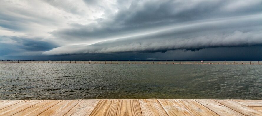
Discussion: I wish I could have bottled the conditions this past Friday and Saturday because it doesn’t get much better in NJ than that. We’ll now return to more of an unsettled pattern as lower geopotential heights dominate our region from Wednesday, through this weekend, and well into next week. This means warm temps (75-85) instead of hot (90+), elevated humidity (not unbearable), and a general mix of sun, clouds, rain, and storms. When you have lower heights/troughs around, moisture has to rise less before condensing back to the surface as rain. Therefore, any lifting generated by nearby lows, sea breeze fronts, or other frontal boundaries/leeward troughs, etc., will easily form showers and storms especially if wind shear or instability are kicking. A much different environment than a hotter ridge where the troposphere is instead expanded and lifting moisture battles stuff like capping inversions and additional inhibiting factors. That’s no doubt coming but might hold off until closer to the start of calendar summer. For now, we’ll deal with the unsettled but warm (not hot) pattern. This is not a call for washouts though. I expect plenty of sunshine nested between the clouds, rain, and storms. But we’re likely not looking at another Friday/Saturday situation until a solid cold front clears the pattern again. I would like to highlight the anomalous sea surface temperatures (+2-4C) that exist off the coast of NJ and well throughout the Atlantic Hurricane Basin. Hurricane season officially started June 1 so this is something I’ll be monitoring as we get further into the heart of the season (July-Sept).
Monday (June 3) high temperatures should reach the mid-80s for most locations away from the ocean. Coastal regions should max closer to 80. Skies should be mixed with sun and clouds with a humid feel. Showers and thunderstorms should be around during afternoon/early-evening hours. Winds should be light out of the W/SW. Overnight lows should fall to the 60-65 range statewide as unsettled conditions continue into early Tuesday AM.
Tuesday (June 4) high temperatures should reach the low-to-mid 80s for most locations away from the ocean. Coastal regions should max in the mid-70s. Skies should be mixed with more sun than clouds. Winds should be light out of the E, perhaps a little breezier out of the E along the immediate ECNJ/SENJ coast. Overnight lows should range from upper-50s to mid-60s from NNJ elevations to SNJ coasts.
Wednesday (June 5) high temperatures should max in the 70s for most NJ locations. Skies should be mixed with more clouds than sun and a humid feel. Rain, possibly storms, should push in from the W eventually. Winds should be light out of the S/SE. Overnight lows should fall to the 60-65 range with showers and storms around through early Thursday AM.
Thursday (June 6) high temperatures should reach the low-to-mid 80s for most NJ locations. Coastal regions should hang just below 80. Skies should start cloudy, rainy, possibly stormy then improve the rest of the day to just a mix of sun and clouds. Winds should be light out of the W/SW. Overnight lows should fall back into the 60-65 range with a humid feel.
Friday (June 7) high temperatures should reach the mid-to-upper 70s for most NJ locations. Skies should be mixed with sun, clouds, and rain. NNJ looks a little rainier, SNJ a little sunnier. Winds should be light out of the SW. Overnight lows should range from mid-50s to mid-60s from NNJ elevations to SNJ coasts.
An early look at the weekend indicates typical late-spring conditions for NJ. Highs ranging from mid-70s to mid-80s with some humidity and ample sun yet isolated showers and boomers possible during afternoon/evening hours. The GFS is a little more unsettled than the Euro but let’s wait a few days until the data is better in-range. Everyone have a great week and please be safe! JC
Premium Services
KABOOM Club offers inside info forecast discussion, your questions answered, and early storm impact maps (ahead of the public). At a buck per month, it’s an extremely feasible way to show support.
My Pocket Meteorologist (MPM), in partnership with EPAWA Weather Consulting, offers professional/commercial interests, whose businesses depend on outdoor weather conditions (snow plowing, landscaping, construction, etc.), with hyper-local text message alerts/forecasts and access to the MPM premium forum—the most comprehensive and technical forecast discussion available for PA and NJ.
Jonathan Carr (JC) is the founder and sole operator of Weather NJ, New Jersey’s largest independent weather reporting agency. Since 2010, Jonathan has provided weather safety discussion and forecasting services for New Jersey and surrounding areas through the web and social media. Originally branded as Severe NJ Weather (before 2014), Weather NJ is proud to bring you accurate and responsible forecast discussion ahead of high-stakes weather scenarios that impact this great garden state of ours. All Weather. All New Jersey.™ Be safe! JC


LOCAL FORECAST | INTERACTIVE RADAR | LATEST NJ WEATHER ALERTS | WEDDING FORECAST| PRIVACY POLICY
© Copyright 2026 Weather NJ LLC. All Rights Reserved.
Some information that can be found on our website is provided by a private weather station and is not an officially recognized station for weather reporting. Though we always strive to achieve accurate reporting for our own use, it is important that you do NOT depend on the data provided here for any purpose.
