

Sept 2: Watching the Tropics
Discussion: We’re now in the peak of the Atlantic hurricane season and there are a few systems worth keeping an eye on. Naturally some click-bait sites are going to show you model runs of hurricanes slamming the east coast. And while there’s a small possibility of that happening, using such model images as main article images from this range sort of endorses the low possibility as that organization’s prediction. Especially since many click-bait consumers ignore the small article text where click-baiters like to state “this is only one model run, not a forecast, etc.” Here at Weather NJ, we’re going to keep it cool, calm and down to earth using actionable discussion to aggregate safety awareness.
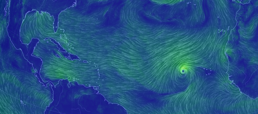
First up is Tropical Storm Florence. Florence is a Cape Verde region tropical development formed by a W African tropical wave. Florence will encounter cooler sea surface temperatures over the next day or two. It will then encounter wind shear unfavorable for development before reaching SE area of the Bermuda region. Between the cooler water and shear, Florence will likely not rapidly intensify during this time.
Once Florence approaches the SE Bermuda region (Sept 9-10), then it will be time to track seriously. Given the overall clockwise circulation naturally generated by the tropical trade winds and mid-latitude westerlies, Florence will want to curve before hitting the E US and become a fish storm with possibly Bermuda in-jeopardy (Sept 11-12) should a “thread the needle” track occur. The GFS has been strongly in this camp. The Euro however has Florence missing the trough connection and floating towards the E US after getting stuck underneath a ridge. The Euro has had this for a few consecutive runs which has commanded my need to write this article. Should the Euro verify then the E US coast would be tracking a possible landfall in the September 13-15 general time-frame.
All the ingredients are on the table for an east coast hurricane to happen. Again, it’s peak season and the waters are very warm in the W Atlantic/E US coast. What’s ultimately going to determine Florence’s final track are the upper-level steering influences which will change many times between now and serious tracking time (Sept 9-10). Therefore it is futile to worry at this point. Let’s take it day by day and see how things evolve. In the interest of safety aggregation, just have it in the back of your mind for now as a low possibility that has not been ruled out yet.
Next up is Invest 91L in the S/SE Bahamas. This is just a wave at this point but is expected to cross the S Florida area and enter the Gulf of Mexico as early as Monday night/Tuesday morning. Regardless of whether this wave develops into a named-storm (would be Gordon), it is expected to then head towards the New Orleans area, possibly as a landfall, before fizzling out over the C US via jet stream absorption. A non issue for New Jersey and the Mid-Atlantic US but certainly something to watch for S Florida/gulf coast interests.
In English: I’m watching Tropical Storm Florence for potential east coast impacts in the Sept 13-15 time period. This is a low possibility but cannot be taken off the table at this time. The more likely scenario is a fish storm that possibly hits Bermuda and intensifies east coast swell/currents. It’s simply too far away for detailed predictions but in the interest of safety awareness, it’s time to start paying attention. Another tropical wave, currently in the S/SE Bahamas, might form into Gordon and impact S Florida/New Orleans between this Sunday night and Wednesday. The tropics are heating up but let’s be cool, calm and rational when embracing the many random dynamics involved in these storms’ future tracks. Try not to panic should you see some outlets trying to capitalize on a slow hurricane season with click-bait. Be safe! JC
Jonathan Carr (JC) is the founder and sole operator of Weather NJ, New Jersey’s largest independent weather reporting agency. Since 2010, Jonathan has provided weather safety discussion and forecasting services for New Jersey and surrounding areas through the web and social media. Originally branded as Severe NJ Weather (before 2014), Weather NJ is proud to bring you accurate and responsible forecast discussion ahead of high-stakes weather scenarios that impact this great garden state of ours. All Weather. All New Jersey.™ Be safe! JC


LOCAL FORECAST | INTERACTIVE RADAR | LATEST NJ WEATHER ALERTS | WEDDING FORECAST| PRIVACY POLICY
© Copyright 2026 Weather NJ LLC. All Rights Reserved.
Some information that can be found on our website is provided by a private weather station and is not an officially recognized station for weather reporting. Though we always strive to achieve accurate reporting for our own use, it is important that you do NOT depend on the data provided here for any purpose.
